Lagny-le-Sec
| Lagny-le-Sec | ||
|---|---|---|
|
|
||
| region | Hauts-de-France | |
| Department | Oise | |
| Arrondissement | Senlis | |
| Canton | Nanteuil-le-Haudouin | |
| Community association | Pays de Valois | |
| Coordinates | 49 ° 5 ' N , 2 ° 45' E | |
| height | 94-116 m | |
| surface | 11.23 km 2 | |
| Residents | 2,062 (January 1, 2017) | |
| Population density | 184 inhabitants / km 2 | |
| Post Code | 60330 | |
| INSEE code | 60341 | |
 town hall |
||
Lagny-le-Sec is a French commune with 2,062 inhabitants (as of January 1 2017) in the department of Oise in the region of Hauts-de-France ; it belongs to the arrondissement of Senlis and the canton of Nanteuil-le-Haudouin .
geography
Lagny-le-Sec is the southernmost commune of the Oise department on the border with the Seine-et-Marne department . Lagny-le-Sec is surrounded by the neighboring communities of Ermenonville in the north and north-west, Le Plessis-Belleville in the north and north-east, Saint-Pathus in the east and south-east, Marchémoret in the south, Rouvres in the south-west and Ève in the west.
The National Route 2 runs through the municipality .
Population development
| year | 1962 | 1968 | 1975 | 1982 | 1990 | 1999 | 2006 | 2017 |
| Residents | 644 | 623 | 1167 | 1619 | 1892 | 1806 | 1815 | 2062 |
| Sources: Cassini and INSEE | ||||||||
Attractions
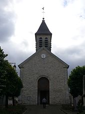
- Church of Saint-Pierre-Saint-Paul (see also: List of Monuments historiques in Lagny-le-Sec )
- town hall
Web links
Commons : Lagny-le-Sec - collection of images, videos and audio files

