Česká Lípa
| Česká Lípa | ||||
|---|---|---|---|---|
|
||||
| Basic data | ||||
| State : |
|
|||
| Historical part of the country : | Bohemia | |||
| Region : | Liberecký kraj | |||
| District : | Česká Lípa | |||
| Area : | 6609.6322 ha | |||
| Geographic location : | 50 ° 41 ' N , 14 ° 32' E | |||
| Height: | 258 m nm | |||
| Residents : | 37,444 (Jan 1, 2019) | |||
| Postal code : | 470 01 | |||
| License plate : | L. | |||
| traffic | ||||
| Street: | I / 9 | |||
| Railway connection: | 080 Bakov nad Jizerou – Ebersbach 081 Děčín – Česká Lípa 086 Liberec – Česká Lípa 087 Lovosice – Česká Lípa |
|||
| structure | ||||
| Status: | city | |||
| Districts: | 15th | |||
| administration | ||||
| Mayor : | Jitka Volfová (as of 2018) | |||
| Address: | nám. TG Masaryka 1 470 01 Česká Lípa |
|||
| Municipality number: | 561380 | |||
| Website : | www.mucl.cz | |||
| Location of Česká Lípa in the Česká Lípa district | ||||

|
||||
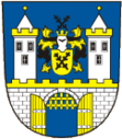
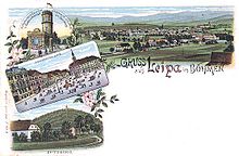
Česká Lípa (German Bohemian Leipa , also Leipa for short ) is a town in Liberecký kraj in the north of the Czech Republic .
Geographical location
The city lies 263 m above sea level on the river Ploučnice ( Polzen ), into which the streams Šporka ( Rohnbach ) and Robečský potok ( Robitzer Bach ) flow on the western outskirts .
history
The city was originally a small settlement owned by the Lords of Leipa . It received city rights in 1381. The city belonged to changing rulers, including Albrecht von Wallenstein . Besides the Nový Zámek Castle , the Leipa reign was the only one of his numerous possessions ( Duchy of Friedland , Duchy of Sagan , Duchy of Glogau , Duchy of Mecklenburg), which was left as a widow's seat to his widow Katharina, née Countess Harrach ; the only daughter, Princess Maria Elisabeth von Friedland (1626–1662), married Rudolf Freiherrn von Kaunitz in 1645, whereby Leipa came into the possession of the Kaunitz family until 1848 .
In 1850, Bohemian Leipa became a district town and a railway junction in the Austro-Hungarian monarchy . Furthermore, the seat of the judicial district of Bohemian Leipa was in the city. Since 1864 the city had a state secondary school. At the end of the 19th century, Böhmisch Leipa had several industrial production plants, including a piano factory, and in addition to an upper secondary school also a grammar school.
After the First World War, the place fell to Czechoslovakia in 1918 due to the Treaty of Saint-Germain . Through the Munich Agreement , the city was incorporated into the German Reich from 1938 to 1945 as part of the Sudetenland . It was the seat of the district of Bohemian Leipa in the Reichsgau Sudetenland , district of Aussig . After the end of the Second World War in May 1945, a large part of the German-Bohemian population was expelled from 1945 to 1946 , expropriated based on the Beneš decrees and forced to leave the city.
On December 1, 1930, Böhmisch Leipa had 13,714 inhabitants, on May 17, 1939 there were 12,000 and on May 22, 1947 11,991. Many new citizens from Central Bohemia and Slovakia, so-called “ repatriants ”, and Roma settled here in the post-war period.
Demographics
Until 1945, Böhmisch Leipa was predominantly populated by German Bohemia , which were expelled.
| year | Residents | Remarks |
|---|---|---|
| 1830 | 5,804 | in 700 houses, including 639 Jews (in 21 houses) |
| 1857 | 8,442 | on October 31st |
| 1900 | 9,217 | (as a community 10,731) almost exclusively German residents |
| 1910 | 9,916 | including 495 Czechs |
| 1930 | 13,714 | 3,081 of them Czechs |
| 1939 | 11,963 | 1,089 Protestants, 10,306 Catholics, 114 other Christians and 22 Jews |
| year | 1950 | 1961 | 1970 | 1980 | 1991 | 2001 | 2011 |
|---|---|---|---|---|---|---|---|
| Residents | 14,932 | 15,864 | 17,658 | 24,862 | 39 463 | 39,358 | 36,017 |
Surname
The name Česká Lípa is derived from the old Bohemian noble family of Leipa (Czech z Lipé ) or the Czech word Lípa for linden tree .
City structure
The town of Česká Lípa consists of the districts Častolovice (Schaßlowitz) , Česká Lípa ( Bohemian Leipa ), Dobranov (Dobern) , Dolní Libchava (Niederliebich) , Dubice (Kleinaicha) , Heřmaničky (Hermsdorf) , Lada (Jägersdorf) , Manušice (Manisch) , Okřešice (Aschendorf) , Písečná (Pießnig) , Stará Lípa (Altleipa) , Vítkov (Leskenthal) , Vlčí Důl (Wolfsthal) and Žizníkov (Schießnig) .
Basic settlement units are Častolovice, Česká Lípa-historické jádro, Dobranov, Dolní Libchava, Dolní Špičák ( Niederspitzberg ), Dubice, Dubická, Heřmaničky, Holý vrch, Horní Špičák ( Oberspitzberg ), K Manušicíši, Měčeký, Stručský park, Keada , Na Bídě, Nádražní, Nový Žizníkov, Obecní les, Okřešice, Písečná, Pod Holým vrchem, Poříčí, Průmyslový obvod, Rasova Hůrka, Robeč (Robitz) , Slovice, Sídliště Lada, Sídliště, Sídliště Ladaště, Sídliště, Sídliště , Sídlišet, Sídliště Ladaštěovo , Sídliště Ladaště, Sídliště Střední Špičák ( Mittelspitzberg ), Svárov ( Schwora ), Špičák ( Spitzberg ), U hřbitova, U Libchavy, U nemocnice, U Okřešického rybníka, U panelárny, U stadiónu, U staré cihelny, Vítkov and Vlčíesovi. Vlčíesovů Žizníkov.
The municipality is subdivided into the cadastral districts of Častolovice u České Lípy, Česká Lípa, Dobranov, Dolní Libchava, Dubice u České Lípy, Heřmaničky u Dobranova, Lada, Manušice, Okřešice u České Lípy, Starpa, Vrančraníá u České Lípy, Písečraníá u Dobíova, Doblíova, Písečraníná Důl and Žizníkov.
Attractions
- Augustinian monastery , founded in 1627 by Albrecht von Waldstein, called Wallenstein , on the site of a small castle of the aristocratic Berka von Dubá family , together with the establishment of a Latin school. In the middle of the cloister is a Loreto chapel from 1698. In the axis of the western wing of the cloister is the former chapel of the Holy Trinity with an altarpiece by Ignaz Raab . Today the monastery houses a local museum and gallery with items from the collection of local researchers Franz Hantschel and Anton Amand Paudler .
- Historical center , market square with preserved historical buildings, with fountain and plague column of the Holy Trinity with statues by the Zittau sculptor J. Ch. Ulrich from 1681.
- Municipal park , created in 1875, with seven hectares one of the largest parks in Bohemia
- Church of the Exaltation of the Cross , single-nave Gothic building with five-sided vestibule and tent roof from 1385 and main altar from 1697. On the south side a Gothic portal with the coat of arms of the Berka von Duba and Leipa family .
- Maria Magdalenen Church from the 13th century. The baroque provost house is on the north side of the church .
- Renaissance pleasure palace, Red House , former hunting lodge from 1583, built by Dietrich Georg Berka von Duba. In 1883 the castle was stylishly restored by Professor Steffen. The interior wall paintings were largely destroyed, on the front facade a strip with hunting scenes and a columned gallery with men's and women's heads - the middle head probably represents the poet Dante.
- Lipý Castle, a moated castle from the 13th century, has only survived part of the masonry and two Gothic gates. The castle was rebuilt as a Renaissance- style castle in the 15th and 17th centuries , later served as a sugar factory and was blown up in the 1950s.
- Movable flap weir on the Polzen River in the middle of the town, built in 1910 according to a design by J. Záhorský.
- Old Jewish Cemetery from 1479 and New Jewish Cemetery from 1905. The oldest gravestone was on the eastern front of the old cemetery. Among the many valuable gravestones, the black granite pyramid column is particularly memorable: It marks the final resting place of 32 Jewish victims with their rabbi , who were barbarically tortured to death by Pandours in an attack in 1745 .
Personalities
literature
- Illustrated Chronicle of Bohemia (published by the Association of Patriotic Scholars and Artists). Volume 1, Prague 1852, pp. 48-54 , pp. 118-120 , pp. 177 and pp. 237-242.
- The Leipa church chronicle . In: Illustrirte Chronik von Böhmen (published by the Association of Patriotic Scholars and Artists). Volume 1, Prague 1852, pp. 121–122 ,
- W. Ernst: B. Leipa before and under Wallenstein. Cultural-historical sketch . In: Annual report of the upper secondary school in Böhmisch-Leipa for the school year 1864 . Böhmisch-Leipa 1865, pp. 9-28 .
- Hermann Hallwich: On the history of the city of Bohemian Leipa. Prague 1870 ( digitized )
Web links
Individual evidence
- ↑ http://www.uir.cz/obec/561380/Ceska-Lipa
- ↑ Český statistický úřad - The population of the Czech municipalities as of January 1, 2019 (PDF; 7.4 MiB)
- ^ E. Seewald: The establishment of the upper secondary school . In: Annual report of the upper secondary school in Böhmisch-Leipa for the school year 1864 . Böhmisch-Leipa 1865, p. 29 ff .
- ↑ a b Meyer's Large Conversation Lexicon . 6th edition, Volume 2, Leipzig and Vienna 1905, p. 162 .
- ↑ Johann Gottfried Sommer : The Kingdom of Bohemia . Volume 1: Leitmeritzer Kreis , Prague 1833, p. 320, paragraph 26).
- ↑ Yearbooks of the Bohemian Museum of Natural and Regional Studies, History, Art and Literature . Volume 2, Prague 1831, p. 197, point 4).
- ↑ Statistical overviews of the population and livestock in Austria . Vienna 1859, p. 40, right column .
- ^ A b c Michael Rademacher: German administrative history from the unification of the empire in 1871 to the reunification in 1990. District Bohemian Leipa (Czech. Ceská Lípa). (Online material for the dissertation, Osnabrück 2006).
- ↑ http://www.uir.cz/casti-obce-obec/561380/Obec-Ceska-Lipa
- ↑ http://www.uir.cz/zsj-obec/561380/Obec-Ceska-Lipa
- ↑ http://www.uir.cz/katastralni-uzemi-obec/561380/Obec-Ceska-Lipa


