
Eging at the lake
| coat of arms | Germany map | |
|---|---|---|

|
Coordinates: 48 ° 43 ' N , 13 ° 16' E |
|
| Basic data | ||
| State : | Bavaria | |
| Administrative region : | Lower Bavaria | |
| County : | Passau | |
| Height : | 419 m above sea level NHN | |
| Area : | 23.66 km 2 | |
| Residents: | 4275 (Dec. 31, 2019) | |
| Population density : | 181 inhabitants per km 2 | |
| Postal code : | 94535 | |
| Area code : | 08544 | |
| License plate : | PA | |
| Community key : | 09 2 75 120 | |
| Market structure: | 30 districts | |
Market administration address : |
Prof.-Reiter-Str. 2 94535 Eging a.See |
|
| Website : | ||
| Mayor : | Walter Bauer ( Überpart.Wgem. / Free Voters ) | |
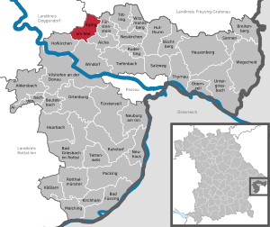
| Location of the Eging a.See market in the Passau district | ||
  |
||


Eging am See (officially: Eging a.See ) is a market in the Lower Bavarian district of Passau and a state-recognized health resort .
geography
Geographical location
The market town is located in the Danube Forest planning region in the southern Bavarian Forest , more precisely in the Dreiburgenland . The village is located 15 km northeast of Vilshofen an der Donau , 27 km northwest of Passau , 25 km southwest of Grafenau and 30 km southeast of Deggendorf . It is only 6 km to the next junction of the federal motorway 3 in Garham .
Community structure
There are 30 districts:
|
There are the districts Eging am See and Garham.
Neighboring communities
- Ausernzell ( Deggendorf district )
- Thurmansbang ( Freyung-Grafenau district )
- Fürstenstein ( District of Passau )
- Aicha vorm Wald ( District of Passau )
- Hofkirchen ( District of Passau )
- Windorf ( district of Passau )
history
Until the church is planted
From the Neolithic there are sites in Hofstetten and Mühlreit in the municipality of Eging. However, no settlement remains were discovered from the following millennia.
In the early Middle Ages , the area of today's municipality Eging belonged to the so-called Nordwald, the forest north of the Danube , today's Bavarian Forest . This was the royal forest, on which farmers willing to settle, probably from the already inhabited south and west, could settle as "royal people". This happened mainly in the area of today's communities Eging, Fürstenstein , Aicha vorm Wald , Tittling , Witzmannsberg and Neukirchen vorm Wald . In Oberpolling , the royal tax was entered in the land register on a property until the 19th century.
A man named Egino cleared the forest around the turn of the millennium and founded Eging. "Egning", as it was called back then, translates as "with the people of Egino".
By 1300 Eging was documented for the first time in a ducal Urbar as property of the Bishopric of Bamberg listed as 78 other so-called Babenberger goods.
In the 16th century the " Gulden Straß " ran through the town of Eging; a Bavarian competition to the Passauer Goldene Steigen , a Salzsäumerstraße , which was soon closed again.
In 1623 and 1633, during the Thirty Years' War , Swedes plundered Eging and Fürstenstein . In the years 1627, 1627 and 1648/1649 here that raged plague . During the Austrian War of Succession , the Pandours looted Eging in 1742.
A landlord that was important for centuries, the Bamberg Monastery of Altenmarkt , was abolished in 1784. The Electress Maria Anna acquired the goods and set up the St. Anna women's monastery . North of the Danube, the former goods of the monastery were combined in the Hofmark Ranfels . In 1803 secularization followed in Bavaria . In 1806, the Englfing / Schöllnach area in the west to the Ilz in the east was assigned to the Passau district court . The formation of the political communities took place with the 2nd community edict of 1818 . Since then, the communities of Eging in the Passau Regional Court have included the places Albersdorf, Alzenhof, lower Einzendoblmühle, Gaisruck, Gaisruckmühle, Harmering, Kollmering, Kroissenhof, Kroißenmühle, Loipfering, Obereging, Otting, Passerting, Preinting, Ritzging, Ruberting and Untereging.
19th century
In 1879 the community was assigned to the Vilshofen district court at its own request . In 1899 the villages of Märzing, Hörmannsdorf and Rohrbach came from the community of Aussernzell to the community of Eging.
20th century
The establishment of the Deggendorf-Eging-Kalteneck railway in 1913/1914 was extremely important for the development of the town . But the soldiers had to take the First World War on the first train .
On February 3, 1944, a Junkers Ju 88 with the identification GC + UP crashed in Eging by a lightning strike. After the repair was completed, the aircraft was to be transferred to a flight school in Dessau. At the end of the Second World War , a Volkssturm was set up to defend itself against the Americans, but after the SS withdrew, the village was handed over in good time without a fight. A concentration camp cemetery was set up in Eging for victims of the evacuation train from the Buchenwald concentration camp in Nammering , where 170 unknown concentration camp victims of this death march are buried, according to the memorial plaque .
In 1953 Eging was raised to the market . In 1956 the four localities of Obereging, Untereging, Albersdorf and Preinting were combined to form Eging. On March 17, 1978, the place name was expanded to include "a.See". In 1997 it was recognized as a climatic health resort .
Incorporations
On May 1, 1978 parts of the dissolved Garham community were incorporated.
Population development
Between 1988 and 2018 the market grew from 3,252 to 4,278 by 1,026 inhabitants or 31.6%.
- 1961: 2526 inhabitants
- 1970: 2917 inhabitants
- 1987: 3208 inhabitants
- 1991: 3370 inhabitants
- 1995: 3587 inhabitants
- 2000: 3742 inhabitants
- 2005: 3932 inhabitants
- 2010: 3983 inhabitants
- 2015: 4269 inhabitants
politics

Market council
The municipal council (16 seats) has been composed as follows since the local elections on March 15, 2020 :
mayor
| year | Politician |
|---|---|
| 1958-1990 | Josef Geier |
| 2014 - | Walter Bauer |
The first mayor since May 1st, 2008 is Walter Bauer (ÜW / FWG), in March 2014 he was re-elected with 77.3% of the valid votes. On March 15, 2020, he was confirmed in office for another six years with 78.3% of the vote.
coat of arms
|
|
Blazon : "Above a green shield base, stacked silver paving stones, in silver two green fir trees with roots." |
Architectural monuments

Soil monuments
Economy and Infrastructure
Jobs
In 2017 there were 1,688 jobs subject to social security contributions in the municipality. Of the resident population, 1723 people were in an employment relationship subject to compulsory insurance. This means that the number of out-commuters was slightly larger than that of in-commuters by 35 people. 85 residents were unemployed.
Agriculture
In 2016 there were 31 farms. 581 hectares of the community area were used for agriculture.
tourism


Eging is known for its wide range of leisure activities. There is a bathing lake named after the place ( Eginger See ), the Sonnentherme (spa), lots of shops, parks, hiking and biking trails in the hilly landscape of the Bavarian Forest. The main attraction is the leisure and western town of Pullman City, founded in 1997 . There are many attractions and performances by real Indians and much more here. Through this western town the number of riding stables increased by leaps and bounds.
In 2017, the eleven accommodation establishments with ten or more beds recorded a total of 39,809 guest arrivals and 97,460 overnight stays.
education
There are the following institutions (as of 2018):
- A day-care center with 152 kindergarten places and 165 children,
- Two primary schools with a total of 19 teachers, 12 classes and 263 students.
literature
- Anton Schuberl: History of my homeland from the beginning until 2003 , winemaker 2007, ISBN 978-3-937438-56-6
- Eginger yearbook 2008 , ed. from the history and culture association Eging am See e. V., Vintner 2008, ISBN 978-3-937438-89-4
- Eginger yearbook 2009 , ed. from the history and culture association Eging am See e. V., Vintner 2009, ISBN 978-3-937438-14-6
- Eginger yearbook 2010 , ed. from the history and culture association Eging am See e. V., Vintner 2010, ISBN 978-3-941425-21-7
- Eginger Yearbook 2011 , ed. from the history and culture association Eging am See e. V., Vintner 2011, ISBN 978-3-941425-42-2
- Eginger yearbook 2012 , ed. from the history and culture association Eging am See e. V., Oberhaching 2012, ISBN 978-3-941425-62-0
- Eginger yearbook 2013 , ed. from the history and culture association Eging am See e. V., Oberhaching 2013, ISBN 978-3-941425-79-8
- Eginger yearbook 2014 , ed. from the history and culture association Eging am See e. V., Oberhaching 2014, ISBN 978-3-941425-92-7
Web links
- Local government
- History and Culture Association Eging am See e. V.
- Eging am See: Official statistics of the LfStat
Individual evidence
- ↑ "Data 2" sheet, Statistical Report A1200C 202041 Population of the municipalities, districts and administrative districts 1st quarter 2020 (population based on the 2011 census) ( help ).
- ↑ Town council members. Municipality of Eging a.See, accessed on June 14, 2020 .
- ↑ Markt Eging a.See in the location database of the Bayerische Landesbibliothek Online . Bayerische Staatsbibliothek, accessed on August 20, 2018.
- ↑ Memorial sites for the victims of National Socialism. A documentation, volume 1. Federal Agency for Civic Education , Bonn 1995, ISBN 3-89331-208-0 , p. 130.
- ^ Federal Statistical Office (ed.): Historical municipality directory for the Federal Republic of Germany. Name, border and key number changes in municipalities, counties and administrative districts from May 27, 1970 to December 31, 1982 . W. Kohlhammer GmbH, Stuttgart / Mainz 1983, ISBN 3-17-003263-1 , p. 620 .
- ^ Federal Statistical Office (ed.): Historical municipality directory for the Federal Republic of Germany. Name, border and key number changes in municipalities, counties and administrative districts from May 27, 1970 to December 31, 1982 . W. Kohlhammer GmbH, Stuttgart / Mainz 1983, ISBN 3-17-003263-1 , p. 621 .
- ↑ Municipal Council from 2020
- ↑ regiowiki: Josef Geier , accessed 2020-02-29
- ↑ Entry on the coat of arms of Eging am See in the database of the House of Bavarian History
Aicha in front of the forest | Aidenbach | Aldersbach | Bad Füssing | Bad Griesbach im Rottal | Beutelsbach | Breitenberg | Büchlberg | Eging am See | Fürstenstein | Fürstenzell | Haarbach | Hauzenberg | Hofkirchen | Hutthurm | Kirchham | Kößlarn | Malching | Neuburg am Inn | Neuhaus am Inn | Neukirchen vorm Wald | Obernzell | Ortenburg | Pocking | Rotthalmünster | Rowing | Ruhstorf an der Rott | Salt Trail | Suns | Tettenweis | Thyrnau | Tiefenbach | Tittling | Untergriesbach | Vilshofen on the Danube | Wegscheid | Windorf | Witzmannsberg