
Hakkâri (Province)
| Hakkari | |
|---|---|
| Province number: | 30th |
  |
|
| Counties | |
 |
|
| Basic data | |
| Coordinates: | 37 ° 28 ′ N , 44 ° 4 ′ E |
| Provincial capital: | Hakkari |
| Region: | Eastern Anatolia |
| Surface: | 7,095 km² |
| Population: | 286,470 (2018) |
| Population density: | 40 inhabitants / km² |
| Political | |
| Governor: | İdris Akbıyık |
| Seats in Parliament: | 3 |
| Structural | |
| Telephone code: | 0438 |
| Features : | 30th |
| Website | |
| www.hakkari.gov.tr (Turkish) | |
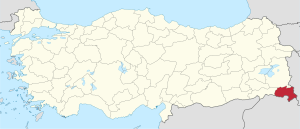
Hakkâri ( Kurdish Colemêrg , Syrian-Aramaic : ܐܰܟ݁ܳܪܳܐ Akkare ) is one of the 81 Turkish provinces . It is located in the mountainous southeastern part of Turkey and borders Iran to the east and Iraq to the south . To the north is Van and to the west is Şırnak . The capital is the Hakkâri of the same name .
geography
The province of Hakkâri is a very mountainous area and is over 1700 m high. There are at least 30 mountains that are over 3000 m high. The highest is the Cilo Dağı (Reşko), which is 4116 m high, followed by the peaks Mordağ (3810 m), Sandil (3818 m) and Geveruki (3680 m). Hakkâri consists of 10% plateaus. Better known among them are Kandil, Shandil, Berçelan, Kanimehan and Vare Berkizan.
Naming
Hakkâri was the name of a Kurdish tribe that lived near Lake Van . Arab historians and geographers named the region Hakkāriyya . The Syriac Aramaic name for Hakkâri is Akkare and means farmer . In the so-called Geniza document from the early 12th century, the name is already mentioned in its present form. The administrative center and seat of the Hakkari princes was Çölemerik. The Armenians call this city Ilmar , the Assyrians Gülarmak and the Mamluks , who also ruled here, Colamerg . The Kurds call it Colemerg and in Turkish it is called Çölemerik . Today the city and province are called Hakkari.
Administrative division
The province is divided into 5 districts ( İlçe ):
- Hakkâri (Kurdish Colemêrg )
- Çukurca (Kurdish Çelê )
- Şemdinli (Kurdish Şemzînan )
- Yüksekova (Kurdish trade )
- Derecik (Kurdish Rubaruk )
| district | Area 1 (km²) |
Population (2018) 2 | Number of Units | Density (Ew / km²) |
urban share (in%) |
Sex ratio 3 |
Founding date 4.5 |
|||
|---|---|---|---|---|---|---|---|---|---|---|
| District ( İlçe ) | Administrative headquarters (Merkez) |
Municipalities (Belediye) |
City quarter (Mahalle) |
Villages (Köy) |
||||||
| Çukurca | 725 | 17,216 | 9,597 | 1 | 3 | 8th | 23.8 | 55.74 | 455 | 1953 |
| Derecik | 437 | 22,953 | 10.184 | 1 | 6th | 4th | 52.5 | 44.37 | 824 | 2018 |
| Hakkari Merkez | 2,179 | 81,424 | 61,549 | 2 | 22nd | 36 | 37.4 | 79.45 | 845 | |
| Şemdinli | 1,207 | 45.117 | 16,973 | 1 | 5 | 18th | 37.4 | 37.62 | 766 | 1936 |
| Yüksekova | 2,547 | 119.760 | 69,602 | 3 | 17th | 58 | 47.0 | 64.06 | 900 | |
| PROVINCE of Hakkâri | 7,095 | 286,470 | 8th | 53 | 124 | 40.4 | 62.19 | 823 | 1935 | |
swell
1 Area 2014
2 Population update on December 31, 2018
3 Gender ratio : number of women per 1000 men (calculated)
4 PDF file of the Ministry of the Interior
5 districts that were only formed after Turkey was founded (1923).
population
The Kurds make up the majority of the population . The four villages Beyyurdu , Boğazköy , Uğuraçan and Yaylapınar are exclusively inhabited by Turks and are all in the Şemdinli district. Of the tens of thousands of Syrian Christians (also called Arameans / Assyrians ), only a few people still live in the province of Hakkâri and in the village of Konak .
Results of the population extrapolation
The following table shows the annual population development at the end of the year after updating by the addressable population register (ADNKS) introduced in 2007. In addition, the population growth rate and the sex ratio (ie number of women per 1000 men) are listed. The 2011 census found 271,405 inhabitants, which is almost 35,000 more than in the 2000 census.
| year | Population at the end of the year | Population growth rate (in%) |
Gender ratio (women per 1000 men) |
Rank (among 81 provinces) |
||
|---|---|---|---|---|---|---|
| total | male | Female | ||||
| 2018 | 286,470 | 157.107 | 129,363 | 3.88 | 823 | 63 |
| 2017 | 275,761 | 148,490 | 127.271 | 2.97 | 857 | 63 |
| 2016 | 267,813 | 142,486 | 125,327 | −3.93 | 880 | 64 |
| 2015 | 278.775 | 151.013 | 127,762 | 0.90 | 846 | 62 |
| 2014 | 276.287 | 148,538 | 127,749 | 1.19 | 860 | 62 |
| 2013 | 273.041 | 146.155 | 126,886 | −2.48 | 868 | 63 |
| 2012 | 279,982 | 154,526 | 125,456 | 2.87 | 812 | 62 |
| 2011 | 272.165 | 147,567 | 124,598 | 8.30 | 844 | 63 |
| 2010 | 251,302 | 128,988 | 122.314 | −2.13 | 948 | 65 |
| 2009 | 256,761 | 135,884 | 120,877 | -0.71 | 890 | 63 |
| 2008 | 258,590 | 138,494 | 120.096 | 4.92 | 867 | 63 |
| 2007 | 246,469 | 128.904 | 117,565 | - | 912 | 65 |
| 2000 | 236,581 | 130,682 | 105,899 | 810 | ||
Census results
The following tables show the population of Hakkâri Province documented in the 14 censuses .
The values in the table on the left are taken from e-books (from the original documents), the values in the table on the right come from the data query of the Turkish statistical institute TÜIK - available on this website:
| year | population | rank | |
|---|---|---|---|
| province | Turkey | ||
| 1927 | 24,980 | 13,648,270 | 63 |
| 1935 | - | 16.158.018 | - |
| 1940 | 36,446 | 17,820,950 | 63 |
| 1945 | 35,124 | 18,790,174 | 63 |
| 1950 | 44.207 | 20,947,188 | 63 |
| 1955 | 54,824 | 24,064,763 | 67 |
| 1960 | 67,766 | 27,754,820 | 67 |
| year | population | rank | |
|---|---|---|---|
| province | Turkey | ||
| 1965 | 83,937 | 31,391,421 | 67 |
| 1970 | 102,312 | 35.605.176 | 67 |
| 1975 | 126.036 | 40,347,719 | 67 |
| 1980 | 155,463 | 44,736,957 | 66 |
| 1985 | 182,645 | 50,664,458 | 65 |
| 1990 | 172.479 | 56.473.035 | 70 |
| 2000 | 236,581 | 67,803,927 | 69 |
Number of provinces in relation to the census years:
- 1927, 1940 to 1950: 63 provinces
- 1935: 57 provinces
- 1955: 67 provinces
- 1960 to 1985: 73 provinces
- 1990: 73 provinces
- 2000: 81 provinces
history
antiquity
Hakkâri has been inhabited by humans since ancient times. There are prehistoric rock carvings whose dating and assignment is not clear.
The first reports about this region come from the Assyrians . They reported of independent principalities of Hubuškia and Zamua (900–700 BC). Two of these princes or kings were called Hubuşki Kaki (a) and Data (na) . The origin of these names is Hurrian . Sometimes these names appeared in connection with the nairi . It is clear from the sources that the principalities consisted of tribal confederations. This way of life has been preserved among the inhabitants of Hakkâri to the present day. After the Assyrian incursions into Anatolia, the Nairi tribes united. The Urartians appeared as opponents of the Assyrians . The first Urartian Empire existed from the 9th century to the 6th century BC. Chr.
Middle Ages and Modern Times
In 1515 the region came under Ottoman suzerainty. However, the sultan's supremacy was only nominal. For a time it was considered the sanjak of the Vilayet Van . In reality, it was under the hereditary rule of Kurdish princes who functioned as Sanjak-Beyi ( Principality of Hakkâri ). It was not until the middle of the 19th century that the gate enforced its sovereignty and made it into an independent vilayet in 1876. As early as 1888 it was annexed to the Van Province again. Until the genocide of the Syrian Christians (Sayfo) in World War I , numerous and well-fortified Assyrian tribes lived here , which formed a large part of the members of the Assyrian Church of the East here .
chronology
Before Christ
- around 850 to around 585: Urartians
- 585-550: Part of the Media
- 550–331: Persians
- 331-323: Macedonians
- 88-66: Tigranes II.
- 66: Part of the Roman Empire
After Christ
- 297–638: part of the Sassanids
- 978: Conquest by Arabs
- 1054: Conquest by Seljuks
- 1142: Conquest by Imaddin Zengi
- 1343: part of the Qara Qoyunlu
- 1360: Principality of Hakkâri
- 1386: Mongols
- 1405: 2nd principality of Hakkâri
- 1534: part of the Ottoman Empire
- 1855: Îzzedîn Shêr uprising against the Ottomans
- 1914: Occupation by Russian forces during the First World War
- 1918: Becomes part of Turkey
- 1924: Assyrian uprising
Personalities
- Ehmedê Xanî (1651–1707), writer and poet
- Çelik Gülersoy (1930–2003), journalist and lawyer
- Pervin Buldan (* 1967), human rights activist and politician
- Sheikh Ubeydallah (1826 / 1827–1883 / 1884), Kurdish sheikh and spiritual leader
- Seyyit Abdülkadir (1851–1925), clergyman and politician
- Yılmaz Erdoğan (* 1967), scholar and writer
Interesting
Ferit Edgü's novel Ein Winter in Hakkari was filmed in 1983 by Erden Kıral under the title A Season in Hakkari .
Individual evidence
- ↑ Türkiye Nüfusu İl ve İlçelere Göre Nüfus Bilgileri , accessed on June 24, 2019
- ↑ Hakkari Province website
- ↑ Lexemes) kr) - ܐܟܪܐ . On dukhrana.com . Retrieved October 9, 2014.
- ^ Premiumwanadoo.com ( Memento of November 3, 2013 in the Internet Archive ). Retrieved October 9, 2014.
- ↑ Directorate General of Mapping PDF file 0.25 MB
- ↑ Türkiye Nüfusu İl İlçe Mahalle Köy Nüfusu , accessed on June 24, 2019
- ↑ illeridaresi.gov.tr TARİH (1) .pdf 1.4 MB
- ↑ Genel Nüfus Sayımları (census results 1965 to 2000)
- ↑ Shabo Talay (2008): The New Aramaic Dialects of the Khabur Assyrians in Northeast Syria: Introduction, Phonology and Morphology. Semitica Viva 41, Harrassowitz Verlag, Wiesbaden 2009. p. 15.
Adana | Adıyaman | Afyonkarahisar | Ağrı | Aksaray | Amasya | Ankara | Antalya | Ardahan | Artvin | Aydın | Balıkesir | Bartın | Batman | Bayburt | Bilecik | Bing oil | Bitlis | Bolu | Burdur | Bursa | Çanakkale | Çankırı | Çorum | Denizli | Diyarbakır | Düzce | Edirne | Elazığ | Erzincan | Erzurum | Eskişehir | Gaziantep | Giresun | Gümüşhane | Hakkâri | Hatay | Iğdır | Isparta | İstanbul | İzmir | Kahramanmaraş | Karabük | Karaman | Kars | Kastamonu | Kayseri | Kırıkkale | Kırklareli | Kırşehir | Kilis | Kocaeli | Konya | Kutahya | Malatya | Manisa | Mardin | Mersin | Muğla | Muş | Nevşehir | Niğde | Ordu | Osmaniye | Rize | Sakarya | Samsun | Siirt | Sinop | Sivas | Şanlıurfa | Şırnak | Tekirdağ | Tokat | Trabzon | Tunceli | Usak | Van | Yalova | Yozgat | Zonguldak