| Surname
|
City district
(location)
|
Size (ha)
|
Year of
creation
|
annotation
|
image
|
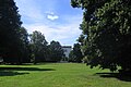
| Green area on Adalbert-Stifter-Straße |
Bogenhausen
( 48 ° 9 ′ 46 ″ N, 11 ° 37 ′ 8 ″ E ) |
14.2 |
|
Landscape protection area (LSG-00599.01) |

more pictures
|
| Agfa Park |
Obergiesing Pheasant Garden
( 48 ° 6 ′ 35 ″ N, 11 ° 34 ′ 58 ″ E ) |
2.3 |
2015 |
New installation on the site of the former Agfa camera factory
|

more pictures
|
| Old Botanical Garden |
Maxvorstadt
( 48 ° 8 ′ 30 ″ N, 11 ° 33 ′ 51 ″ E ) |
4th |
1812 |
protected landscape component |

more pictures
|
| At the perspective |
Pasing-Obermenzing
( 48 ° 9 ′ 42 ″ N, 11 ° 28 ′ 10 ″ E ) |
98 |
1957 |
the park was created on the area of the view from Nymphenburg Palace to Blutenburg Palace, kept free from buildings
|

|
| On the high way |
Harlaching
( 48 ° 6 ′ 0 ″ N, 11 ° 34 ′ 32 ″ E ) |
4.0 |
|
Landscape protection area (LSG-00120.09) |

more pictures
|
| At the Krempelhuberplatz |
Feldmoching-Hasenbergl
( 48 ° 11 ′ 41 ″ N, 11 ° 32 ′ 35 ″ E ) |
1.5 |
|
|

|
| Amphion Park |
Moosach
( 48 ° 10 ′ 27 ″ N, 11 ° 30 ′ 56 ″ E ) |
3 |
|
|

|
| Arnulfpark |
Neuhausen-Nymphenburg
( 48 ° 8 ′ 37 ″ N, 11 ° 32 ′ 28 ″ E ) |
3.5 |
2005 |
|

more pictures
|
| Athens Square |
Harlaching
( 48 ° 5 ′ 24 ″ N, 11 ° 34 ′ 2 ″ E ) |
2.8 |
|
|

more pictures
|
| Marianne-Plehn-Straße green area - Bajuwarenpark |
Trudering-Riem
( 48 ° 7 ′ 12 ″ N, 11 ° 39 ′ 31 ″ E ) |
3 |
2008 |
|

more pictures
|
| Bischweiler Tree Nursery |
Untergiesing-Harlaching
( 48 ° 7 ′ 8 ″ N, 11 ° 33 ′ 56 ″ E ) |
3 |
1901 |
Landscape protection area (LSG-00120.09) |

more pictures
|
| Bavariapark |
Schwanthalerhöhe
( 48 ° 7 ′ 51 ″ N, 11 ° 32 ′ 37 ″ E ) |
7th |
1831 |
protected part of the landscape, monument |

more pictures
|
| Bayernplatz |
Schwabing-West
( 48 ° 9 ′ 58 ″ N, 11 ° 34 ′ 6 ″ E ) |
3 |
1911 |
|

more pictures
|
| Behrpark |
Berg am Laim
( 48 ° 7 ′ 44 ″ N, 11 ° 38 ′ 1 ″ E ) |
0.87 |
|
Originally part of Villa Kreillerstraße 25, monument protection |

more pictures
|
| Šumava Square |
Bogenhausen
( 48 ° 8 ′ 38 ″ N, 11 ° 36 ′ 47 ″ E ) |
2 |
1930 |
Created in 1912 as a jewelery space, brought into its current form in 1930. |

more pictures
|
| Botanical Garden |
Neuhausen-Nymphenburg
( 48 ° 9 ′ 45 ″ N, 11 ° 30 ′ 6 ″ E ) |
18th |
1914 |
Landscape protection area (LSG-00588.01) |

more pictures
|
| Mayor's Garden |
Bogenhausen
( 48 ° 8 ′ 51 ″ N, 11 ° 36 ′ 13 ″ E ) |
1 |
1898 |
Mayor's villa in the park is a listed building |

more pictures
|
|
Denninger Anger (western part) |
Bogenhausen
( 48 ° 8 ′ 50 ″ N, 11 ° 37 ′ 18 ″ E ) |
11 |
1960 |
The western part of Denninger Angers, laid out in the early 1960s, was expanded into a hilly undulating city park after the construction of the Arabellapark in the 1980s. |

more pictures
|
| Echopark (green area on Max-Reinhardt-Weg) |
Ramersdorf-Perlach
( 48 ° 5 ′ 37 ″ N, 11 ° 38 ′ 19 ″ E ) |
2.0 |
|
|
more pictures
|
| English garden |
Altstadt-Lehel , Schwabing-Freimann
( 48 ° 9 ′ 44 ″ N, 11 ° 36 ′ 16 ″ E ) |
375 |
1789 |
one of the most spacious inner-city parks in the world, the northern part is also known as Hirschau and is part of the Hirschau and Obere Isarau landscape protection area (LSG-00599.01) |

more pictures
|
| Fasaneriesee |
Feldmoching-Hasenbergl
( 48 ° 12 ′ 15 ″ N, 11 ° 31 ′ 47 ″ E ) |
23, of which 15 are lake |
|
|

more pictures
|
| Feldmochinger See |
Feldmoching-Hasenbergl
( 48 ° 12 ′ 47 ″ N, 11 ° 30 ′ 51 ″ E ) |
28, of which 15 lake |
|
Landscape protection area (LSG-00120.13) |

more pictures
|
| Freimanner Heide |
Schwabing-Freimann
( 48 ° 12 ′ 18 ″ N, 11 ° 36 ′ 13 ″ E ) |
|
|
|

|
| Leisure park Wohnring Neuperlach |
Ramersdorf-Perlach
( 48 ° 6 ′ 10 ″ N, 11 ° 38 ′ 29 ″ E ) |
4th |
1978 |
|

|
Finance garden
or poet garden
|
Maxvorstadt
( 48 ° 8 ′ 39 ″ N, 11 ° 34 ′ 53 ″ E ) |
2 |
1804 |
1979: open to the public, landscape protection area (LSG-00120.09) |

more pictures
|
| Flaucher systems |
Sendling , Untergiesing-Harlaching
( 48 ° 6 ′ 27 ″ N, 11 ° 33 ′ 27 ″ E ) |
|
1950 in its current form |
Landscape protection area (LSG-00120.09) |
more pictures
|
| Lerchenauer See |
Feldmoching-Hasenbergl
( 48 ° 11 ′ 49 ″ N, 11 ° 32 ′ 14 ″ E ) |
18, of which 8 lake |
Designed in 1967 |
|

more pictures
|
| Aubing-Ost leisure park |
Aubing-Lochhausen-Langwied
( 48 ° 8 ′ 46 ″ N, 11 ° 25 ′ 52 ″ E ) |
9 |
1971 |
|

more pictures
|
Herzogpark amusement park
or Herzog-Albrecht-Anlage
|
Bogenhausen
( 48 ° 9 ′ 16 ″ N, 11 ° 36 ′ 31 ″ E ) |
2 |
1913 |
|

more pictures
|
| Fröttmaninger Berg |
Schwabing-Freimann
( 48 ° 12 ′ 53 ″ N, 11 ° 37 ′ 54 ″ E ) |
36 |
1985 |
|

more pictures
|
| Spring plants |
Au-Haidhausen
( 48 ° 7 ′ 27 ″ N, 11 ° 34 ′ 27 ″ E ) |
16 |
|
Landscape protection area (LSG-00120.09) |

more pictures
|
| Gierlinger Park |
Thalkirchen-Obersendling-Forstenried-Fürstenried-Solln
( 48 ° 5 ′ 52 ″ N, 11 ° 32 ′ 33 ″ E ) |
3.4 |
1965 |
Landscape protection area (LSG-00120.09) |

more pictures
|
| Gilgwiese |
Thalkirchen-Obersendling-Forstenried-Fürstenried-Solln
( 48 ° 4 ′ 39 ″ N, 11 ° 30 ′ 49 ″ E ) |
1.3 |
|
|

|
| Goldsmith's place |
Feldmoching-Hasenbergl
( 48 ° 13 ′ 9 ″ N, 11 ° 33 ′ 44 ″ E ) |
2.31 |
1960; Designed in 2007 |
|

more pictures
|
| Grünwald Park |
Neuhausen-Nymphenburg
( 48 ° 9 ′ 29 ″ N, 11 ° 31 ′ 46 ″ E ) |
3 |
|
Landscape protection area (LSG-00588.01) |

more pictures
|
| Harthofanger |
Milbertshofen-Am Hart
( 48 ° 12 ′ 17 ″ N, 11 ° 34 ′ 10 ″ E ) |
6th |
|
|

more pictures
|
| Hartmannshofer Park |
Moosach
( 48 ° 10 ′ 23 ″ N, 11 ° 29 ′ 35 ″ E ) |
37 |
1964 |
Landscape protection area (LSG-00120.07) |

more pictures
|
|
Heckenstallerpark
|
Sendling-Westpark
( 48 ° 6 ′ 37 ″ N, 11 ° 31 ′ 49 ″ E ) |
2.75 |
2017 |
|

more pictures
|
| Hinterbrühler Park |
Thalkirchen-Obersendling-Forstenried-Fürstenried-Solln
( 48 ° 5 ′ 11 ″ N, 11 ° 32 ′ 32 ″ E ) |
12 |
1907 |
Landscape protection area (LSG-00120.09), in the park there is a lake and a golf course |

more pictures
|
| Deer garden |
Neuhausen-Nymphenburg
( 48 ° 8 ′ 55 ″ N, 11 ° 30 ′ 45 ″ E ) |
28 |
1780 |
Landscape protection area (LSG-00120.16) |
more pictures
|
| Courtyard garden |
Altstadt-Lehel
( 48 ° 8 ′ 34 ″ N, 11 ° 34 ′ 48 ″ E ) |
4th |
1560 |
Landscape protection area (LSG-00120.09) |

more pictures
|
| Korbinianplatz |
Milbertshofen
( 48 ° 11 ′ 8 ″ N, 11 ° 34 ′ 17 ″ E ) |
1 |
|
|

more pictures
|
| Kronepark |
Au-Haidhausen
( 48 ° 7 ′ 13 ″ N, 11 ° 34 ′ 52 ″ E ) |
2 |
1870 |
Landscape protection area (LSG-00120.09) |

more pictures
|
| Green area on Kuntersweg |
Harlaching
( 48 ° 5 ′ 51 ″ N, 11 ° 34 ′ 5 ″ E ) |
4.6 |
|
Landscape protection area (LSG-00120.09) |

more pictures
|
| Kustermannpark |
Ramersdorf-Perlach
( 48 ° 7 ′ 23 ″ N, 11 ° 36 ′ 7 ″ E ) |
2.7 |
1973 |
|

more pictures
|
Leopoldpark
or Unipark
|
Schwabing-Freimann
( 48 ° 9 ′ 22 ″ N, 11 ° 34 ′ 52 ″ E ) |
3 |
around 1845 |
|

|
| Lerchenauer See |
Feldmoching-Hasenbergl
( 48 ° 11 ′ 49 ″ N, 11 ° 32 ′ 14 ″ E ) |
18, of which 8 lake |
Designed in 1967 |
|
more pictures
|
Luitpoldpark
with Luitpoldhügel
|
Schwabing-West
( 48 ° 10 ′ 15 ″ N, 11 ° 34 ′ 11 ″ E ) |
33 |
1911 |
|

more pictures
|
| Maßmannpark |
Maxvorstadt
( 48 ° 9 ′ 9 ″ N, 11 ° 33 ′ 34 ″ E ) |
2 |
1948 |
|
more pictures
|
| Maximiliansanlagen |
Au-Haidhausen , Bogenhausen
( 48 ° 8 ′ 21 ″ N, 11 ° 35 ′ 44 ″ E ) |
30th |
1866 |
is also considered the southern part of the English Garden , landscape protection area (LSG-00120.09) |

more pictures
|
| Michaelianger |
Berg am Laim
( 48 ° 7 ′ 22 ″ N, 11 ° 38 ′ 12 ″ E ) |
19th |
2000 |
The western part of the Michaeliangers is also independently as Echardinger Park called |

more pictures
|
| Green area at Miesbacher Platz |
Harlaching
( 48 ° 5 ′ 46 ″ N, 11 ° 34 ′ 59 ″ E ) |
1.2 |
|
|

more pictures
|
| Münchner-Kindl-Weg |
Harlaching
( 48 ° 5 ′ 31 ″ N, 11 ° 34 ′ 50 ″ E ) |
4.6 |
|
On the northern edge of the Perlacher Forest |

more pictures
|
| New deck systems |
Au-Haidhausen
( 48 ° 7 ′ 24 ″ N, 11 ° 35 ′ 4 ″ E ) |
2 |
|
Landscape protection area (LSG-00120.09) |

|
| Neuhofener Berg |
Sendling
( 48 ° 6 ′ 30 ″ N, 11 ° 32 ′ 29 ″ E ) |
8th |
|
|

more pictures
|
| Walnut Park |
Ludwigsvorstadt-Isarvorstadt
( 48 ° 7 ′ 58 ″ N, 11 ° 33 ′ 49 ″ E ) |
2 |
1812 |
Monument protection |

more pictures
|
| Upper Isarau |
Schwabing-Freimann
( 48 ° 12 ′ 5 ″ N, 11 ° 38 ′ 4 ″ E ) |
|
|
Landscape protection area (LSG-00599.01) |

|
| Green area on Oberhofer Weg |
Milbertshofen-Am Hart
( 48 ° 11 ′ 9 ″ N, 11 ° 34 ′ 33 ″ E ) |
13 |
|
elongated green area from Petuelring to Rathenaustraße |

more pictures
|
| Olympic Park |
Milbertshofen-Am Hart
( 48 ° 10 ′ 12 ″ N, 11 ° 33 ′ 6 ″ E ) |
85 |
1972 |
|

more pictures
|
| East Park |
Ramersdorf-Perlach
( 48 ° 6 ′ 49 ″ N, 11 ° 38 ′ 17 ″ E ) |
56 |
1973 |
|

more pictures
|
| Pachmayrplatz |
Bogenhausen
( 48 ° 9 ′ 1 ″ N, 11 ° 37 ′ 51 ″ E ) |
1.8 |
|
|
|
| Pasing city park |
Pasing-Obermenzing
( 48 ° 8 ′ 21 ″ N, 11 ° 27 ′ 10 ″ E ) |
20th |
1929 |
|

more pictures
|
| Perlach Park |
Ramersdorf-Perlach
( 48 ° 5 ′ 12 ″ N, 11 ° 38 ′ 10 ″ E ) |
5 |
1988 |
|

more pictures
|
| Petuelpark |
Schwabing-West , Milbertshofen-Am Hart
( 48 ° 10 ′ 40 ″ N, 11 ° 34 ′ 45 ″ E ) |
7th |
2004 |
|

more pictures
|
| Piusplatz |
Berg am Laim
( 48 ° 7 ′ 22 ″ N, 11 ° 36 ′ 53 ″ E ) |
4th |
1935 |
Redesign in 2012 |
more pictures
|
| Postwiese |
Au-Haidhausen
( 48 ° 7 ′ 36 ″ N, 11 ° 35 ′ 59 ″ E ) |
1 |
|
|

more pictures
|
| Praterinsel |
Altstadt-Lehel
( 48 ° 8 ′ 10 ″ N, 11 ° 35 ′ 26 ″ E ) |
4th |
1810 |
Landscape protection area (LSG-00120.09) |

more pictures
|
| Green area on Pühnstrasse |
Bogenhausen
( 48 ° 8 ′ 40 ″ N, 11 ° 37 ′ 52 ″ E ) |
|
2019 |
in the middle of the Denninger Angers park |
|
| Quartierplatz Theresienhöhe |
Schwanthalerhöhe
( 48 ° 7 ′ 40 ″ N, 11 ° 32 ′ 29 ″ E ) |
2 |
2010 |
|

more pictures
|
| Riemer Park |
Trudering-Riem
( 48 ° 7 ′ 35 ″ N, 11 ° 42 ′ 7 ″ E ) |
133 |
2005 |
|

more pictures
|
| Green area on Schittgablerstrasse |
Feldmoching-Hasenbergl
( 48 ° 11 ′ 28 ″ N, 11 ° 32 ′ 40 ″ E ) |
3.75 |
2020 |
|

|
| Nymphenburg Palace Park |
Neuhausen-Nymphenburg
( 48 ° 9 ′ 28 ″ N, 11 ° 29 ′ 34 ″ E ) |
229 |
1664 (beginning) |
Dankmalschutz, landscape protection area (LSG-00588.01) |

more pictures
|
| Schuchwäldchen |
Thalkirchen-Obersendling-Forstenried-Fürstenried-Solln
( 48 ° 4 ′ 48 ″ N, 11 ° 30 ′ 38 ″ E ) |
0.6 |
|
|

|
| Shakespeare Square |
Bogenhausen
( 48 ° 8 ′ 33 ″ N, 11 ° 36 ′ 26 ″ E ) |
0.6 |
1912 |
Well is a listed building |

more pictures
|
| Stemmerwiese |
Sendling
( 48 ° 7 ′ 20 ″ N, 11 ° 32 ′ 20 ″ E ) |
1.5 |
|
Remainder of the agricultural area of the Stemmerhof
|

|
| South park |
Thalkirchen-Obersendling-Forstenried-Fürstenried-Solln
( 48 ° 6 ′ 12 ″ N, 11 ° 30 ′ 40 ″ E ) |
60 |
1970 |
|

more pictures
|
| Taxi park |
Neuhausen-Nymphenburg
( 48 ° 9 ′ 47 ″ N, 11 ° 32 ′ 0 ″ E ) |
13 |
1924 |
|

|
| Hellabrunn Zoo |
Untergiesing-Harlaching
( 48 ° 5 ′ 46 ″ N, 11 ° 33 ′ 6 ″ E ) |
34 |
1911 |
|

more pictures
|
| Valleyplatz |
Sendling
( 48 ° 6 ′ 59 ″ N, 11 ° 32 ′ 47 ″ E ) |
2 |
|
The Genoveva fountain by Hermann Geibel (1933) is a listed building |

more pictures
|
| Full marpark |
Untergiesing-Harlaching
( 48 ° 5 ′ 38 ″ N, 11 ° 34 ′ 35 ″ E ) |
4th |
|
|

more pictures
|
| Green area on Wahnfriedallee |
Bogenhausen
( 48 ° 9 ′ 36 ″ N, 11 ° 37 ′ 26 ″ E ) |
6th |
|
Also called the park on Wahnfriedallee , divided into two parts by Effnerstraße, to the south of the eastern part is the allotment garden "Schlösselgarten". |
|
| Walchenseeplatz |
Obergiesing Pheasant Garden
( 48 ° 6 ′ 45 ″ N, 11 ° 35 ′ 2 ″ E ) |
1 |
|
Ensemble of multi-storey housing estate Walchenseeplatz ; Well is a listed building |

more pictures
|
| Weißenseepark |
Obergiesing Pheasant Garden
( 48 ° 6 ′ 28 ″ N, 11 ° 35 ′ 7 ″ E ) |
9 |
2010/2016 |
|

more pictures
|
| West Park |
Sendling-Westpark
( 48 ° 7 ′ 21 ″ N, 11 ° 31 ′ 21 ″ E ) |
69 |
1983 |
|

more pictures
|
| Green area on Wilramstrasse |
Ramersdorf-Perlach
( 48 ° 6 ′ 53 ″ N, 11 ° 36 ′ 37 ″ E ) |
5 |
|
|

more pictures
|
| Green area at Wörnbrunner Platz |
Harlaching
( 48 ° 5 ′ 56 ″ N, 11 ° 34 ′ 51 ″ E ) |
1.1 |
|
with skate park
|

more pictures
|
| Wotanshain |
Bogenhausen
( 48 ° 9 ′ 26 ″ N, 11 ° 37 ′ 24 ″ E ) |
2.7 |
|
also Odinshain called, next to the Höchl-Schlössl located |
|
| Zamilapark |
Bogenhausen
( 48 ° 8 ′ 40 ″ N, 11 ° 38 ′ 39 ″ E ) |
13 |
1993 |
Eastern part of Denninger Angers , designed as a green area after the construction of the Zamilapark settlement and named after the settlement |

more pictures
|
| To German unity |
Bogenhausen
( 48 ° 9 ′ 3 ″ N, 11 ° 38 ′ 36 ″ E ) |
13 |
1925 |
1 |

more pictures
|


_01.jpg)


_-_Panoramablick_in_den_Ostteil.jpg)


