List of state roads in Finland
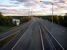
The state roads (Finnish valtatie , Swedish riksväg ) are the highest road category in Finland . They connect the largest cities in the country and are used for long-distance transport. In total there are 29 state roads in Finland with a total length of 8,570 km. They were established in 1938. In the Finnish road numbering system, the numbers 1–39 are provided for the state roads, currently 1–16 and 18–29 are used. On street signs the main streets are marked with a white number on a red background. A total of 700 km of the state roads are built like motorways , but the motorways are not a separate road category. Some European roads follow the course of the Finnish state roads.
List of state roads in Finland

blue: state road and European road
red: state road, no European road
yellow: main road , no state road
The former 17 belongs since 2010 to 9 . Two-digit numbers from 40 onwards refer to main roads that complement the system.
Roads in the Åland Islands
The streets of the autonomous archipelago have their own numbering; however, the signs follow those in the mother country. Its name is Huvudväg (only in Swedish ).
There are four main streets:
- Huvudväg 1 : Mariehamn - Eckerö
- Huvudväg 2 : Mariehamn - Sund (with a ferry to Vårdö Island )
- Huvudväg 3 : Mariehamn - Långnäs (near Lumparland )
- Huvudväg 4 : Godby ( Finström municipality ) - Geta
Individual evidence
- ↑ Finnish Road Administration: Road Statistics 2006 (Finnish / Swedish / English)
- ↑ Karttakeskus Tiekartat: Tiekartta GT1 1: 250,000. Helsinki 2008

