Striegistal
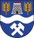
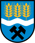
| coat of arms | Germany map | |
|---|---|---|

|
Coordinates: 51 ° 0 ' N , 13 ° 11' E |
|
| Basic data | ||
| State : | Saxony | |
| County : | Central Saxony | |
| Height : | 270 m above sea level NHN | |
| Area : | 77.23 km 2 | |
| Residents: | 4601 (Dec. 31, 2019) | |
| Population density : | 60 inhabitants per km 2 | |
| Postal code : | 09661 | |
| Primaries : | 037207, 034322 | |
| License plate : | FG, BED, DL, FLÖ, HC, MW, RL | |
| Community key : | 14 5 22 540 | |
| Community structure: | 14 districts | |
| Address of the municipal administration: |
Etzdorf, Waldheimer Straße 13 09661 Striegistal |
|
| Website : | ||
| Mayor : | Bernd Wagner | |
| Location of the municipality Striegistal in the district of central Saxony | ||
Striegistal is a municipality in the district of central Saxony in Saxony . The majority of the districts are located on the Kleine Striegis , the Große Striegis and the (combined) Striegis .
geography
Geographical location

The municipality of Striegistal is located in the foothills of the Ore Mountains in the middle of the Free State of Saxony between the three large cities of Dresden, Chemnitz and Leipzig. Close to Striegistal is the town of Mittweida about 15 km east , the town of Döbeln 16 km south and the district town of Freiberg 17 km north-west . In Berbersdorf the small and large Striegis unite to form the Striegis , whose water flows into the Freiberg Mulde in Niederstriegis .
Neighboring communities
| Kriebstein | Horse wine | Nossen |
| Rossau |

|
Large company |
| Hainichen | Hainichen | Oberschöna |
Community structure, population figures
| District | Size in km² | Resident July 1, 2020 |
|---|---|---|
| Arnsdorf | 4.1 | 319 |
| Berbersdorf | 8.1 | 440 |
| Böhrigen | 5.3 | 555 |
| Dittersdorf | 2.2 | 80 |
| Etzdorf | 9.5 | 662 |
| Gersdorf | 3.5 | 107 |
| Goßberg | 3.1 | 93 |
| Cold furnace | 3.2 | 70 |
| Marbach , with Kummersheim | 16.4 | 975 |
| Mobendorf | 8.6 | 570 |
| Naundorf | 2.8 | 200 |
| Pappendorf | 7.4 | 517 |
| Schmalbach | 2.8 | 139 |
history
From the settlement to the Reformation
The majority of the villages were founded in the course of the German settlement in the east under Margrave Otto between 1156 and 1162. In 1162, Emperor Friedrich I, Barbarossa, at the request of the margrave, confirmed that he could donate 800 Hufen land, which he had cleared and made arable at his own expense, to a monastery, the later Altzella monastery . In a document from 1185 the boundaries of the Altzella monastery are described. After that, apart from Arnsdorf, Dittersdorf, Kaltofen and Naundorf, the territories of all other villages in the Striegistal community belonged to the foundation area. Although not a single name of a village in the Striegistal municipality is mentioned in the boundary description, it can be assumed that the majority of the villages existed in 1162.
It cannot be proven whether the settlement of the 800 hooves was already complete at that time. Recent research results allow the conclusion that the village of Kaltofen, possibly also Goßberg, came into being later. Böhrigen is already mentioned in a document dated June 9, 1183. From this document and from archaeological findings it is known that there were attempts to colonize the region before 1156.
First documentary mention of the districts
| local community | first documentary mention | spelling at that time |
|---|---|---|
| Arnsdorf | 1348 | Arnoldisdorf |
| Berbersdorf | 1428 | Berbirsdorff |
| Böhrigen | 1183 | boron |
| Dittersdorf | 1325 | Dytrichdorph |
| Etzdorf | 1314 | Erzwinstorf |
| Gersdorf | 1502 | Gerßdorf |
| Goßberg | 1428 | Gogisperg |
| Cold furnace | 1297 | to the Kaldovene |
| Sorrow home | 1428 | Komersheim |
| Marbach | 1264 | Marchbach |
| Mobendorf | 1428 | Obirndorf |
| Naundorf | 1337 | Nuendorf |
| Pappendorf | 1230 | Poppendorf |
| Schmalbach | 1428 | Smalbach |
From the Reformation to the middle of the 19th century
A few years after the Reformation, Ulrich von Mordeisen became the landlord of the villages of Berbersdorf, Bräunsdorf , Goßberg, Großschirma , Großvoigtsberg, Kaltofen, Kleinschirma, Kleinvoigtsberg, Kleinwaltersdorf, Langhennersdorf, Lossnitz, Mobendorf , Seifersdorf, Pappendorf and Reichenbach, which formerly belonged to the Altzella monastery . After Ulrich von Mordeisen's death, his sons inherited the villages. All three had no interest in owning five villages each. They sold them to the Saxon ruling house. Rudolf Mordeisen took the longest time. He had inherited the villages of Pappendorf, Mobendorf, Berbersdorf, Goßberg and Kaltofen. The purchase contract with Elector Christian is dated July 5, 1587. These villages were added to the Nossen Office , which was founded in the course of the Reformation, and administered from there for centuries.
In the district of Berbersdorf in 1701 two men got into a witch trial as part of the witch hunt , in the district of Marbach in 1700 an old man.
Incorporations
In 1994 four municipalities merged to form the municipality of Striegistal as part of the municipal area reform, and six more to form the municipality of Tiefenbach . It was named after the small and large Striegis and the (unified) Striegis as well as the small river Tiefenbach, flowing through or tangential to the districts .
| Former parish | date | annotation |
|---|---|---|
| Arnsdorf | January 1, 1994 | Merger with 5 other municipalities to Tiefenbach |
| Berbersdorf | January 1, 1994 | Merger with 3 other communities to form Striegistal |
| Böhrigen | January 1, 1994 | Merger with 5 other municipalities to Tiefenbach |
| Dittersdorf | January 1, 1994 | Merger with 5 other municipalities to Tiefenbach |
| Etzdorf | January 1, 1994 | Merger with 5 other municipalities to Tiefenbach |
| Gersdorf | before 1875 | Incorporation to Etzdorf |
| Goßberg | January 1, 1994 | Merger with 3 other communities to form Striegistal |
| Cold furnace | 1st January 1974 | Incorporation to Pappendorf |
| Sorrow home | July 1, 1950 | Reclassification from Zella to Marbach |
| Marbach | January 1, 1994 | Merger with 5 other municipalities to Tiefenbach |
| Mobendorf | January 1, 1994 | Merger with 3 other communities to form Striegistal |
| Naundorf | January 1, 1994 | Merger with 5 other municipalities to Tiefenbach |
| Pappendorf | January 1, 1994 | Merger with 3 other communities to form Striegistal |
| Schmalbach | July 1, 1950 | Incorporation to Berbersdorf |
| Tiefenbach | July 1, 2008 | Merger with Striegistal to form Striegistal |
Population development
- 2016: 4,701
- 2020: 4,727
politics
Municipal council
Since the municipal council election on May 26, 2019 , the 18 seats of the municipal council have been distributed among the individual groups as follows:
- General and Free Electoral Association Striegistal (AFWS): 14 seats
- CDU : 4 seats
mayor
Bernd Wagner has been the mayor since February 1, 1993. In the last election in September 2015, he was confirmed in office with 87.4% of the votes.
Culture and sights
Buildings
- Lookout tower Böhrigen
- Castle complex in the district of Gersdorf
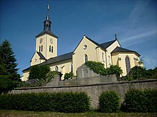
- Churches in the districts of Etzdorf , Marbach and Pappendorf
- Stone arch bridge from the 17th century over the Große Striegis in the Pappendorf district
- Paddag's house in Pappendorf
- Replicas of the Saxon post-mile pillars No. 16 (all-mile column Marbach - Rosental from the postal route Dresden - Leipzig ) or Leipzig- Freiberg and No. 19 (quarter milestone Berbersdorf, exit A4 ), No. 20 (all-mile column Pappendorf, church) and No. 21 (quarter milestone Kaltofen, direction Hainichen ) from the post route Nossen - Chemnitz
- Reconstructed royal Saxon milestones from the period from 1859 to 1865 as full and half milestones as well as road caretaker stone from the Hainichen- and Waldheim -Nossen postal courses in Etzdorf and Marbach or as a signpost from the Freiberg – Hainichen post road in Mobendorf- Ziegerhäuser
Natural monuments
- Striegistäler landscape protection area
- Teufelskanzel and Otterberg view over the Striegistal
- Aschbachtal nature reserve
- approx. 600 year old sweet chestnut in the castle park of Gersdorf
Memorials
In the valley of the Perzbach on the road from Goßberg to Langhennersdorf there is a memorial site with a stone tablet in memory of the female concentration camp prisoners of a death march from the subcamps Leipzig-Schönefeld and Taucha of the Buchenwald concentration camp , who succumbed to their mistreatment in the spring of 1945 or from SS Men were murdered.
Remarkable
The mining area in Gersdorf is part of the Ore Mountains Mining Region UNESCO World Heritage Site .
Economy and Infrastructure
With a net building area of 121 hectares, the municipality markets one of the largest industrial and commercial areas in the Free State of Saxony. Edeka Nordbayern-Sachsen-Thüringen and Landgard Ost maintain large company settlements here. Another medium-sized company is the large laundry of the Elis company in Böhrigen.
traffic
By the municipality that leads A 4 which is accessible from the located in the center of the municipality motorway junction Berbersdorf. The state capital Dresden and Chemnitz can be reached from here in just 20 minutes. The B 169 runs through Arnsdorf in the west of the municipality. The former Böhrigen and Berbersdorf stations are located on the Roßwein – Niederwiesa railway line, which was closed in 2004 (in passenger traffic as early as 1998) and on which the Striegistal cycle path from Hainichen to Roßwein is being planned. The bus routes 672, 690, 691 and 695 connect the community today with local public transport with the surrounding towns and Dresden.
media
The Striegistalbote is published as the official gazette of the Striegistal community.
Personalities
Sons and daughters of the church
- David Schirmer (* 1623 in Pappendorf , † 1686 in Dresden ), lyric poet of the Baroque period
- Julius Kell (born May 2, 1813 in Pappendorf; † May 28, 1849 in Dresden), educator, member of the state parliament and author of non-fiction
- Wolfgang Schindler (born January 6, 1929 in Marbach ; † December 9, 1991 in Berlin ), classical archaeologist
- Hermann Franz Gerhard Starke (born August 16, 1916 in Berbersdorf (Striegistal), † May 24, 1996 in Berlin) was a German journalist .
- Anton Wiede (born December 24, 1836 in Böhrigen, † April 19, 1911 in Karlsbad), mining engineer and entrepreneur
- Martin Kröger (born October 3, 1894 in Böhrigen, Saxony; † August 23, 1980 in Essen), chemist and professor at the University of Leipzig
- Friedrich Wernicke (born May 6, 1902 in Böhrigen; † February 27, 1982 in Baden-Baden), mining captain
Personalities who have worked in the church
- Richard Witzsch (born August 24, 1877 in Glauchau; † November 5, 1939 in Dresden), local history researcher and elementary school teacher in Mobendorf
- Friedrich Gottlob Lehmann (born August 12, 1805 in Hainichen; † July 3, 1869), textile manufacturer in Böhrigen and member of the state parliament.
- Carl Gustav Leonhardt (born February 20, 1845 in Hainichen; † September 8, 1903), textile manufacturer
- Diethmar villicus de Poppendorf
Web links
- Arnsdorf in the Digital Historical Directory of Saxony
- Dittersdorf in the Digital Historical Directory of Saxony
- Kummersheim in the Digital Historical Directory of Saxony
- Naundorf in the Digital Historical Directory of Saxony
Individual evidence
- ↑ Population of the Free State of Saxony by municipalities on December 31, 2019 ( help on this ).
- ↑ Manfred Wilde : The sorcery and witch trials in Kursachsen , Cologne, Weimar, Vienna 2003, pp. 551–554.
- ↑ Manfred Wilde : The sorcery and witch trials in Kursachsen , Cologne, Weimar, Vienna 2003, p. 484.
- ↑ a b c d e f g h i j k State Statistical Office of the Free State of Saxony: Area changes
- ↑ Community and place directory for the Kingdom of Saxony, 1904, publisher: Statistical Bureau of the Royal Ministry of the Interior
- ↑ a b c municipalities 1994 and their changes since 01.01.1948 in the new federal states , Metzler-Poeschel publishing house, Stuttgart, 1995, ISBN 3-8246-0321-7 , publisher: Federal Statistical Office
- ↑ a b Lists of the municipalities incorporated since May 1945 and evidence of the breakdown of the independent manor districts and state forest districts, 1952, publisher: Ministry of the Interior of the State of Saxony
- ↑ State Statistical Office of the Free State of Saxony
- ↑ http://saebi.isgv.de/biografie/David_Schirmer_(1623-1687)
- ^ Ralf Höppner: Die Striegistäler.de . In: heimatverein-striegistal.de .
- ↑ http://www.heimatverein-striegistal.com/Witzsch.pdf
- ^ Ralf Höppner: Die Striegistäler.de . In: heimatverein-striegistal.de .


