
Maximilianstrasse underground station

.jpg)

The underground station Maximilianstraße (abbreviation: MA ) is the 18th underground station of the Nuremberg underground and was opened on June 20, 1981. It is 722 meters from the Eberhardshof underground station and 700 meters from the Bärenschanze underground station . Maximilianstrasse was named after King Maximilian II and is part of the Middle Ring . Where the bus station and the striking savings bank building are located today, the main administration building of the Nuremberg-Fürth tram , the so-called villa , stood until 1977 . In the original plans, this underground station was to be named Maximilianstraße / Nordwestring (analogous to the Frankenstraße / Südring underground station ). It is used by around 18,300 passengers every day.
location
The station is located in the Seeleinsbühl district of Nuremberg and extends underground in an east-west direction under Fürther Straße between Beckstraße and Maximilianstraße. From the eastern station head an exit leads to a distribution floor and from there to the south and north side of Fürther Straße, from the western station head an exit leads to a distribution floor under the intersection of Fürther- / Maximilianstraße and from there to all four corners of the intersection and to the Maximilianstrasse bus station . There is also an elevator from the platform level to the pedestrian zone on the south side of Fürther Straße.
The Nuremberg Higher Regional Court and District Court and the Nuremberg-Fürth Regional Court are located in the vicinity of the train station .
Building and architecture
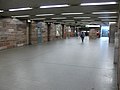
The station structure is 210 m long, 17 m wide and 7.5 m deep (one and a half times the depth). The construction work for the station began on February 5, 1979 and was carried out in the open construction method with Berlin shoring .
The color of the station is green . The platform walls, tiled with ceramic tiles, are white from the top edge of the rail to the edge of the platform and then in green, interrupted by the white band with the station name in black. A stylized sculpture of the eagle was embedded in the building wall on the western distribution floor.

Surface access

Striking access building
Distribution floor

Plastic of the eagle in the distribution floor

Exit from the distribution level to the platform level

Platform level


Nürnberg-West stop
At the height of today's underground station and the intersection of Maximilianstrasse / Fürther Strasse, the Nuremberg-West stop of the Ludwig Railway , which ran from Nuremberg Ludwigsbahnhof to Fürth Ludwigsbahnhof , had existed since December 7, 1835 . Its operation was stopped on October 31, 1922 due to inflation and its tracks were removed on June 5, 1925.
.svg)
.svg)
Passenger traffic : In operation: Dürrenhof | Dutzendteich | Eibach | Erlenstegen | Fischbach | Frankenstadion | Gleißhammer | Central station | Katzwang | Laufamholz | Mögeldorf | Northeast Station | Ostbahnhof | Ostring | Rehhof | Reichelsdorf | Reichelsdorfer Keller | Rothenburgerstrasse | Sandreuth | Schweinau | Stone | Steinbühl • Closed: Buchenbühl | Doos | Fürth intersection | Fürth South | Großgründlach | Long water | Ludwigsbahnhof | Muggenhof | Neusündersbühl | Marshalling yard exit | Shunting yard depot | West | Brick | Customs House
Freight traffic : In operation: container terminal (port) | Dutzendteich | Wholesale market | Port station | Long water | North Station | Marshalling yard | Marshalling yard exit | Shunting yard depot | Marshalling yard entrance | Shunting yard fore yard • Closed: container terminal (Gostenhof) | Main freight station | Northeast Station | Northwest Station | Ostbahnhof | Südbahnhof | stockyard
Lines
| line | course |
|---|---|
|
|
Langwasser Süd - Community House - Langwasser Mitte - Scharfreiterring - Langwasser Nord - Messe - Bauernfeindstrasse - Hasenbuck - Frankenstrasse - Maffeiplatz - Aufseßplatz - Central Station - Lorenzkirche - White Tower - Plärrer - Gostenhof - Bärenschanze - Maximilianstrasse - Eberhardshof - Muggenhof - city limits - Jakobinenstrasse - Fürth Central Station - Fürth Rathaus - Fürth Stadthalle - Fuerth Hospital - Furth Hardhöhe |
The station is served by the U1 underground line . On the surface there is a bus station with the possibility to change to the city bus lines 35 , 38 and 39 . The N9 night bus also runs on weekends and before public holidays .
literature
- City of Nuremberg / Building Department (Ed.): U-Bahn Nuremberg Bärenschanze-Eberhardshof . Press and Information Office of the City of Nuremberg, Nuremberg 1981.
- Michael Schedel: Nuremberg U-Bahn Album . Robert Schwandl Verlag, Berlin 2007, ISBN 3-936573-11-5 .
Web links
- Local area map on the sides of the VGN (PDF; 60.68 KB)
- Station description on local traffic Franconia (private)
- Station pictures on cityverkehr.de (private)
Individual evidence
- ↑ Overview: These are the most used underground stations in Nuremberg on nordbayern.de, from December 27, 2019, accessed on January 6, 2020
- ^ Ludwigsbahnhof Nuremberg on nuernberginfos.de, accessed on January 25, 2018
Coordinates: 49 ° 27 ′ 19 ″ N , 11 ° 2 ′ 32 ″ E

Lines :
![]() |
|
![]() |
|
![]() • Former lines :
• Former lines :
![]() |
|
![]()
Vehicles : type DT1 | Type DT2 | Type DT3 / DT3-F | Type A | Type G1
Railway stations : Aufseßplatz | Bauernfeindstrasse | Bärenschanze | Eberhardshof | Airport | Frankenstrasse | Friedrich-Ebert-Platz | Fürth Hardhöhe | Fürth Central Station | Fürth Clinic | Fürth town hall | Fürth City Hall | Community house | Gostenhof | Großreuth near Schweinau | Gustav-Adolf-Strasse | Hasenbuck | Central station | Herrnhütte | High torture | Jakobinenstrasse | Kaulbachplatz | North Hospital | Langwasser middle | Langwasser North | Langwasser South | Lorenz Church | Maffeiplatz | Maxfeld | Maximilianstrasse | Fair | Muggenhof | Northeast Station | Northwest Ring | Opera House | Blusterer | Rathenauplatz | Rennweg | Röthenbach | Rothenburger Strasse | Scharfreiterring | Schoppershof | Schweinau | St. Leonhard | City limits | Sündersbühl | White Tower | Wöhrder Wiese | Brick