Gros-Chastang
| Gros-Chastang | ||
|---|---|---|

|
|
|
| region | Nouvelle-Aquitaine | |
| Department | Corrèze | |
| Arrondissement | Grommet | |
| Canton | Sainte-Fortunade | |
| Community association | Tulle agglo | |
| Coordinates | 45 ° 13 ′ N , 1 ° 59 ′ E | |
| height | 260-546 m | |
| surface | 13.37 km 2 | |
| Residents | 181 (January 1, 2017) | |
| Population density | 14 inhabitants / km 2 | |
| Post Code | 19320 | |
| INSEE code | 19089 | |
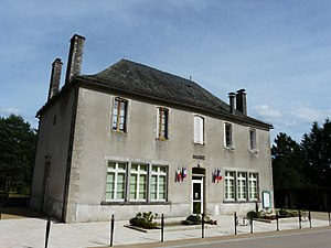
 Mairie (Town Hall) |
||
Gros-Chastang is a French municipality with 181 inhabitants (at January 1, 2017) in the Correze in the region Nouvelle-Aquitaine . The inhabitants call themselves Gros-Chastagniers (ières).
geography
The community is located in the Massif Central . The prefecture of the Tulle department is located around 29 kilometers northwest and Égletons 26 kilometers north.
Neighboring municipalities of Gros-Chastang are Marcillac-la-Croisille in the northeast, Bassignac-le-Haut in the southeast, Saint-Martin-la-Méanne in the south, La Roche-Canillac in the southwest, Gumond in the west and Saint-Pardoux-la-Croisille in the north-west.
coat of arms
Description : Divided in gold with two red hammers and monkshood .
Population development
| year | 1962 | 1968 | 1975 | 1982 | 1990 | 1999 | 2007 | 2016 |
| Residents | 206 | 240 | 176 | 168 | 173 | 156 | 169 | 179 |
Web links
Commons : Gros-Chastang - collection of images, videos and audio files
