La Roche-Canillac
| La Roche-Canillac | ||
|---|---|---|

|
|
|
| region | Nouvelle-Aquitaine | |
| Department | Corrèze | |
| Arrondissement | Grommet | |
| Canton | Sainte-Fortunade | |
| Community association | Tulle agglo | |
| Coordinates | 45 ° 12 ′ N , 1 ° 58 ′ E | |
| height | 280-523 m | |
| surface | 3.02 km 2 | |
| Residents | 142 (January 1, 2017) | |
| Population density | 47 inhabitants / km 2 | |
| Post Code | 19320 | |
| INSEE code | 19174 | |
 La Roche-Canillac |
||
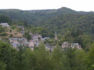
La Roche-Canillac ( La Rocha Canilhac in Occitan ) is a French municipality with 142 inhabitants (at January 1, 2017) in the Correze in the region Nouvelle-Aquitaine . The municipality is the capital of the canton of Sainte-Fortunade .
geography
The municipality is located in the Massif Central and is traversed by the Doustre River , a tributary of the Dordogne . The prefecture of the Tulle department is located about 24 kilometers southwest and Égletons 30 kilometers slightly northeast.
Neighboring municipalities of La Roche-Canillac are Gumond in the north, Gros-Chastang in the northeast, Saint-Martin-la-Méanne in the southeast and Champagnac-la-Prune in the southwest.
Population development
| year | 1962 | 1968 | 1975 | 1982 | 1990 | 1999 | 2007 | 2016 |
| Residents | 146 | 119 | 110 | 93 | 80 | 103 | 114 | 146 |
Web links
Commons : La Roche-Canillac - collection of images, videos and audio files
