Meilhards
|
Meilhards Melhars |
||
|---|---|---|

|
|
|
| region | Nouvelle-Aquitaine | |
| Department | Corrèze | |
| Arrondissement | Grommet | |
| Canton | Uzerche | |
| Community association | Pays d'Uzerche | |
| Coordinates | 45 ° 34 ′ N , 1 ° 39 ′ E | |
| height | 377-580 m | |
| surface | 44.99 km 2 | |
| Residents | 517 (January 1, 2017) | |
| Population density | 11 inhabitants / km 2 | |
| Post Code | 19510 | |
| INSEE code | 19131 | |
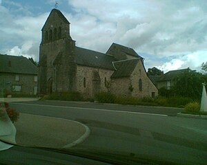
 Saint-Yrieix church |
||
Meilhards ( Melhars in Occitan ) is a French municipality with 517 inhabitants (at January 1, 2017) in the Correze in the region Nouvelle-Aquitaine . The municipality is a member of the Pays d'Uzerche municipal association . The inhabitants call themselves Meilhardois (es).
geography
The municipality is located in the Massif Central at the foot of the Plateau de Millevaches on the left side of the upper reaches of the Vézère .
Tulle , the prefecture of the department, is about 35 kilometers southeast, Brive-la-Gaillarde about 50 kilometers south and Uzerche about 15 kilometers southwest. The place is about 13 kilometers from exit 43 of the Autoroute A20 .
Neighboring municipalities of Meilhards are Surdoux in the north, Chamberet in the northeast, Soudaine-Lavinadière and Rilhac-Treignac in the east, Peyrissac and Eyburie in the southeast, Condat-sur-Ganaveix in the south, Lamongerie in the west and La Croisille-sur-Briance in the northwest.
coat of arms
Description : Three red posts in gold, each with three silver five-pointed stars .
Population development
| year | 1962 | 1968 | 1975 | 1982 | 1990 | 1999 | 2007 | 2016 |
| Residents | 794 | 897 | 789 | 700 | 622 | 519 | 529 | 507 |
Attractions
- The 17th century tomb of Philippe de Meilhards. The tomb has been classified as a monument historique since 1908 .
