Middle Erzgebirgskreis
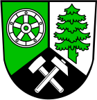
| coat of arms | Germany map |
|---|---|

|
 Help with maps |
| Basic data (as of 2008) | |
| Existing period: | 1994-2008 |
| State : | Saxony |
| Administrative region : | Chemnitz |
| Administrative headquarters : | Marienberg |
| Area : | 595.37 km 2 |
| Residents: | 86,667 (Dec. 31, 2007) |
| Population density : | 146 inhabitants per km 2 |
| License plate : | MEK |
| Circle key : | 14 1 81 |
| Circle structure: | 22 municipalities |
| District Administrator : | Albrecht Kohlsdorf ( CDU ) |
| Location of the Middle Ore Mountains in Saxony | |
The Middle Erzgebirgskreis was a district in the administrative region of Chemnitz in the southwest of the Free State of Saxony . 86,667 people lived in the district (December 31, 2007) on an area of 595.37 km². The administrative seat was in the city of Marienberg .
geography
The highest elevation in the district was south of statute on the border with the Czech Republic (899 m above sea level), but generally the 891 m high and striking Hirtstein north of statute was the highest mountain.
economy
With the decline of mining in the Ore Mountains , the natural raw material wood was developed as a new source of income . This resulted in a traditional, economically significant special production of Ore Mountains products known all over the world, such as the original Seiffen nutcracker and the smokers . Production facilities can be found primarily in Seiffen, Olbernhau, Grünhainichen and Borstendorf. In addition to this traditional, wood processing industry, mechanical engineering , the electrical industry , the construction industry and the trade and service industries are the main branches of the region. Among the most important products in these industries include refrigerators , industrial springs , standard parts , lamps , fixtures , woodworking machinery and motorcycles . A large number of commercial areas were created for the manufacturing and service industries . Companies from the construction industry , mechanical engineering, metalworking industry, food industry , folk art , electrical installation , electronics / electrical industry , lighting construction, furniture , environmental technology , recycling , transport and freight forwarding , sanitary and heating construction , wood industry as well as trade and services settled here. The district was shaped by tourism , through which the Silberstrasse ran .
history
The Middle Erzgebirgskreis was founded on August 1st 1994 mainly as a merger of the districts of Marienberg and Zschopau . The municipalities of Borstendorf and Grünhainichen came from the district of Flöha and the municipality of Kleinolbersdorf-Altenhain from the district of Chemnitz joined the new Central Ore Mountains . The northern part of the toy corner fell to the Freiberg district .
In the course of another administrative reform in Saxony, the districts of Annaberg , Aue-Schwarzenberg , Middle Erzgebirgskreis and Stollberg merged on August 1st, 2008 to form the new Erzgebirgskreis .
politics
The last district administrator of the Middle Ore Mountains was Albrecht Kohlsdorf (CDU).
District council
The 50 seats in the last district assembly were distributed among the individual parties as follows:
Political party |
Seats
|
| CDU |
29
|
| LEFT |
8th
|
| FDP |
5
|
| SPD |
4th
|
| District farmers' association |
2
|
| BFW |
1
|
| GREEN |
1
|
cities and communes
The Middle Erzgebirgskreis consisted of 22 municipalities (including six cities). Twelve municipalities were united in three administrative communities and two administrative associations.
|
Administrative communities and administrative associations
|
License Plate
On August 1, 1994, the district was assigned the MAB , which has been valid since January 1, 1991 for the Marienberg district. This was replaced on January 1, 1995 by the new distinctive sign MEK , which was issued until July 31, 2008. It has been available in the Erzgebirgskreis since November 9, 2012.
Until about the year 2000, vehicles from the old district of Zschopau received license plates with the letters A to Z and numbers from 1 to 999.
literature
- District Office Middle Erzgebirgskreis, Ed .: On the history of the cities and municipalities in the Middle Erzgebirgskreis , a time table (parts 1–3)

