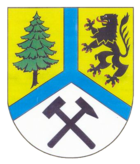
Weißeritzkreis
| coat of arms | Germany map |
|---|---|

|

Coordinates: 50 ° 54 ' N , 13 ° 40' E |
| Basic data (as of 2008) | |
| Existing period: | 1994-2008 |
| State : | Saxony |
| Administrative region : | Dresden |
| Administrative headquarters : | Dippoldiswalde |
| Area : | 765.71 km 2 |
| Residents: | 120,645 (Dec. 31, 2007) |
| Population density : | 158 inhabitants per km 2 |
| License plate : | DW |
| Circle key : | 14 2 90 |
| Circle structure: | 16 municipalities |
| Address of the district administration: |
Weißeritzstrasse 7 01744 Dippoldiswalde |
| District Administrator : | Bernd Greif ( CDU ) |
| Location of the Weißeritz district in Saxony | |
The Weißeritzkreis was a district in the Free State of Saxony until the 2008 district reform . Since August 1, 2008, the area of the former district has belonged to the Saxon Switzerland-Eastern Ore Mountains district . The neighboring districts were Freiberg , Meißen , Saxon Switzerland and the city of Dresden . In the south, the Weißeritzkreis bordered the Czech Republic ( Okres Teplice ).
geography
The name of the former district describes its geographical location - it was due to the Roter and Wilder Weißeritz , which still united in the Weißeritz district , south of the state capital Dresden in the Eastern Ore Mountains and its foreland. The district also included parts of the valleys of the Elbe tributaries Müglitz ( Geising and Glashütte ), Lockwitzbach ( Reinhardtsgrimma and Kreischa ) and Wilde Sau ( Wilsdruff ). The Wilde Weißeritz, the Müglitz and the Lockwitzbach are only a few kilometers apart on their upper reaches.
As a result of the hull areas of the Pultscholle , the landscape of the former district consists mainly of the valleys and plateaus under agricultural and forestry use. To the south, to the ridge of the Eastern Ore Mountains, the altitude increases steadily. The lowest point was about 160 m above sea level. NN in Freital, the highest with 905 m on the Kahleberg near Zinnwald. The Landberg near Pohrsdorf , the Windberg in Freital, the Golberoder Zughübel with the Babisnauer Poplar , the mountains of the Karsdorf Fault with the Wilisch , the Luchberg near Luchau and the Geisingberg formed striking landmarks .
Well-known standing waters were the Malter reservoir used for tourism and the Lehnmühle and Klingenberg reservoirs required for drinking water . In Lauenstein which was created by 2006 retention basins Müglitztal .
Significant forest areas in the former district are the Tharandt Forest , the Dippoldiswalder Heide and the Bärenfels forest district .
In addition to the nature reserves that belong to the Erzgebirge / Vogtland Nature Park , the protected mountain meadows in the Eastern Ore Mountains with their unique rocky ridge landscape, the Georgenfeld high moor near Zinnwald and the Rabenauer Grund deserve special mention.
history
The Weißeritzkreis was formed on August 1, 1994 by the union of the Dippoldiswalde and Freital districts as part of the Saxon district reform . On July 1, 1998, the city of Wilsdruff moved from the district of Meißen to the Weißeritz district.
In the course of the second Saxon district reform, the district was dissolved on August 1, 2008. The new Saxon Switzerland-Eastern Ore Mountains district was created through the merger with the Saxon Switzerland district to the east . Both circles had already agreed on this in the phase of the voluntary orientation of the district mergers of the Free State of Saxony (2007). The new district office is located in Pirna .
politics
The only district administrator in the Weißeritz district was Bernd Greif (CDU). The 54 seats in the district council were ultimately distributed among the individual parties as follows:
| Political party | Seats |
|---|---|
| CDU | 28 |
| LEFT | 9 |
| Free voters Weißeritzkreis | 8th |
| SPD | 4th |
| FDP | 3 |
| GREEN | 2 |
cities and communes
(Population figures as of December 31, 2006)
|
|
- Administrative community Altenberg with the member communities Altenberg and Hermsdorf / Erzgeb.
- Administrative community Pretzschendorf with the member communities Hartmannsdorf-Reichenau and Pretzschendorf
- Administrative community Tharandt with the member communities Dorfhain and Tharandt
License Plate
On August 1, 1994, the district was assigned the DW distinguishing sign , which had been valid for the Dippoldiswalde district since January 1, 1991 and was issued until July 31, 2008. It has been available in the Saxon Switzerland-Eastern Ore Mountains district since November 12, 2012.

