Sonoma County
| administration | |
|---|---|
| US state : | California |
| Administrative headquarters : | Santa Rosa |
| Foundation : | 1850 |
| Demographics | |
| Residents : | 483,878 (2010) |
| Population density : | 118.5 inhabitants / km 2 |
| geography | |
| Total area : | 4580 km² |
| Water surface : | 498 km² |
| map | |
| Website : www.sonoma-county.org | |
The Sonoma County is a county in the state of California of the United States . The county seat is in Santa Rosa .
geography
Sonoma County is bounded to the west by the Pacific Ocean . To the south it borders Marin County . In the east it borders in the northern third on Lake County and with the southern two-thirds on Napa County . Sonoma County shares its northern border with Mendocino County . The area is 4,580 square kilometers. The largest cities are the county seat of Santa Rosa and Petaluma .
history

The county was founded in 1850, making it one of the oldest in California. Sonoma is a term from the language of the Miwok - Indians and is called "Valley of the Moon" or as "country or trunk of the chief's nose translated".
There are 6 National Historic Landmarks in Sonoma County . A total of 66 buildings and sites in the county are listed on the National Register of Historic Places .
economy
The county is known for its wine production , with a total of over 200 businesses in the industry. It is one of the 13 state-recognized wine-growing areas ( American Viticultural Areas ) in the USA. In 2004, 150,396 tons of grapes were harvested on a cultivation area of 242.7 square kilometers. The most common varieties are Chardonnay , Cabernet Sauvignon and Pinot Noir , but Merlot and Zinfandel are also produced.
The Geysers geothermal field has been generating electricity on a commercial scale from dry steam since 1960 . The current production capacity is 900 MW.
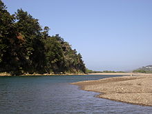
Tourism is also an important economic factor in the region . The 17-mile-long Sonoma Coast State Beach on Highway 1 between Jenner and Bodega Bay is considered one of the most beautiful stretches of beach in California, and is also very popular with surfers.
education
The Sonoma State University , a branch of the California State University , and founded in 1918, Santa Rosa Junior College have in Sonoma County located. The Santa Rosa Junior College is one of the ten oldest colleges in California and is widely considered one of the best in the State.
Demographic data
| growth of population | |||
|---|---|---|---|
| Census | Residents | ± in% | |
| 1850 | 560 | - | |
| 1860 | 11,867 | 2,019.1% | |
| 1870 | 19,810 | 66.9% | |
| 1880 | 25,926 | 30.9% | |
| 1890 | 32,721 | 26.2% | |
| 1900 | 38,480 | 17.6% | |
| 1910 | 48.394 | 25.8% | |
| 1920 | 52,090 | 7.6% | |
| 1930 | 62,222 | 19.5% | |
| 1940 | 69.052 | 11% | |
| 1950 | 103.405 | 49.7% | |
| 1960 | 147.375 | 42.5% | |
| 1970 | 204,885 | 39% | |
| 1980 | 299,681 | 46.3% | |
| 1990 | 388.222 | 29.5% | |
| 2000 | 458.614 | 18.1% | |
| 2010 | 483,878 | 5.5% | |
| Before 1900
1900–1990 2000 + 2010 |
|||

According to the 2000 census , Sonoma County had a population of 458,614. There were 172,403 households and 112,406 families. The population density was 112 inhabitants per square kilometer. The racial the population was composed of 81.60% white, 1.42% African American, 1.18% Native American, 3.07% Asian, 0.20% Pacific islander and 8.44% from other races Groups; 4.09% from two or more races. 17.34% of the population were Hispanic or Latino of any race.
Of the 172,403 households, 31.90% had children and adolescents under the age of 18 living with them. 50.30% were married couples living together, 10.40% were single mothers. 34.80% were not families. 25.70% were single households and 10.00% had someone who was 65 years of age or older. The average household size was 2.60 and the average family size was 3.12.
For the entire county, the population was composed of 24.50% residents under 18 years of age, 8.80% between 18 and 24 years of age, 29.20% between 25 and 44 years of age, and 24.90% between 45 and 64 years of age 12.60% were 65 years of age or over. The median age was 38 years. For every 100 females there were 97.00 males, and for every 100 females aged 18 and over there were 94.00 males.
The median income for a household in the city was $ 53,076 , and the median income for a family was $ 61,921. Males had a median income of $ 42,035 versus $ 32,022 for females. The per capita income was $ 25,724. 8.10% percent of the population and 4.70% of families are below the poverty line. 8.40% of these were under 18 years of age and 5.70% were 65 years of age or older.
Web links
Individual evidence
- ↑ GNIS-ID: 1657246. Retrieved on February 22, 2011 (English).
- ↑ Listing of National Historic Landmarks by State: California . National Park Service , accessed August 27, 2017.
- ↑ Search mask database in the National Register Information System. National Park Service , accessed August 27, 2017.
- ↑ US Census Bureau - Census of Population and Housing . Retrieved March 15, 2011
- ↑ Extract from Census.gov . Retrieved February 28, 2011
- ↑ Extract from census.gov (2000 + 2010). Accessed April 2, 2012
Coordinates: 38 ° 31 ' N , 122 ° 56' W


