
Straßkirchen
| coat of arms | Germany map | |
|---|---|---|

|
Coordinates: 48 ° 50 ' N , 12 ° 43' E |
|
| Basic data | ||
| State : | Bavaria | |
| Administrative region : | Lower Bavaria | |
| County : | Straubing arch | |
| Management Community : | Straßkirchen | |
| Height : | 324 m above sea level NHN | |
| Area : | 38.39 km 2 | |
| Residents: | 3263 (Dec. 31, 2019) | |
| Population density : | 85 inhabitants per km 2 | |
| Postal code : | 94342 | |
| Area code : | 09424 | |
| License plate : | SR , BOG, MAL | |
| Community key : | 09 2 78 192 | |
| Community structure: | 15 districts | |
| Address of the municipal administration: |
Lindenstrasse 1 94342 Straßkirchen |
|
| Website : | ||
| Mayor : | Christian Hirtreiter ( CSU ) | |
| Location of the community of Straßkirchen in the district of Straubing-Bogen | ||
  |
||


Straßkirchen is a municipality in the Lower Bavarian district of Straubing-Bogen and the seat of the Straßkirchen administrative community .
geography
Straßkirchen is located in the Danube Forest region and in the Gäuboden . The Danube flows past Straßkirchen at a distance of about three kilometers.
Community structure
Straßkirchen has 15 districts:
|
There are the districts of Grafling, Paitzkofen, Schambach and Straßkirchen.
history
Until the church is planted
Straßkirchen was first mentioned in a document in 1140. Straßkirchen belonged to the Straubing Rent Office and the Natternberg Regional Court of the Electorate of Bavaria . Court brands existed in Schambach, Paitzkofen and Stetten . In the course of the administrative reforms in Bavaria , today's municipality was created with the municipal edict of 1818 .
Territory changes
On April 1, 1949, Niederharthausen 's parts of the municipality Haberkofen, Niederast and Oedhof were incorporated, which went hand in hand with an increase in area from almost 471 hectares to 1610.13 hectares.
As part of the municipal reform in Bavaria, the previously independent municipalities of Irlbach , Paitzkofen (officially until 1870 Peitzkofen ) and Schambach and parts of the dissolved municipalities of Amselfing (Entau, Sophienhof) and Grafling (Gänsdorf, Seehof, Thal) were incorporated on May 1, 1978 . After a judgment by the Bavarian Constitutional Court in 1983, Irlbach became an independent municipality again, into which Entau and Sophienhof were also spun off.
Population development
In the period from 1988 to 2018, the municipality grew from 2,799 to 3,193 inhabitants or by 14.1%.
- 1939: 2150 inhabitants
- 1950: 3251 inhabitants
- 1961: 2935 inhabitants
- 1970: 2777 inhabitants
- 1987: 2725 inhabitants
- 1991: 2935 inhabitants
- 1995: 3162 inhabitants
- 2000: 3283 inhabitants
- 2005: 3346 inhabitants
- 2009: 3304 inhabitants
- 2010: 3278 inhabitants
- 2011: 3221 inhabitants
- 2012: 3162 inhabitants
- 2013: 3150 inhabitants
- 2014: 3126 inhabitants
- 2015: 3170 inhabitants
- 2016: 3180 inhabitants
(Source: LfStat )
politics
The first mayor is Christian Hirtreiter (CSU).
In 2014 he was elected with 56.6% in the runoff election against the incumbent of the SPD and re-elected in 2020 against a candidate of the FW.
After the 2020 local elections, the local council has 16 members with the following distribution of seats:
- CSU: 8 seats (2014: +1)
- SPD / UWG: 2 seats (2014: −3)
- Free voters Straßkirchen (FW): 4 seats (2014: +2)
- Free Schambach Electoral Association (FWV): 2 seats (2014: +0).
The municipality's budget in 2013 comprised a total volume of € 10.37 million, with the administrative budget accounting for € 4,904,468 and the asset budget for € 5,465,340. The trade tax income amounted to 1,800,000 €. The per capita debt was 73 euros and the total debt was 237,618 euros. (As of 12/2013)
The municipality's budget in 2018 again comprised a total volume of € 11.56 million, with the administrative budget accounting for € 6,769,875 and the asset budget for € 4,788,619. The trade tax income amounted to € 1,720,000. The per capita debt was 437 euros and the total debt was 1,389,666 euros. (As of 12/2018).
Architectural monuments
Important architectural monuments in the community are the church and inn on the church square in the main town of Straßkirchen and Schambach Castle .
Economy and Infrastructure
Economy including agriculture and forestry
According to official statistics, there were 17 employees at the place of work in 1998 in the field of agriculture and forestry, 197 in the manufacturing sector and 105 in trade and transport. In other economic sectors 155 people were employed at the place of work subject to social security contributions. There were a total of 1083 employees at the place of residence subject to social insurance contributions. There were two companies in the manufacturing sector and eight in the construction sector. In addition, in 1999 there were 80 farms with an agriculturally used area of 2781 ha, of which 2725 ha were arable land and 56 ha were permanent green space.
traffic
Straßkirchen is right on the B 8 and also has a station from which daytime hour commuter trains of agilis both in the direction Straubing / Regensburg and after Plattling / Passau drive. The municipality spends over 200,000 euros each year on street lighting and road maintenance.
Local and community roads: The local roads have a length of 23.466 km, of which 21.025 km have been expanded. The communal roads are 37.363 km long, of which 20,992 km have been expanded. The dirt roads in the municipality measure 128.806 km in total, of which 51.076 km in Straßkirchen, 41.280 km in Schambach and 36.450 km in the districts of Paitzkofen, Thal, Gänsdorf, Seehof, Tiefenbrunn, Makofen and Stetten.
education
There are the following facilities:
- two kindergartens with 125 kindergarten places and 114 children: St. Martin, St. Elisabeth (as of 2011)
- Elementary school (elementary and middle school) with 16 teachers and 274 students (as of 2015/2016)
Personalities
- Willie Huber (1958-2010), born in Straßkirchen, emigrated with his parents to Canada, where he was active for several years in the highest ice hockey league , the National Hockey League , and became a Canadian national player .
- Christian Schmiedbauer (* 1976), grew up in Straßkirchen, lives in Augsburg. As a graphic artist under the pseudonym Landrömer , his comics “Kauboi und Kaktus” reach a broad public.
- Klaus Krinner (* 1938), holder of the Golden Citizen Medal, inventor and entrepreneur.
Honorary citizen
- Josef Schlecht, Mayor 1919–1923, awarded on March 22, 1954
- Johann Altschäffl, Mayor 1945–1972
- Josef Schraml, clergyman, awarded on June 22, 1947
- Edmund Krumbacher, Customs Inspector, awarded on September 29, 1950
- Klaus Krinner , entrepreneur, awarded in December 2019

Straßkirchen: Town hall with memorial stone 1140–1990
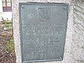
Straßkirchen: memorial stone for the first documentary mention in 1140

Straßkirchen: memorial stone for honorary citizens


Web links
- Entry on the coat of arms of Straßkirchen in the database of the House of Bavarian History
Individual evidence
- ↑ "Data 2" sheet, Statistical Report A1200C 202041 Population of the municipalities, districts and administrative districts 1st quarter 2020 (population based on the 2011 census) ( help ).
- ↑ a b Local elections in the district of Straubing-Bogen. District Sraubing-Bogen, accessed on May 30, 2020 .
- ^ Community of Straßkirchen in the local database of the Bayerische Landesbibliothek Online . Bavarian State Library
- ↑ District. Municipalities and districts. Bavarian Surveying Administration, archived from the original on April 11, 2013 ; accessed on March 31, 2015 .
- ↑ Bavarian State Office for Statistics and Data Processing (Hrsg.): The municipalities of Bavaria according to the territorial status May 25, 1987. The population of the municipalities of Bavaria and the changes in the acquisitions and territory from 1840 to 1987 (= contributions to Statistics Bavaria . Issue 451). Munich 1991, p. 72 , urn : nbn: de: bvb: 12-bsb00070717-7 ( digitized version - footnote 33).
- ↑ Bavarian State Statistical Office (ed.): Localities directory for the Free State of Bavaria according to the census of June 16, 1925 and the territorial status of January 1, 1928 . Issue 109 of the articles on Bavaria's statistics. Munich 1928, Section II, Sp. 634 ( digitized - 1139.39 hectares).
- ↑ Bavarian State Statistical Office (ed.): Official place directory for Bavaria - edited on the basis of the census of September 13, 1950 . Issue 169 of the articles on Bavaria's statistics. Munich 1952, DNB 453660975 , Section II, Sp. 603 ( digitized - 1610.13 hectares).
- ^ Wilhelm Volkert (ed.): Handbook of Bavarian offices, communities and courts 1799–1980 . CH Beck, Munich 1983, ISBN 3-406-09669-7 , p. 577 .
- ^ Federal Statistical Office (ed.): Historical municipality directory for the Federal Republic of Germany. Name, border and key number changes in municipalities, counties and administrative districts from May 27, 1970 to December 31, 1982 . W. Kohlhammer GmbH, Stuttgart / Mainz 1983, ISBN 3-17-003263-1 , p. 632 f .
- ↑ Straßkirchen: Official statistics of the LfStat
- ↑ Straßkirchen primary school in the school database of the Bavarian State Ministry for Education and Culture , accessed on August 6, 2017.
- ^ Middle School Straßkirchen in the school database of the Bavarian State Ministry for Education and Culture , accessed on August 6, 2017.
- ↑ honorary citizen on the community homepage
- ↑ Honorary Citizen on RegioWiki
- ↑ Honorary citizenship for entrepreneurs . In: Bogener newspaper . December 16, 2019, p. 1 u. 20 .

Aholfing | Aiterhofen | Ascha | Atting | Bow | Falkenfels | Feldkirchen | Geiselhöring | Haibach | Haselbach | Hunderdorf | Irlbach | Kirchroth | Konzell | Laberweinting | Leiblfing | Loitzendorf | Mallersdorf-Pfaffenberg | Mariaposching | Mitterfels | Neukirchen | Niederwinkling | Oberschneiding | Parkstetten | Perasdorf | Perkam | Rain | Rattenberg | Rattiszell | Salching | Sankt Englmar | Schwarzach | Stallwang | Steinach | Straßkirchen | Wiesenfelden | Windberg
Ackerhof | Gänsdorf | Haberkofen | Haidhof | Makofen | Niederast | Oedhof | Paitzkofen | Putzenhofen | Schambach | Seehof | Stetten | Straßkirchen | Thal | Tiefenbrunn