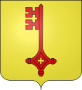
Til-Châtel
| Til-Châtel | ||
|---|---|---|

|
|
|
| region | Bourgogne-Franche-Comté | |
| Department | Côte-d'Or | |
| Arrondissement | Dijon | |
| Canton | Is-sur-Tille | |
| Community association | Vallées de la Tille et de l'Ignon | |
| Coordinates | 47 ° 31 ' N , 5 ° 11' E | |
| height | 273-349 m | |
| surface | 26.37 km 2 | |
| Residents | 1,110 (January 1, 2017) | |
| Population density | 42 inhabitants / km 2 | |
| Post Code | 21120 | |
| INSEE code | 21638 | |
| Website | http://www.til-chatel.fr/ | |
Til-Chatel is a French commune with 1,110 inhabitants (as of January 1 2017) in the department of Côte-d'Or in the region Bourgogne Franche-Comté . It belongs to the Arrondissement of Dijon and the canton of Is-sur-Tille .
geography
Til-Châtel is located about 23 kilometers north-northeast of Dijon . Here the Ignon flows into the Tille . Til-Châtel is surrounded by the neighboring communities Selongey in the north, Orville in the north and northeast, Véronnes in the east and northeast, Lux in the southeast, Gemeaux in the south and southwest, Marcilly-sur-Tille and Is-sur-Tille in the west and Échevannes in the Northwest.
The A31 autoroute runs through the municipality .
Population development
| 1962 | 1968 | 1975 | 1982 | 1990 | 1999 | 2006 | 2013 |
| 745 | 731 | 735 | 755 | 768 | 819 | 940 | 1,055 |
| Source: Cassini and INSEE | |||||||
Attractions
- Saint-Florent-et-Saint-Honoré church
- Chapel of the Knights Templar
- Til-Châtel airport
Personalities
Maybe here's Edme Mariotte (1620-1684) was born here.
Web links
Commons : Til-Châtel - Collection of images, videos and audio files


