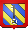
Longvic
| Longvic | ||
|---|---|---|

|
|
|
| region | Bourgogne-Franche-Comté | |
| Department | Côte-d'Or | |
| Arrondissement | Dijon | |
| Canton | Longvic (main town) | |
| Community association | Dijon metropolis | |
| Coordinates | 47 ° 17 ' N , 5 ° 4' E | |
| height | 219-247 m | |
| surface | 10.56 km 2 | |
| Residents | 8,604 (January 1, 2017) | |
| Population density | 815 inhabitants / km 2 | |
| Post Code | 21600 | |
| INSEE code | 21355 | |
| Website | www.ville-longvic.fr | |
 Fort de Beauregard |
||
Longvic is a commune with 8604 inhabitants (at January 1, 2017) in the department of Côte-d'Or in the region Bourgogne Franche-Comté . It belongs to the Arrondissement of Dijon and the canton of Longvic .
geography
The municipality is located in the urban center south of Dijon . It borders in the north on Dijon, in the north-east on Sennecey-lès-Dijon , in the east on Neuilly-Crimolois with Neuilly-lès-Dijon , in the south-east on Ouges , in the south on Fénay , in the south-west on Marsannay-la-Côte and in the west to Chenôve .
The municipality is crossed by the Ouche River, which receives the Suzon tributary on the left . The Canal de Bourgogne also runs in the river valley .
history
During the Second World War there was a POW camp in Longvic. Félix Kir made it possible for around 5,000 inmates to escape.
Population development
| year | 1968 | 1975 | 1982 | 1990 | 1999 | 2006 | 2016 |
| Residents | 5202 | 7448 | 8179 | 8273 | 9017 | 9332 | 8793 |
Economy and Infrastructure
- Branch of the Lennox International company .
- The Dijon Air Base as a civilian check-in area of the airbase Base aérienne 102 Dijon-Longvic
Attractions
- Église Saint-Pierre , parish church from the 17th century
- Fort de Beauregard , fortifications from the 19th century - Monument historique
Personalities
- Madjid Bougherra , Algerian-French soccer player
Town twinning
- Florennes , Belgium
- Verbandsgemeinde Maxdorf , Germany (since 1983)
- Diawara , Senegal
- New Holland , USA
Web links
- statistical data of the municipality (French)
Individual evidence
- ↑ Fort de Beauregard in the Base Mérimée of the French Ministry of Culture (French)
- ↑ [1]
- ↑ [2]
