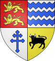
Aubusson (Orne)
| Aubusson | ||
|---|---|---|

|
|
|
| region | Normandy | |
| Department | Orne | |
| Arrondissement | Argentan | |
| Canton | Flers-2 | |
| Community association | Flers Agglo | |
| Coordinates | 48 ° 47 ′ N , 0 ° 33 ′ W | |
| height | 168-272 m | |
| surface | 3.9 km 2 | |
| Residents | 431 (January 1, 2017) | |
| Population density | 111 inhabitants / km 2 | |
| Post Code | 61100 | |
| INSEE code | 61011 | |
 Aubusson Town Hall (Mairie) |
||
Aubusson one is French municipality with 431 inhabitants (at January 1, 2017) in the department of Orne in the region Normandy (before 2016 Basse-Normandie ). The municipality belongs to the Arrondissement of Argentan and the canton of Flers-2 (until 2015 Flers-Nord ). The inhabitants are called Aubussonnais .
geography
Aubusson is about 46 kilometers south-southwest of Caen . Aubusson is surrounded by the neighboring communities of Montilly-sur-Noireau in the north, Athis-de-l'Orne in the east, Flers in the south and south-east, Saint-Georges-des-Groseillers in the south and west and Caligny in the north-west.
Population development
| year | 1962 | 1968 | 1975 | 1982 | 1990 | 1999 | 2006 | 2011 | 2016 |
| Residents | 186 | 189 | 221 | 314 | 329 | 335 | 375 | 425 | 427 |
| Source: Cassini and INSEE | |||||||||
Attractions
- Saint-Céneri church
Web links
Commons : Aubusson - collection of images, videos and audio files

