
Berchères-les-Pierres
| Berchères-les-Pierres | ||
|---|---|---|
|
||
| region | Center-Val de Loire | |
| Department | Eure-et-Loir | |
| Arrondissement | Chartres | |
| Canton | Chartres-2 | |
| Community association | Chartres metropolis | |
| Coordinates | 48 ° 23 ' N , 1 ° 33' E | |
| height | 136-156 m | |
| surface | 19.83 km 2 | |
| Residents | 1,000 (January 1, 2017) | |
| Population density | 50 inhabitants / km 2 | |
| Post Code | 28630 | |
| INSEE code | 28035 | |
| Website | http://www.berchereslespierres.fr/ | |

Berchères-les-Pierres is a French commune with a population of 1,000 (as at 1st January 2017) in the department of Eure-et-Loir in the region Center-Val de Loire . It belongs to the Arrondissement of Chartres and the Canton of Chartres-2 (until 2015: Canton of Chartres-Sud-Est ).
geography
Berchères-les-Pierres is about eight kilometers southeast of Chartres . Berchères-les-Pierres is surrounded by the neighboring communities of Gellainville in the north and north-west, Sours in the north-east, Prunay-le-Gillon in the east and south-east, Theuville in the south, Dammarie in the south and south-west, Corancez in the west and south-west and Morancez in the west.
The Route nationale 154 forms the northeastern municipal boundary.
Population development
| 1962 | 1968 | 1975 | 1982 | 1990 | 1999 | 2006 | 2017 |
|---|---|---|---|---|---|---|---|
| 612 | 670 | 728 | 711 | 882 | 916 | 957 | 1000 |
| Sources: Cassini and INSEE | |||||||
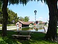
Attractions
- Notre-Dame church from the 12th century
- House La Grandmaison with portal from the 13th century
- Dolmen La Pierre Nochat
- Auguste Bollée's wind turbine, monument historique since 1993

Notre-Dame church
Auguste Bollée's wind turbine
.JPG)
.JPG)