Chuyer
| Chuyer | ||
|---|---|---|
|
|
||
| region | Auvergne-Rhône-Alpes | |
| Department | Loire | |
| Arrondissement | Saint-Etienne | |
| Canton | Le Pilat | |
| Community association | Pilat Rhodania | |
| Coordinates | 45 ° 27 ' N , 4 ° 42' E | |
| height | 319-880 m | |
| surface | 12.06 km 2 | |
| Residents | 775 (January 1, 2017) | |
| Population density | 64 inhabitants / km 2 | |
| Post Code | 42410 | |
| INSEE code | 42064 | |
| Website | http://www.chuyer.fr/ | |
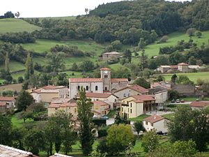
 Look at Chuyer |
||
Chuyer is a French municipality with 775 inhabitants (as of January 1 2017) in the department of Loire in the region Auvergne Rhône-Alpes . The municipality belongs to the arrondissement of Saint-Étienne and is part of the canton of Le Pilat (until 2015: canton of Pélussin ). The inhabitants are called chuyards .
geography
Chuyer is about 23 kilometers east of Saint-Étienne . Chuyer is surrounded by the neighboring communities of La Chapelle-Villars in the north, Vérin in the east, Saint-Michel-sur-Rhône in the east and south-east, Chavanay in the south and south-east, Pélussin in the south-west and Pavezin in the west.
Chuyer is located in the Pilat Regional Nature Park .
Population development
| year | 1962 | 1968 | 1975 | 1982 | 1990 | 1999 | 2006 | 2013 |
|---|---|---|---|---|---|---|---|---|
| Residents | 411 | 383 | 372 | 423 | 457 | 587 | 694 | 785 |
| Source: Cassini and INSEE | ||||||||
Web links
Commons : Chuyer - collection of images, videos and audio files
