Saint-Pierre-de-Boeuf
| Saint-Pierre-de-Boeuf | ||
|---|---|---|

|
|
|
| region | Auvergne-Rhône-Alpes | |
| Department | Loire | |
| Arrondissement | Saint-Etienne | |
| Canton | Le Pilat | |
| Community association | Pilat Rhodania | |
| Coordinates | 45 ° 23 ' N , 4 ° 45' E | |
| height | 130-445 m | |
| surface | 5.95 km 2 | |
| Residents | 1,726 (January 1, 2017) | |
| Population density | 290 inhabitants / km 2 | |
| Post Code | 42520 | |
| INSEE code | 42272 | |
| Website | http://www.saintpierredeboeuf.com/ | |
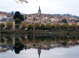
 View of Saint-Pierre-de-Bœuf |
||
Saint-Pierre-de-Boeuf is a French commune with 1,726 inhabitants (as of January 1 2017) in the department of Loire in the region Auvergne Rhône-Alpes . The municipality belongs to the arrondissement of Saint-Étienne and is part of the canton of Le Pilat (until 2015: canton of Pélussin ). The inhabitants are called Pétribociens .
geography
Saint-Pierre-de-Bœuf is located about 28 kilometers east-southeast of Saint-Étienne on the Rhone . A part of the river island Île de la Platière is located in the municipality. Saint-Pierre-de-Bœuf is surrounded by the neighboring communities of Chavanay in the north, Saint-Maurice-l'Exil in the east, Le Péage-de-Roussillon in the southeast, Limony in the south, Maclas in the southwest and Malleval in the west.
Saint-Pierre-de-Bœuf is located in the Pilat Regional Nature Park . Here the wine with the appellation Saint-Joseph is produced.
Population development
| year | 1962 | 1968 | 1975 | 1982 | 1990 | 1999 | 2006 | 2012 |
|---|---|---|---|---|---|---|---|---|
| Residents | 1,145 | 1,026 | 1,114 | 1,051 | 1,174 | 1.306 | 1,532 | 1,683 |
| Source: Cassini and INSEE | ||||||||
Attractions
- Saint-Pierre church
