Roche-la-Molière
| Roche-la-Molière | ||
|---|---|---|

|
|
|
| region | Auvergne-Rhône-Alpes | |
| Department | Loire | |
| Arrondissement | Saint-Etienne | |
| Canton | Saint-Etienne-3 | |
| Community association | Saint-Étienne Métropole | |
| Coordinates | 45 ° 26 ' N , 4 ° 19' E | |
| height | 469-700 m | |
| surface | 17.44 km 2 | |
| Residents | 9,697 (January 1, 2017) | |
| Population density | 556 inhabitants / km 2 | |
| Post Code | 42230 | |
| INSEE code | 42189 | |
| Website | www.rochelamoliere.com | |
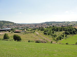
 View of the town of Saint-Genest-Lerpt from |
||
Roche-la-Molière is a French commune in the district of Saint-Etienne in the department of Loire in the region Auvergne Rhône-Alpes . It is located about 50 kilometers southwest of Lyon in the Massif Central . The 9697 inhabitants (as of January 1, 2017) of the city call themselves Rouchonnes or Rouchons . Roche-la-Molière is about five kilometers east of the Loire and west of Saint-Étienne .
history
The place is only mentioned in the 13th century (including 1252: Guillelmus de Rocha Moeyr ). The château, which was built later, is worth seeing.
politics
Melle Marie-Hélène Sauzéa (PS) has been mayor of the city since 2003. The municipality belongs to the canton of Saint-Étienne-Nord-Ouest-2 .
Population development
- 1962: 10.142
- 1968: 10.614
- 1975: 9.893
- 1982: 9.211
- 1990: 10.103
- 1999: 10.123
- 2006: 10,365
- 2010: 10,215
Web links
Commons : Roche-la-Molière - collection of images, videos and audio files

