Contrisson
| Contrisson | ||
|---|---|---|

|
|
|
| region | Grand Est | |
| Department | Meuse | |
| Arrondissement | Bar-le-Duc | |
| Canton | Canton of Revigny-sur-Ornain | |
| Community association | Communauté de communes du Pays de Revigny-sur-Ornain | |
| Coordinates | 48 ° 48 ' N , 4 ° 57' E | |
| height | 130-181 m | |
| surface | 11.82 km 2 | |
| Residents | 817 (January 1, 2017) | |
| Population density | 69 inhabitants / km 2 | |
| Post Code | 55800 | |
| INSEE code | 55125 | |
| Website | http://www.contrisson.fr/ | |
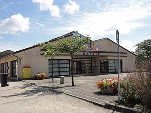
 Mairie (Town Hall) |
||
Contrisson is a French commune in the Meuse department in the region Grand Est . It has an area of 11.82 km² and 817 inhabitants (2017).
Neighboring municipalities are: Revigny-sur-Ornain , Vassincourt , Mognéville , Andernay , Sermaize-les-Bains , Remennecourt and Rancourt-sur-Ornain .
Population development
| year | 1962 | 1968 | 1975 | 1982 | 1990 | 1999 | 2005 | 2010 | 2015 |
|---|---|---|---|---|---|---|---|---|---|
| Residents | 517 | 414 | 472 | 658 | 698 | 685 | 721 | 745 | 811 |
| Source: Cassini and INSEE | |||||||||
Attractions
- Saint-Quentin Church ( Monument historique ), built in the 15th century
- lock
- Half-timbered houses
literature
- Le Patrimoine des Communes de la Meuse. Flohic Editions, Volume 2, Paris 1999, ISBN 2-84234-074-4 , pp. 771-773.
Web links
Commons : Contrisson - collection of images, videos and audio files

