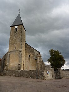
Darcey
| Darcey | ||
|---|---|---|

|
|
|
| region | Bourgogne-Franche-Comté | |
| Department | Côte-d'Or | |
| Arrondissement | Montbard | |
| Canton | Montbard | |
| Community association | Communauté de communes du Pays d'Alésia et de la Seine | |
| Coordinates | 47 ° 33 ' N , 4 ° 34' E | |
| height | 253-446 m | |
| surface | 18.91 km 2 | |
| Residents | 338 (January 1, 2017) | |
| Population density | 18 inhabitants / km 2 | |
| Post Code | 21150 | |
| INSEE code | 21226 | |
Darcey is a French municipality with 338 inhabitants (at January 1, 2017) in the department of Côte-d'Or in the region Bourgogne Franche-Comté . It belongs to Arrondissement Montbard and the eponymous canton Montbard .
location
The municipality is located around 19 kilometers south-east of Montbard on the banks of the Vau River , which flows into the Oze in the municipality . Neighboring communities are La Villeneuve-les-Convers in the north, Frôlois in the north-east, Corpoyer-la-Chapelle and Frôlois in the east, Gissey-sous-Flavigny in the south-east, Flavigny-sur-Ozerain in the south, Grésigny-Sainte-Reine in the south-west and Bussy -le-grand in the west.
Population development
| year | 1962 | 1968 | 1975 | 1982 | 1990 | 1999 | 2008 | 2015 |
|---|---|---|---|---|---|---|---|---|
| Residents | 411 | 437 | 394 | 336 | 328 | 301 | 336 | 336 |
Web links
Commons : Darcey - collection of images, videos and audio files

