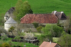
Mussy-la-Fosse
| Mussy-la-Fosse | ||
|---|---|---|

|
|
|
| region | Bourgogne-Franche-Comté | |
| Department | Côte-d'Or | |
| Arrondissement | Montbard | |
| Canton | Montbard | |
| Community association | Communauté de communes du Pays d'Alésia et de la Seine | |
| Coordinates | 47 ° 31 ' N , 4 ° 26' E | |
| height | 237-427 m | |
| surface | 4.45 km 2 | |
| Residents | 86 (January 1, 2017) | |
| Population density | 19 inhabitants / km 2 | |
| Post Code | 21150 | |
| INSEE code | 21448 | |
 Mussy-la-Fosse |
||
Mussy-la-Fosse is a French municipality with 86 inhabitants (at January 1, 2017) in the department of Côte-d'Or in the region Bourgogne Franche-Comté . It belongs to Arrondissement Montbard and the eponymous canton Montbard .
geography
The Ozerain River flows into the Brenne at Mussy-la-Fosse as a right tributary .
Neighboring municipalities are Venarey-les-Laumes in the north, Alise-Sainte-Reine in the northeast, Flavigny-sur-Ozerain in the east, Pouillenay in the south and Massingy-lès-Semur in the west.
Population development
| year | 1962 | 1968 | 1975 | 1982 | 1990 | 1999 | 2008 | 2015 |
|---|---|---|---|---|---|---|---|---|
| Residents | 91 | 93 | 86 | 86 | 92 | 87 | 79 | 82 |
Web links
Commons : Mussy-la-Fosse - Collection of images, videos and audio files
