
Schmidgaden airfield
| Schmidgaden airfield | |||
|---|---|---|---|
|
|||
| Characteristics | |||
| ICAO code | EDPQ | ||
| Coordinates | |||
| Height above MSL | 376 m (1234 ft ) | ||
| Transport links | |||
| Distance from the city center | 7.5 km southwest of Nabburg , 17 km east of Amberg |
||
| Street |
|
||
| Basic data | |||
| opening | 1960 | ||
| operator | Aero Club Schmidgaden | ||
| surface | 5.2 ha | ||
| Start-and runway | |||
| 12/30 | 540 m × 35 m grass with asphalt strips 520 × 10 m | ||
| website | |||
| www.aeroclub-schmidgaden.de | |||


The airfield Schmidgaden is the Sonderlandeplatz the community Schmidgaden in Upper Palatinate district Schwandorf . The owner and operator is the Aero Club Schmidgaden e. V.
geography
The airfield is located one kilometer northeast of the historic center of Schmidgaden and twelve kilometers north of Schwandorf at an altitude of 374 to 379 m above sea level. NN . The Schwärzerbach flows north of the airfield and a barrier-regulated municipal road crosses the runway. In terms of nature, it is located in the Upper Palatinate Forest , the Naab Valley extends to the east , the Bodenwöhr Bay to the south and the Vilstal to the west . The state border with the Czech Republic runs 35 km to the east .
history
Schmidgaden airfield was built in 1960 as a grass runway and an aircraft hangar and club house were built. The airfield hosted the German aerobatic championship in 1977, the training camp for the aerobatic world championship in 1978 and hosted the international PIPER meeting in 1983 . Free flights for old and disabled people and children are carried out every year. In 1989 the runway was asphalted and in 2016 the Aero Club Schmidgaden acquired ownership of the airfield.
A flight school was established for the acquisition of a private pilot license (PPL) for microlight aircraft and the German Air Observation Service regularly uses the area as a base for aerial observation of the risk of forest fires .
Airfield and equipment
The airfield is a special airfield for all types of aircraft up to 2000 kg maximum take-off weight (MTOW), helicopters up to 2500 kg and has no regular operating hours. Flight operations are mostly on the weekends on Saturdays from 1 p.m. to 6 p.m. and on Sundays and public holidays from 10 a.m. to 6 p.m. or until sunset at the latest, if the weather conditions permit. Landing is only possible after prior registration ( PPR ). The place carries the ICAO code EDPQ.
There is a multi-purpose building with a tower (frequency 134.540 MHz), two hangars and the clubhouse. The traffic pattern is located north of the airfield at 2000 ft.
The grass runway has a length of 540 m, width of 35 m and is equipped with an asphalt strip 520 × 10 m. There is a petrol station with an oil service. Take-off and landing are prohibited while refueling.
Incidents
- On October 11, 1964, a historic Focke-Wulf Fw 44 double-decker was badly damaged on EDPQ .
- On June 10, 1973, a parachutist had an accident in Schmidgaden.
- On January 17, 2016, a driver used the freshly snow-covered maneuvering area for unauthorized driving and skidding exercises. This came off the paved runway, caused property damage and land damage and fled.
traffic
- The airfield is accessible via a barrier-regulated municipal road to the state road St 2040 . This leads west to the federal highway 6 , east to Nabburg and there to the federal highway 93 .
- The public transport does not serve the airport directly. In Schmidgaden you can board the VGN buses 462 and 6317; the closest rail connections are to the southeast at Schwarzenfeld station on the Regensburg – Weiden railway line and southwest at Freihöls stop on the Nuremberg – Irrenlohe railway line .

Runway (2013)

Piper Meetings (2013)

Piper Meetings (2013)
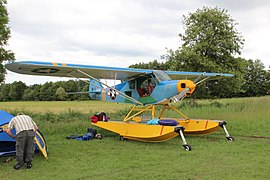
Piper Meetings (2013)


Web links
- Aero Club Schmidgaden
- EDPQ at Oberpfalz-Luftbild.de
- Airfield information for pilots
- Forest fire observation flight on EDPQ (YouTube video 5:51)
- Aviation map for Schwandorf Airfield on SkyVector.com
Individual evidence
- ↑ EDPQ at BayernAtlas
- ↑ At the Aero Club, press report at Oberpfalz Medien
- ↑ Press report, reconnaissance flights in the event of forest fire risk
- ↑ log of D-EQAX
- ↑ Federal Archives, BFU investigation report CX0029 / 73 (.xml)
- ↑ Press report from Jan. 17, 2016