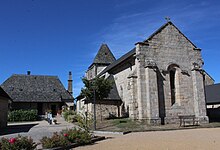
Saint-Paul (Corrèze)
|
Saint-Paul Sent Paul |
||
|---|---|---|

|
|
|
| region | Nouvelle-Aquitaine | |
| Department | Corrèze | |
| Arrondissement | Grommet | |
| Canton | Sainte-Fortunade | |
| Community association | Tulle agglo | |
| Coordinates | 45 ° 13 ' N , 1 ° 54' E | |
| height | 269-574 m | |
| surface | 14.10 km 2 | |
| Residents | 221 (January 1, 2017) | |
| Population density | 16 inhabitants / km 2 | |
| Post Code | 19150 | |
| INSEE code | 19235 | |
 Mairie Saint-Paul |
||
Saint Paul ( Sent Paul in Occitan ) is a commune of 221 inhabitants (at January 1, 2017) in the Correze in the region Nouvelle-Aquitaine . The community is a member of the community association Tulle Agglo .
geography
The community is located in the Massif Central . Tulle , the prefecture of the department, is a good 20 kilometers to the northwest.
coat of arms
Description : A silver shield head in blue with two black merlettes .
Neighboring communities
Neighboring municipalities of Eyrein are Espagnac in the north, Gumond in the northeast, Champagnac-la-Prune in the southeast, Saint Sylvain in the south, Forgès in the southwest, Lagarde-Marc-la-Tour with Marc-la-Tour in the west and Pandrignes in the northwest.
Population development
| year | 1962 | 1968 | 1975 | 1982 | 1990 | 1999 | 2007 | 2016 |
| Residents | 288 | 310 | 259 | 232 | 236 | 238 | 231 | 212 |
Web links
Commons : Saint-Paul - Collection of images, videos and audio files

