Saint-Salvy
| Saint-Salvy | ||
|---|---|---|
|
|
||
| region | Nouvelle-Aquitaine | |
| Department | Lot-et-Garonne | |
| Arrondissement | Agen | |
| Canton | Le Confluent | |
| Community association | Confluent et Coteaux de Prayssas | |
| Coordinates | 44 ° 18 ' N , 0 ° 26' E | |
| height | 63-184 m | |
| surface | 9.26 km 2 | |
| Residents | 200 (January 1, 2017) | |
| Population density | 22 inhabitants / km 2 | |
| Post Code | 47360 | |
| INSEE code | 47275 | |
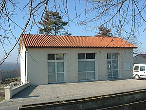
 Town hall (Mairie) of Saint-Salvy |
||
Saint-Salvy is a French commune of 200 inhabitants (at January 1, 2017) in the department of Lot-et-Garonne in the region Nouvelle-Aquitaine (before 2016 Aquitaine ). The municipality belongs to the Arrondissement of Agen and the canton of Le Confluent ( Port-Sainte-Marie until 2015 ).
geography
Saint-Salvy is about 20 kilometers west-northwest of Agen . Saint-Salvy is surrounded by the neighboring municipalities of Bourran in the north and northwest, Lacépède in the north and northeast, Prayssas in the east, Frégimont in the south, Bazens in the south and southwest and Galapian in the west.
Population development
| year | Residents | |||||||
|---|---|---|---|---|---|---|---|---|
| 1962 | 219 | |||||||
| 1968 | 177 | |||||||
| 1975 | 171 | |||||||
| 1982 | 155 | |||||||
| 1990 | 166 | |||||||
| 1999 | 187 | |||||||
| 2006 | 196 | |||||||
| 2013 | 179 | |||||||
| Source: Cassini and INSEE | ||||||||
Web links
Commons : Saint-Salvy - collection of images, videos and audio files
