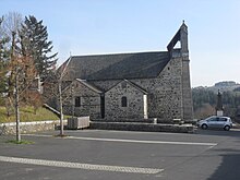
Val d'Arcomie
| Val d'Arcomie | ||
|---|---|---|
|
|
||
| region | Auvergne-Rhône-Alpes | |
| Department | Cantal | |
| Arrondissement | Saint-Flour | |
| Canton | Neuvéglise | |
| Community association | Saint-Flour Community | |
| Coordinates | 44 ° 56 ' N , 3 ° 13' E | |
| height | 726–1,087 m | |
| surface | 86.27 km 2 | |
| Residents | 987 (January 1, 2017) | |
| Population density | 11 inhabitants / km 2 | |
| Post Code | 15320 | |
| INSEE code | 15108 | |
| Website | http://valdarcomie.fr/ | |
Val d'Arcomie is a commune in the French department of Cantal in the region of Auvergne Rhône-Alpes . The municipality, which has existed since January 1, 2016, belongs to the canton of Neuvéglise in the arrondissement of Saint-Flour . It is named after the Arcomie river , which touches the municipality mark.
It was created as Commune nouvelle by decree of September 30, 2015 by amalgamating the previous municipalities of Loubaresse , Faverolles , Saint-Just and Saint-Marc . Since then, these have been Communes déléguées , belonged to the canton of Ruynes-en-Margeride until 2015 and had a total of 999 inhabitants in 2013. Loubaresse is the main town (chief-lieu).
structure
| District | former INSEE code |
Area (km²) |
Population (2016) |
|---|---|---|---|
| Faverolles | 15068 | 32.19 | 292 |
| Loubaresse (administrative headquarters) | 15108 | 28.24 | 429 |
| Saint-Just | 15195 | 17.06 | 191 |
| Saint-Marc | 15197 | 8.78 | 81 |
geography
Neighboring communities
| Alleuze | Anglards-de-Saint-Flour |
Ruynes-en-Margeride , Chaliers |
| Fridefont |

|
Chaulhac * |
| Albaret-le-Comtal * | Les Monts-Verts * | Albaret-le-Comtal * |
* These neighboring communities are in the Lozère department .
Attractions
Web links
Commons : Val d'Arcomie - collection of images, videos and audio files
Individual evidence
- ↑ Population figures retrospectively from January 1, 2016

