
Weißenborn / Erzgeb.
| coat of arms | Germany map | |
|---|---|---|
 Help on coat of arms |
Coordinates: 50 ° 52 ' N , 13 ° 24' E |
|
| Basic data | ||
| State : | Saxony | |
| County : | Central Saxony | |
| Management Community : | Lichtenberg-Weissenborn | |
| Height : | 386 m above sea level NHN | |
| Area : | 22.57 km 2 | |
| Residents: | 2468 (Dec. 31, 2019) | |
| Population density : | 109 inhabitants per km 2 | |
| Postal code : | 09600 | |
| Area code : | 03731 | |
| License plate : | FG, BED, DL, FLÖ, HC, MW, RL | |
| Community key : | 14 5 22 590 | |
| Association administration address: | Bahnhofstrasse 3A 09638 Lichtenberg / Erzgeb. |
|
| Website : | ||
| Mayor : | Udo Eckert ( FDP ) | |
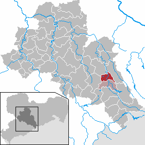
| Location of the community Weißenborn / Erzgeb. in the district of central Saxony | ||
  |
||

Weißenborn / Erzgeb. is a municipality in the district of central Saxony in Saxony (Germany). With the neighboring municipality of Lichtenberg / Erzgeb. Weißenborn forms the administrative community Lichtenberg-Weißenborn . Weißenborn / Erzgeb. consists of the place Weißenborn / Erzgeb. with Süßenbach and the Berthelsdorf / Erzgeb district incorporated in 1994 . .
geography

The Waldhufendorf Weißenborn is located in the northern part of the Osterzgebirge . With its lower part it lies in the valley of the Freiberger Mulde and stretches steeply for several kilometers in a side valley. In the northeast and east, the community borders on Bobritzsch-Hilbersdorf , in the south on Lichtenberg / Erzgeb. , to the west to Brand-Erbisdorf and to the northwest to Freiberg . The distances are 6 km to Freiberg, 31 km to Dresden , 19 km to Dippoldiswalde , 12 km to Frauenstein and 5 km to Brand-Erbisdorf. The Süßenbach part of the municipality is located in the southeast on Frauensteiner Straße .
In the Weißenborn district of Berthelsdorf / Erzgeb. exists with the train station Berthelsdorf (Erzgeb) and the stop Berthelsdorf (Erzgeb) Ort railway connection to the railway line Freiberg – Holzhau . On the Berthelsdorf – Großhartmannsdorf railway line , you come across the disused Zug stop at around 480 m above sea level. NN . State roads lead to Freiberg, Frauenstein and Brand-Erbisdorf.
history

The area of Weißenborn was in the middle of the border forest between the margraviate of Meissen and northern Bohemia . In the 12th century the forest was settled and cleared, which resulted in Weissenborn. A donation of 10 hooves and a sale of 2 hooves from Heinrich II. Von Dohna , which were entered in the Zellische acquisition list, has survived. On November 7th, 1213 Pope Innocent I took the Altzella monastery and its possessions under his protection. In this certificate a “Wizenburnes” with 12 hooves is listed. Until 1356 the place remains with Altzella. In this year Nicol von Hartitzsch , mayor of Freiberg, was enfeoffed with Weißenborn. From 1477 was mainly north of the Weissenborn silver ore later lead - tin and - copper ore with a golden age in the 16th century to the Thirty Years' War won. This mining is included in the Freiberg mining district . After this war, mining never regained its original importance until it was stopped in 1852. Weißenborn / Erzgeb. until 1856 in the electoral or royal Saxon district office Freiberg . At that time, the manor over the place lay with the Weißenborn manor .

From 1856, Weißenborn belonged to the Freiberg court office and from 1875 to the Freiberg district administration . In 1871 the paper mill started operations because of its location on the Freiberg Mulde. The place developed from a farming village to an urban settlement. In 1888 the Weißenborn paper mill was given a siding to the Berthelsdorf station (Erzgebirge) on the Nossen – Moldau railway line. This was in operation until 2015. This year the paper mill relocated its transports to the road.
The search for uranium ore after 1945 was unsuccessful. With the second district reform in the GDR came Weißenborn / Erzgeb. in 1952 to the Freiberg district in the Chemnitz district (renamed the Karl-Marx-Stadt district in 1953 ), which was continued in 1990 as the Saxon district of Freiberg . With the second district reform in the Free State of Saxony, the Brand-Erbisdorf district was added to the Freiberg district. This was the incorporation of the west of Weißenborn / Erzgeb. located village of Berthelsdorf / Erzgeb. possible from January 1, 1994. The municipality of Weißenborn / Erzgeb has belonged to the municipality since 2008. to the district of central Saxony.
Population development
The following population figures refer to December 31 of the previous year with the territory January 2007:
|
1982 to 1988
|
1989 to 1995
|
1996 to 2002
|
2003 to 2013
|
- Source: State Statistical Office of the Free State of Saxony
politics
Municipal council
Since the municipal council election on May 26, 2019 , the 14 seats of the municipal council have been distributed among the individual groups as follows:
- Free voter community Weißenborn-Erzgeb. (FWG): 13 seats
- CDU : 1 seats
mayor
Udo Eckert was elected to succeed Peter Hünig in May 2008 and was confirmed in office in May 2015 with 82.7% of the votes.
Culture and sights
Buildings
Economy and Infrastructure
Paper has been produced in Weißenborn without interruption since 1871. The Freiberg paper factory in Weißenborn is now part of the Felix Schoeller Group .
Personalities
- Ernst Wilhelm Traugott Eckardt (1819–1892), teacher, school director in Roßwein, Zschopau and Glauchau, district school inspector of Grimma
- Erich Oehme (1889–1970), sculptor, born in Berthelsdorf
- Manfred Wolf (1931-2010), geologist
- Friedrich Naumann (* 1940), historian, born in Berthelsdorf
- Ute Hommola (* 1952), athlete (javelin thrower)
- Julia Kodaneck (* 1986), disabled athlete / judoka, lives in Weißenborn
literature
- Richard Steche : Weissenborn. In: Descriptive representation of the older architectural and art monuments of the Kingdom of Saxony. 3. Issue: Amtshauptmannschaft Freiberg . CC Meinhold, Dresden 1884, p. 124.
Web links
- Atlas Central Saxony
- Official website of the community of Weißenborn
- Weißenborn / Erzgeb. in the digital historical directory of Saxony
Individual evidence
- ↑ Population of the Free State of Saxony by municipalities on December 31, 2019 ( help on this ).
- ^ Süßenbach in the Digital Historical Directory of Saxony
- ^ Karlheinz Blaschke , Uwe Ulrich Jäschke : Kursächsischer Ämteratlas. Leipzig 2009, ISBN 978-3-937386-14-0 ; P. 72 f.
- ^ The Amtshauptmannschaft Freiberg in the municipality register 1900
- ^ Berthelsdorf on the website of the community Weißenborn / Erzgeb.
- ↑ "Schoeller Shuts Down Works" in Freie Presse, Chemnitz, January 17, 2015
- ↑ Berthelsdorf / Erzgeb. on gov.genealogy.net
- ↑ Results of the 2019 municipal council elections
- ↑ Allocation of seats in the 2019 municipal council elections