
Brand-Erbisdorf district
| coat of arms | Germany map |
|---|---|

|
 Help with maps |
| Basic data (as of 1994) | |
| Existing period: | 1990-1994 |
| State : | Saxony |
| Administrative region : | Chemnitz |
| Administrative headquarters : | Brand-Erbisdorf |
| Area : | 353.73 km 2 |
| Residents: | 35,563 (Oct 3, 1990) |
| Population density : | 101 inhabitants per km 2 |
| License plate : | BED |
| Circle key : | 14 0 17 |
| Circle structure: | 27 municipalities |
| District Administrator : | Volkmar Krauss ( DSU ) |
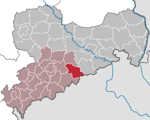
| Location of the district of Brand-Erbisdorf in Saxony | |
  |
|
The district of Brand-Erbisdorf existed from May 17, 1990 to August 1, 1994 in the Free State of Saxony .
history
The district was created on May 17, 1990 by law from the Brand-Erbisdorf district . The first and only district administrator in the district was from May 31, 1990 to July 31, 1994, the DSU politician Volkmar Krauss (1941–1999).
The Brand-Erbisdorf district existed until the first Saxon district reform in 1994 . With effect from August 1, 1994, the entire district became part of the newly formed Freiberg district . The city of Brand-Erbisdorf received the status of a large district town to compensate for the loss of the district seat .
geography
The Freiberger Mulde flows through the district in the eastern Ore Mountains .
| Freiberg district | ||
| District of Flöha |
.svg)
|
District of Dippoldiswalde |
| Marienberg district |
Czechoslovakia (until January 1, 1993) Czech Republic |
structure
Territorial changes
The number of municipalities decreased from 27 to 12.
- Dissolution of the municipalities of Middle and Upper Saida - incorporation into Großhartmannsdorf (January 1, 1993)
- Dissolution of the municipality of Oberreichenbach - incorporation into Langenau (January 1, 1993)
- Dissolution of the community of St. Michaelis - incorporation into Brand-Erbisdorf (October 1, 1993)
- Dissolution of the community Weigmannsdorf-Müdisdorf - incorporation into Lichtenberg (October 1, 1993)
- Dissolution of the community of Voigtsdorf - incorporation into Dorfchemnitz (January 1, 1994)
- Dissolution of the municipality of Dittersbach - incorporation into Frauenstein (January 1, 1994)
- Dissolution of the community of Niedersaida in the district of Marienberg - incorporation into Großhartmannsdorf in the district of Brand-Erbisdorf (January 1, 1994)
- Dissolution of the communities of Helbigsdorf and Zethau - incorporation into Mulda (January 1, 1994)
- Dissolution of the communities of Clausnitz and Holzhau - incorporation into Rechenberg-Bienenmühle (January 1, 1994)
- Dissolution of the Friedebach community - incorporation into Sayda (January 1, 1994)
- Merger of the municipality of Cämmerswalde with the municipality of Neuhausen from the Marienberg district to form the new municipality of Neuhausen / Erzgeb. in the district of Brand-Erbisdorf (January 1, 1994)
- Dissolution of the communities of Burkersdorf and Nassau - incorporation into Frauenstein (March 1, 1994)
traffic
The federal highways 101 and 171 as well as the railway lines Nossen – Moldava , Berthelsdorf – Großhartmannsdorf and Brand-Erbisdorf – Langenau ran through the district.
At the beginning of 1991 the district received the BED vehicle distinguishing mark . It was issued until July 31, 1994. It has been available in the Central Saxony district since November 9, 2012 .