
Lapovo: Difference between revisions
No edit summary |
m grammar |
||
| (34 intermediate revisions by 21 users not shown) | |||
| Line 1: | Line 1: | ||
{{Use dmy dates|date= |
{{Use dmy dates|date=December 2021}} |
||
{{Infobox settlement |
{{Infobox settlement |
||
| |
|native_name = {{native name|sr-Cyrl|Лапово|italics=off}} |
||
| |
|native_name_lang = sr |
||
| |
|official_name = Lapovo |
||
| |
|other_name = |
||
| |
|settlement_type = [[List of cities in Serbia|Town]] and [[Municipalities and cities of Serbia|municipality]] |
||
| |
|image_shield = Lapovo-grb.png |
||
| |
|image_flag = |
||
| |
|image_skyline = lapovo_center.jpg |
||
| |
|image_caption = Town center |
||
| |
|image_map = Municipalities of Serbia Lapovo.png |
||
| |
|map_caption = Location of the municipality of Lapovo within Serbia |
||
| |
|mapsize = |
||
|coordinates = {{coord|44|11|N|21|06|E|region:RS|display=inline,title}} |
|||
| latd = 44 |latm =11 |latNS =N |
|||
| ⚫ | |||
| longd = 21 |longm=06 |longEW=E |
|||
| ⚫ | |||
| coordinates_display = inline,title |
|||
| subdivision_type1 = [[Subdivisions of Serbia|Region]] |
|||
| coordinates_region= RS |
|||
| ⚫ | |||
| ⚫ | |||
| subdivision_type2 = [[List of districts of Serbia|District]] |
|||
| ⚫ | |||
| |
| subdivision_name2 = [[Šumadija District|Šumadija]] |
||
|parts_type = Settlements |
|||
| ⚫ | |||
| |
|parts_style = para |
||
| |
|p1 = 2 |
||
| |
|leader_title = Mayor |
||
|leader_name = Boban Miličić ([[Serbian Progressive Party|SNS]]) |
|||
| leader_title = Mayor |
|||
| ⚫ | |||
| leader_name = Nebojsa Miletic ([[Demokratska stranka|DS]]) |
|||
| ⚫ | |||
| ⚫ | |||
| ⚫ | |||
| ⚫ | |||
| elevation_m = 105 |
|||
| ⚫ | |||
| |
|population_footnotes = <ref>{{Serbian census 2011}}</ref> |
||
| |
|population_as_of = 2011 census |
||
| |
|population_blank1_title = Town |
||
| |
|population_blank1 = 7147 |
||
| |
|population_blank2_title = Municipality |
||
| |
|population_blank2 = 7837 |
||
| |
|timezone = [[Central European Time|CET]] |
||
| |
|utc_offset = +1 |
||
| |
|timezone_DST = [[Central European Summer Time|CEST]] |
||
| |
|utc_offset_DST = +2 |
||
| |
|postal_code_type = [[Postal codes in Serbia|Postal code]] |
||
| |
|postal_code = 34220 |
||
| |
|area_code_type = [[Telephone numbers in Serbia|Area code]] |
||
| |
|area_code = +381(0)34 |
||
| |
|blank_name = [[Vehicle registration plates of Serbia|Car plates]] |
||
| |
|blank_info = KG |
||
| |
|website = {{url|www.lapovo.rs}} |
||
}} |
}} |
||
'''Lapovo''' ({{lang-sr-cyrl|Лапово}}) is a municipality located in the |
'''Lapovo''' ({{lang-sr-cyrl|Лапово}}) is a town and municipality located in the [[Šumadija District]] of central Serbia. The population of the town is 7,837 according to the 2011 census.<ref>[http://media.popis2011.stat.rs/2011/prvi_rezultati.pdf Census of Population, Households and Dwellings of the Republic of Serbia page 64]</ref> |
||
==History== |
==History== |
||
The first mention of ''Lapovo'' dates from the 12th century when [[Stefan Nemanja]] conquered region of [[Lepenica]] from Bizanthy. More accurate information about Lapovo's existence came after the [[Battle of Kosovo]] in 1389 while duke Mihailo or |
The first mention of ''Lapovo'' dates from the 12th century when [[Stefan Nemanja]] conquered region of [[Lepenica (region)|Lepenica]] from Bizanthy.{{Sources needed|date=June 2020}} More accurate information about Lapovo's existence came after the [[Battle of Kosovo]] in 1389 while duke Mihailo or Mihalj was running the estate in today's region of Lapovo. |
||
The Charter of Princess Milica from 1395 mentions landed property of Duke Mihajlo in Hlapova plain, Lapovo today, on the basis of which |
The Charter of Princess Milica from 1395 mentions landed property of Duke Mihajlo in Hlapova plain, Lapovo today, on the basis of which it can be concluded that Lapovo is a village which has a medieval origin.{{Citation needed|date=March 2011}} After the liberation from the Turks, a rapid development of Lapovo began, primarily thanks to its favourable geostrategic position. In 1896 Lapovo was declared for the town by decree of King Aleksandar Obrenovic. Municipality of Lapovo is located at Corridor 10, at the intersection of highway Belgrade-Nis. Lapovo also represents one of the most important railway hubs, on the railway line Belgrade-Nis-Athens. Lapovo is currently in a phase of economical development, which is accompanied by the appearance of a large number of national and foreign investors. |
||
==Demographics== |
|||
==Lapovo industrial zone== |
|||
{{Historical populations |
|||
'''Lapovo free zone''' has been formed between international highway E-5 Belgrade-Nis and railroad tracks 108 km from [[Belgrade]]. Quadrature of the zone is approximately 80 hectares with possibility of further enlargement. Because of its attractive geographical location, developed transport infrastructure of Lapovo, many foreign firms and companies are coming to Lapovo with the aim to build their factories, offices etc. in this area. |
|||
| type = |
|||
| percentages = pagr |
|||
|1948|7819 |1953|8255 |1961|8850 |1971|9156 |1981|9631 |1991|9480 |2002|8228 |2011|7837 |
|||
| source =<ref>{{cite web|title=2011 Census of Population, Households and Dwellings in the Republic of Serbia |url=http://pod2.stat.gov.rs/ObjavljenePublikacije/Popis2011/Knjiga20.pdf |website=stat.gov.rs |publisher=Statistical Office of the Republic of Serbia |access-date=11 January 2017 |url-status=dead |archive-url=https://web.archive.org/web/20140714191241/http://pod2.stat.gov.rs/ObjavljenePublikacije/Popis2011/Knjiga20.pdf |archive-date=14 July 2014 }}</ref> |
|||
}} |
|||
==Economy== |
|||
One of the first Greenfield investments in Lapovo is "Kronospan Srb", an Austrian company of board materials. According to estimates of the Agency for Foreign Investments (SIEPA), it is one of the largest direct investments in 2009, not only by the value of the investment, but also by the number of new job positions.{{Citation needed|date=March 2011}} A modern communal sanitary landfill{{Clarify|date=March 2011}} "Vrbak" which was built according to the most modern ecological standards was opened in Lapovo. The investment itself was entrusted to the Group ASA which is headquartered in Czech Republic. Form a Ideale, Wacker Neuson Kramer, Hodlemayer, Logist Centre, Tir base DW Oil, Eling, International fine arts and sports camp (ECPD and OUN), Rehabilitation centre with geothermal mineral water (Humanitarian organization from France) also expressed their intention to invest in the Municipality of Lapovo. |
|||
The Lapovo industrial zone has been formed between international highway [[A1 motorway (Serbia)|A1 motorway]] and railroad tracks, {{convert|108|km|abbr=off}} from [[Belgrade]]. Quadrature of the zone is approximately {{convert|80|ha|abbr=off}} with possibility of further enlargement.{{citation_needed|date=March 2019}} |
|||
The following table gives a preview of total number of employed people per their core activity (as of 2017):<ref name="stats18">{{cite web|title=ОПШТИНЕ И РЕГИОНИ У РЕПУБЛИЦИ СРБИЈИ, 2018.|url=http://publikacije.stat.gov.rs/G2018/Pdf/G201813045.pdf|website=stat.gov.rs|publisher=[[Statistical Office of the Republic of Serbia]]|access-date=16 March 2019|language=sr}}</ref> |
|||
The basis for the formation of industrial zones and for attracting foreign investors was created by adopting the Master Plan "Lapovo 2020". Economy in Lapovo consists of the construction company GIK "1. maj" which is in the process of revitalization after the privatization of this enterprise and also 44 enterprises and 245 private entrepreneurs according to statistical data of APR. The backbone of the economy is small and medium enterprises who employ a large number of workers from the territory of Lapovo. |
|||
{| class="wikitable sortable" style="font-size:95%;" |
|||
|- |
|||
! Activity |
|||
! Total |
|||
|- |
|||
|Agriculture, forestry and fishing||align="right"|11 |
|||
|- |
|||
|Mining||align="right"|1 |
|||
|- |
|||
|Processing industry||align="right"|611 |
|||
|- |
|||
|Distribution of power, gas and water||align="right"|14 |
|||
|- |
|||
|Distribution of water and water waste management||align="right"|84 |
|||
|- |
|||
|Construction||align="right"|9 |
|||
|- |
|||
|Wholesale and retail, repair||align="right"|201 |
|||
|- |
|||
|Traffic, storage and communication ||align="right"|450 |
|||
|- |
|||
|Hotels and restaurants||align="right"|35 |
|||
|- |
|||
|Media and telecommunications||align="right"|4 |
|||
|- |
|||
|Finance and insurance||align="right"|4 |
|||
|- |
|||
|Property stock and charter||align="right"|- |
|||
|- |
|||
|Professional, scientific, innovative and technical activities||align="right"|36 |
|||
|- |
|||
|Administrative and other services||align="right"|20 |
|||
|- |
|||
|Administration and social assurance||align="right"|69 |
|||
|- |
|||
|Education||align="right"|83 |
|||
|- |
|||
|Healthcare and social work ||align="right"|99 |
|||
|- |
|||
|Art, leisure and recreation||align="right"|12 |
|||
|- |
|||
|Other services||align="right"|22 |
|||
|- class="sortbottom" |
|||
|'''Total'''||align="right"|'''1,766''' |
|||
|} |
|||
==Notable people== |
|||
In 2006 businessmen from Lapovo founded "The Association of Private Entrepreneurs". Better contact among the Municipality of Lapovo, businessmen from the territory of the municipality and potential national and foreign investors is expected through establishing an Office for local economic development in Lapovo. The Municipality of Lapovo is a member of the National alliance for local economic development and it is in the process of certification of municipalities. Through this certification the Municipality of Lapovo would become the ninth municipality town in Serbia with a favourable business environment. This would open the way for Lapovo to European accession funds and to the development of the municipality itself. It is important to mention that Lapovo is also a unique open air museum. In Lapovo a good portion of the population lived and still lives by working on the railway. Combining tradition and the present, the decision of the Municipal Assembly of Lapovo declared Lapovo as "Town-railway museum". Every year on 14 October, the International Exhibition of Artists is held in Lapovo.{{Citation needed|date=March 2011}} |
|||
* [[Mike Stojanović|Momčilo Stojanović]] |
|||
==Technology and development== |
|||
Lapovo had a website before Kragujevac www.lapovo.org by Borjan Zlatkovic, had the first Wi-Fi 2.4 and 5 GHz. |
|||
==Gallery== |
==Gallery== |
||
<gallery> |
<gallery> |
||
File:Lapovo_City_Hall.jpg|Lapovo City Hall |
File:Lapovo_City_Hall.jpg|Lapovo City Hall |
||
File:Saint_Petka_Church.jpg| |
File:Saint_Petka_Church.jpg|St. Paraskeve church |
||
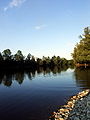
File:Morava_river1.jpg|Morava river |
File:Morava_river1.jpg|Morava river |
||
File:Morava_river2.jpg|Morava river |
File:Morava_river2.jpg|Morava river |
||
| Line 80: | Line 128: | ||
{{reflist}} |
{{reflist}} |
||
{{Šumadija District}} |
|||
{{Municipalities of Serbia}} |
{{Municipalities of Serbia}} |
||
<!--please leave the empty space as standard--> |
|||
[[Category:Populated places in Šumadija District]] |
[[Category:Populated places in Šumadija District]] |
||
Latest revision as of 00:05, 27 August 2023
Lapovo
Лапово (Serbian) | |
|---|---|
Town and municipality | |
 Town center | |
 Coat of arms | |
 Location of the municipality of Lapovo within Serbia | |
| Coordinates: 44°11′N 21°06′E / 44.183°N 21.100°E | |
| Country | |
| Region | Šumadija and Western Serbia |
| District | Šumadija |
| Settlements | 2 |
| Government | |
| • Mayor | Boban Miličić (SNS) |
| Area | |
| • Municipality | 55 km2 (21 sq mi) |
| Elevation | 105 m (344 ft) |
| Population (2011 census)[2] | |
| • Town | 7,147 |
| • Municipality | 7,837 |
| Time zone | UTC+1 (CET) |
| • Summer (DST) | UTC+2 (CEST) |
| Postal code | 34220 |
| Area code | +381(0)34 |
| Car plates | KG |
| Website | www |
Lapovo (Serbian Cyrillic: Лапово) is a town and municipality located in the Šumadija District of central Serbia. The population of the town is 7,837 according to the 2011 census.[3]
History[edit]
The first mention of Lapovo dates from the 12th century when Stefan Nemanja conquered region of Lepenica from Bizanthy.
This article needs additional citations for verification. (June 2020) |
More accurate information about Lapovo's existence came after the Battle of Kosovo in 1389 while duke Mihailo or Mihalj was running the estate in today's region of Lapovo.
The Charter of Princess Milica from 1395 mentions landed property of Duke Mihajlo in Hlapova plain, Lapovo today, on the basis of which it can be concluded that Lapovo is a village which has a medieval origin.[citation needed] After the liberation from the Turks, a rapid development of Lapovo began, primarily thanks to its favourable geostrategic position. In 1896 Lapovo was declared for the town by decree of King Aleksandar Obrenovic. Municipality of Lapovo is located at Corridor 10, at the intersection of highway Belgrade-Nis. Lapovo also represents one of the most important railway hubs, on the railway line Belgrade-Nis-Athens. Lapovo is currently in a phase of economical development, which is accompanied by the appearance of a large number of national and foreign investors.
Demographics[edit]
| Year | Pop. | ±% p.a. |
|---|---|---|
| 1948 | 7,819 | — |
| 1953 | 8,255 | +1.09% |
| 1961 | 8,850 | +0.87% |
| 1971 | 9,156 | +0.34% |
| 1981 | 9,631 | +0.51% |
| 1991 | 9,480 | −0.16% |
| 2002 | 8,228 | −1.28% |
| 2011 | 7,837 | −0.54% |
| Source: [4] | ||
Economy[edit]
The Lapovo industrial zone has been formed between international highway A1 motorway and railroad tracks, 108 kilometres (67 miles) from Belgrade. Quadrature of the zone is approximately 80 hectares (200 acres) with possibility of further enlargement.[citation needed]
The following table gives a preview of total number of employed people per their core activity (as of 2017):[5]
| Activity | Total |
|---|---|
| Agriculture, forestry and fishing | 11 |
| Mining | 1 |
| Processing industry | 611 |
| Distribution of power, gas and water | 14 |
| Distribution of water and water waste management | 84 |
| Construction | 9 |
| Wholesale and retail, repair | 201 |
| Traffic, storage and communication | 450 |
| Hotels and restaurants | 35 |
| Media and telecommunications | 4 |
| Finance and insurance | 4 |
| Property stock and charter | - |
| Professional, scientific, innovative and technical activities | 36 |
| Administrative and other services | 20 |
| Administration and social assurance | 69 |
| Education | 83 |
| Healthcare and social work | 99 |
| Art, leisure and recreation | 12 |
| Other services | 22 |
| Total | 1,766 |
Notable people[edit]
Gallery[edit]
-
 Lapovo City Hall
 -
 St. Paraskeve church
 -
 Morava river
 -
 Morava river


References[edit]
- ^ "Municipalities of Serbia, 2006". Statistical Office of Serbia. Retrieved 28 November 2010.
- ^ "2011 Census of Population, Households and Dwellings in the Republic of Serbia: Comparative Overview of the Number of Population in 1948, 1953, 1961, 1971, 1981, 1991, 2002 and 2011, Data by settlements" (PDF). Statistical Office of Republic Of Serbia, Belgrade. 2014. ISBN 978-86-6161-109-4. Retrieved 27 June 2014.
- ^ Census of Population, Households and Dwellings of the Republic of Serbia page 64
- ^ "2011 Census of Population, Households and Dwellings in the Republic of Serbia" (PDF). stat.gov.rs. Statistical Office of the Republic of Serbia. Archived from the original (PDF) on 14 July 2014. Retrieved 11 January 2017.
- ^ "ОПШТИНЕ И РЕГИОНИ У РЕПУБЛИЦИ СРБИЈИ, 2018" (PDF). stat.gov.rs (in Serbian). Statistical Office of the Republic of Serbia. Retrieved 16 March 2019.


