
Baruth / Mark
| coat of arms | Germany map | |
|---|---|---|

|
Coordinates: 52 ° 3 ' N , 13 ° 30' E |
|
| Basic data | ||
| State : | Brandenburg | |
| County : | Teltow-Fläming | |
| Height : | 58 m above sea level NHN | |
| Area : | 233.84 km 2 | |
| Residents: | 4217 (Dec. 31, 2019) | |
| Population density : | 18 inhabitants per km 2 | |
| Postal code : | 15837 | |
| Primaries : | 033704, 033745 (Ließen, Petkus) | |
| License plate : | TF | |
| Community key : | 12 0 72 014 | |
| City structure: | 12 districts or city districts | |
City administration address : |
Ernst-Thälmann-Platz 4 15837 Baruth / Mark |
|
| Website : | ||
| Mayor : | Peter Ilk | |
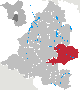
| Location of the city of Baruth / Mark in the Teltow-Fläming district | ||
  |
||

Baruth / Mark [ˈbaʁut] ( Želm in Lower Sorbian ) is a town in the Teltow-Fläming district in Brandenburg (Germany).
geography
Baruth / Mark includes parts of the Lower Fläming and the Baruther glacial valley . It is located in the immediate vicinity of the Spreewald and around 40 kilometers from the southern border of the city of Berlin at the intersection of federal highways 96 and 115 .
- Neighboring communities
Baruth / Mark borders on the following communities (clockwise, starting from the north): Am Mellensee , Zossen , Teupitz , Halbe , Rietzneuendorf-Staakow , Golßen , Steinreich , Dahme / Mark , Niederer Fläming , Nuthe-Urstromtal .
City structure
The city is divided into the following local and inhabited districts:
- Baruth / Mark with the community part Klein Ziescht
- Dornswalde
- Groß Ziescht with the Kemlitz community
- Horstwalde
- Klasdorf with the community part Glashütte
- Left
- Merzdorf
- Mückendorf
- Paplitz
- Petkus with the community part Charlottenfelde
- Radeland
- Schöbendorf
There are also the living spaces Am Bahnhof, Bernhardsmüh, Bombachhaus, Forsthaus Brand, Forsthaus Johannismühle, Forsthaus Wunder, Horstmühle , Lochow , Mühlenberg, Pechhütte, Radelandsiedlung and Siedlung.
history
12th to 17th centuries

A castle with an associated settlement was built in the course of the German East Settlement in the 12th century. The settlers chose a sandy headland 1.5 km to 2 km wide, which enabled a safe crossing of the Glogau-Baruther glacial valley . Baruth / Mark was first mentioned in a document in 1234 and then belonged to the Ernestine Dukes of Saxony before it came to the Albertine line under Moritz von Sachsen . The parish church of St. Sebastian was built in the second half of the 15th or first half of the 16th century , presumably including a previous building. In 1537 the Solms family acquired the dominion of Sonnewalde ( Niederlausitz ) and Pouch (near Bitterfeld ). 1581/1582, the family sold from Schlieben the rule Baruth on the Trebbiner Amtshauptmann, Hans von book. Shortly afterwards, in 1595, there was a fire in the town, in which the castle was destroyed and the church was badly damaged. Von Buch then sold Baruth the following year for 70,000 guilders to Count Otto zu Solms-Laubach . He decided not to rebuild the castle, but instead to build a castle consisting of a multi-wing complex from 1598. After the death of his son in 1615, this branch of the family died out and Baruth became an independent county of Solms-Baruth under its new ruler, Johann Georg II. In 1616, Baruth / Mark received the so-called Magdeburg town charter . Johann Georg II was the head of the Saxon regiment and therefore rarely in Baruth. When he died in 1632, his wife Anna Maria, née Countess zu Erbach-Fürstenau, moved with the children to the town for a short time. After the outbreak of the Thirty Years' War , however, in 1636 she fled to Lichtenburg Castle , the widow's residence of Hedwig of Denmark , wife Christian II. In 1641 there was another fire in the city, which also destroyed the castle. After the end of the war, Anna Maria's son, Johann Friedrich, took over the business in Baruth. After her death in 1663, the brothers Friedrich Sigismund I and Johann Georg III. the place below and initially managed it together. After 1665 the castle was rebuilt as a two-storey , multi-axis building with a stair tower on the foundation of the previous building. It was therefore referred to as the Old Castle at a later date . However, after a city fire in 1671, a dispute arose as to who should contribute which part of the reconstruction. Ultimately, the brothers divided the place between themselves in 1673: The Baruth reign was divided into a western and an eastern part with seven villages each, and each received half of the town of Baruth - a decisive event that lasted into the 19th century should stay. At the end of the 17th century, Baruth was ruled by the brothers Friedrich Sigismund II and Johann Christian I. In 1697 he married Countess Helena Constantia Henckel von Donnersmarck , whose grandson, Johann Christian II., In 1764 married Wilhelmine Countess Luise zu Promnitz , née Countess zu Lippe-Biesterfeld. She brought the rule of Klitschdorf from their first marriage into the relationship that was to become a residence of a branch of the family until 1945. Both installed a bailiff in Baruth for administration.
18th century
Friedrich Sigismund II, in turn, took a large forest fire in 1715 as an opportunity to engage the master glassmaker Bernsdorf in 1716. He was given the right to build the Baruth glassworks and used the Solms-Baruth forests to extract potassium carbonate from which he - mixed with sand - made glass. From 1784 Friedrich Karl Leopold took over the property, but he did not stay often in Baruth either. His father had already bought chasuble in 1763 ; In 1792 he bought Golzig . His son, Friedrich Heinrich Ludwig, also lived in Kasel at first. In 1820 he married Bertha Gräfin zu Solms-Baruth, the sister of Count Johann Christian Heinrich Hermann zu Solms-Baruth, who at that time owned the second share. He sold his share to Friedrich Heinrich Ludwig, who established a majorate to avoid further fragmentation of the rule. In doing so, he stipulated that in future only the next male relative and, if the relationship was the same, the oldest should inherit. Friedrich Heinrich Ludwig succeeded not only in consolidating the Baruth rule after more than 120 years, but also expanded it with the purchase of Kreblitz in 1838 and Golßen in 1846. Under his aegis , the Baruther glassworks in particular led to an economic boom. After the Congress of Vienna in 1815, the city was assigned to the administrative district of Potsdam and thus Prussia. In 1879 his only son, Friedrich Herrmann Adolph, succeeded him. He was by Friedrich III. raised to the rank of prince and Baruth was thus the seat of a prince until 1844. On his initiative, Frauenberg , located southwest of the city, was converted into a park with a hereditary burial site in 1890.
19th to 21st century
From 1815 to 1946 Baruth belonged to the Jüterbog-Luckenwalde district in the Prussian province of Brandenburg , which was renamed the Luckenwalde district in 1946. From 1952 to 1993 Baruth was in the Zossen district (until 1990 in the GDR district of Potsdam ). During excavations in the 1980s and 1990s, a donjon made of field stones and a diameter of 11.5 m was uncovered north of the old castle's women's shelter . Renovation work has been going on at the women's shelter since 2009. The foundation walls of the old palace from 1440 were discovered. They stand on a previous wooden building, the wood of which could be dated to the second half of the 12th century through dendrochronological research . The church was therefore extensively renovated between 2001 and 2008.
Incorporations
The place Klein Ziescht was incorporated on April 1, 1974. Four parishes were added on December 31, 1997, and another five on December 31, 2001.
| Former parish | date | annotation |
|---|---|---|
| Charlottenfelde | 2nd January 1971 | Incorporation after Petkus |
| Dornswalde | December 31, 2001 | |
| Glassworks | July 1, 1950 | Incorporation to Klasdorf |
| Big Ziescht | December 31, 1997 | |
| Horstwalde | December 31, 1997 | |
| Kemlitz | January 1, 1957 | Incorporation to Groß Ziescht |
| Klasdorf | December 31, 2001 | |
| Klein Ziescht | April 1, 1974 | |
| Left | December 31, 1999 | Incorporation after Petkus |
| Merzdorf | December 31, 1999 | Incorporation after Petkus |
| Mückendorf | December 31, 1997 | |
| Paplitz | December 31, 2001 | |
| Petkus | December 31, 2001 | |
| Radeland | December 31, 1997 | |
| Schöbendorf | December 31, 2001 |
Population development
|
|
|
|
Territory of the respective year. Population: As of December 31 (from 1990)
The strong increase in the number of inhabitants in 2000 and 2005 is due to the incorporation in 1997 and 2001.
politics
City Council
The city council of Baruth consists of 16 city councilors and the full-time mayor with the following distribution of seats:
| Party / group of voters | Seats |
|---|---|
| List association for districts of Baruth (LOB) | 5 |
| The left | 3 |
| CDU | 3 |
| SPD | 2 |
| Baruth Women's Network | 2 |
| Individual applicant Dennis Härtel | 1 |
(Status: local elections 2019 )
mayor
- since 2002: Peter Ilk (list association for the districts of Baruth)
Ilk was elected mayor on June 16, 2002 in a runoff election with over 60% of the valid votes. On May 27, 2018, he was confirmed in office for a further eight years with 91.8% of the valid votes.
coat of arms
The coat of arms was approved on December 19, 2001.
Blazon : Divided by a silver left sloping bar from green to red; above a golden double-towered, pointed-roofed church with a gate and two windows each in black; below a golden glass vessel. The left bar is covered with 12 black fir trees.
Attractions
In the list of architectural monuments in Baruth / Mark and the list of ground monuments in Baruth / Mark are the cultural monuments entered in the list of monuments of the state of Brandenburg.
Buildings


- The brick building of the parish church of St. Sebastian , a late Gothic hall church , is a new building from the 15th / 16th centuries. Century. The church burned down completely in 1595 and 1671. The Baruth Counts began to rebuild the church in 1672. The church was extensively renovated from 2001 to 2008. In the right church window of the organ loft you can see a red cross set in glass. It indicates the relationship between the Solms-Baruth family and the English royal family.
- Baruth Castle from the 17th century

- The Soviet memorial cemetery on the B96 is reminiscent of the under Marshal Konev in Halbe fallen soldiers of the 3rd and 4th Panzer Army of the 1st Ukrainian Front of the Red Army . It is considered to be one of the "largest and most important Russian war cemeteries in Brandenburg". Two Soviet T-34 tanks stand at the entrance to the federal road, while a massive obelisk represents the center of the cemetery complex.
- Field stone churches in the districts, for example in the village church Groß Ziescht , Merzdorf , Kemlitz and Paplitz
- Ließen village church , a baroque plastered building from the early 18th century
- Replica of the Saxon postal mileage pillar from 1730 on the market, inaugurated on August 17, 2014
- Peace mill Petkus in the district of Petkus, in operation as a post mill from 1837 to 1940 , since 1950 Paltrockmühle with compass rose and louvre blades, completely restored, wind and grinding.
- Telecommunications tower in the Petkus district, 106 meters high, built in the 1960s ( location )
- Radeland compressor station of the Baltic Sea pipeline connection in the Radeland district
Baruther Glassworks

In 1716 a glassworks with an associated glassmaking settlement was built between the villages of Klasdorf , Friedrichshof and Dornswalde , the village of Glashütte, which today belongs to Baruth. Glass production was stopped in 1980. Today Glashütte is a listed settlement with over 30 buildings and a living museum village.
The Museum Baruther Glashütte is a special museum for industrial culture and the history of glass. In the monument of the hut from 1861 there is a permanent exhibition on the cultural and technological history of glass in general and the history of the Baruther glassworks in particular.
Various businesses have settled in the museum village, such as a felting factory, a pottery, a factory inn and a museum hostel with an organic swimming pond.
Parks
According to a plan by Peter Joseph Lenné from 1838, the princely-counts of the Solms-Baruth family laid out their new palace gardens in Baruth in the English style.
The new park became necessary after the construction of a new castle in the orangery buildings of the old castle. Around the same time, Solms-Baruth also built a castle on his chasuble manor , which was built in the same style on the outside.
Johannismühle Wildlife Park

The Wildlife Park, founded in 1997, is located in the Klasdorf district, which is home to mainly native and formerly native animals in its diverse forest, meadow and pond landscape on an area of over 100 hectares. The property was under Soviet administration until 1994 and served as a special hunting area for the commander-in-chief of the Soviet armed forces in Germany.
Natural monuments
Economy and Infrastructure
Established businesses
- Klenk Holz AG
- Pfleiderer Baruth GmbH
- Classen GmbH, manufacture of HDF panels
- Fiberboard GmbH, laminate flooring production
- Altmühltaler Mineralbrunnen GmbH & Co. KG, bottling of mineral water from Brandenburger Urstromquelle
- Unitherm Baruth GmbH, biomass power plant for the generation of thermal and electrical energy
- Zollikofer Holzverwertung Baruth (ZHB), waste wood processing plant
- Own operation WaBau (water supply and disposal), pure water works and industrial sewage treatment plant, built in 2007
traffic

- The federal highway 96 runs through the city between Zossen and Luckau , the federal highway 115 from Jüterbog to Lübben and the state road L73 to Luckenwalde .
- The Baruth / Mark junction is on the 13 Berlin – Dresden motorway .
- Baruth is on the Berlin – Dresden railway line , and the regional express line RE 5 Rostock –Berlin–– Elsterwerda that runs here stops at the Baruth / Mark and Klasdorf-Glashütte stations .
- The radio station VOR / DME Klasdorf is located about 3.5 nautical miles southeast of Baruth . Arrivals and departures to / from the south to Berlin-Schönefeld Airport are directed via this rotary radio beacon .
- Baruth is on the eastern edge of the Flaeming-Skate skate and cycle network .
education
The Baruther Urstromtal school center combines the elementary school and the Baruth / Mark free high school under one roof. The primary school also offers a day care center. The Free Oberschule Baruth, sponsored by the Anerkierter Schulgesellschaft mbH (ASG), was founded in the 2006/2007 school year and has moved into the school center of the city of Baruth / Mark.
Sports
- Sports club Fichte Baruth / Mark (soccer, gymnastics, bowling, table tennis, volleyball)
- Riding and driving club Baruth / Mark (Baruther Reiterhof)
- Petkuser Sports Club (founded in 1924 - football, volleyball, bowling, table tennis)
sons and daughters of the town
- Christian Kunth (1757–1829), educator, educator of Alexander and Wilhelm von Humboldt
- Johann Georg Lehmann (1765–1811), geodesist and cartographer
- Johann Gottlob Nathusius (1760–1835), entrepreneur
- Johann Karl Erler the Elder (1770–1848), theologian
- Friedrich zu Solms-Baruth (1795–1879), politician
- Johann Karl Erler the Younger (1802–1875), theologian
- Ferdinand von Lochow (1849-1924), grain breeder; born in Petkus
- Ewald von Lochow (1855–1942), Prussian infantry general; born in Petkus
- Hans Joachim Heinrichs (1917–1995), lyricist and emcee
- Feodora zu Solms (1920–2006), track and field athlete
- Frank-Dietmar Richter (* 1944), forester
- Karl-Fred Müller (1958-2018), actor
literature
- Astrid Schlegel: Sand and Windbreak - Glass from Glashütte. In: The Mark Brandenburg. Issue 26, Lucie Großer Verlag Berlin, 1997, ISBN 978-3-910134-46-1 .
- Georg Dehio : Handbook of the German art monuments . Brandenburg, Deutscher Kunstverlag 2000.
- Jan Feustel: Between swamp and sand - rule and city of Baruth. In: The Mark Brandenburg. Issue 70, Marika Großer Verlag Berlin, 2008, ISBN 978-3-910134-17-1 .
- Hiltrud and Carsten Preuß: The manor houses and manors in the Teltow-Fläming district , Lukas Verlag für Kunst- und Geistesgeschichte, 1st edition, November 29, 2011, ISBN 978-3-86732-100-6 , p. 244
Web links
Individual evidence
- ↑ Population in the State of Brandenburg according to municipalities, offices and municipalities not subject to official registration on December 31, 2019 (XLSX file; 223 KB) (updated official population figures) ( help on this ).
- ^ Main statute of the city of Baruth / Mark PDF
- ^ Service portal of the state administration Brandenburg. City of Baruth / Mark
- ↑ Parishes in 1994 and their changes since January 1, 1948 in the new states. Metzler-Poeschel publishing house, Stuttgart, 1995, ISBN 3-8246-0321-7 , publisher: Federal Statistical Office
- ^ StBA: Changes in the municipalities in Germany, see 1997
- ↑ StBA: Changes in the municipalities in Germany, see 2001
- ↑ Baruth website on the Radeland part of the municipality with some history
- ↑ Historical municipality register of the state of Brandenburg 1875 to 2005. District Teltow-Fläming . Pp. 14-17
- ↑ Population in the state of Brandenburg from 1991 to 2017 according to independent cities, districts and municipalities , Table 7
- ^ Office for Statistics Berlin-Brandenburg (Ed.): Statistical report AI 7, A II 3, A III 3. Population development and population status in the state of Brandenburg (respective editions of the month of December)
- ^ Result of the local election on May 26, 2019
- ↑ Local elections October 26, 2003. Mayoral elections , p. 33
- ↑ Brandenburg Local Election Act, Section 74
- ^ Result of the mayoral election on May 27, 2018
- ↑ Coat of arms information on the service portal of the state administration of Brandenburg . In the blazon of the portal, the designations front and back are mistakenly used instead of top and bottom.
- ↑ Monument of the month: Soviet cemetery of honor in Baruth / Mark adorns calendar sheet of the month June , website of the Teltow-Fläming district, accessed on May 15, 2015.
- ^ Soviet Cemetery of Honor Baruth / Mark south of Berlin . In: Berlin's Taiga . September 7, 2017 ( berlinstaiga.de [accessed September 25, 2017]).
Baruth / Mark | Charlottenfelde | Dornswalde | Glassworks | Groß Ziescht | Horstwalde | Kemlitz | Klein Ziescht | Klasdorf | Let | Merzdorf | Mückendorf | Paplitz | Petkus | Radeland | Schöbendorf