
Brueil-en-Vexin
| Brueil-en-Vexin | ||
|---|---|---|
|
||
| region | Île-de-France | |
| Department | Yvelines | |
| Arrondissement | Mantes-la-Jolie | |
| Canton | Limay | |
| Community association | Grand Paris Seine et Oise | |
| Coordinates | 49 ° 2 ′ N , 1 ° 49 ′ E | |
| height | 62-192 m | |
| surface | 7.34 km 2 | |
| Residents | 691 (January 1, 2017) | |
| Population density | 94 inhabitants / km 2 | |
| Post Code | 78440 | |
| INSEE code | 78113 | |

Brueil-en-Vexin is a commune in the French department of Yvelines in the Ile-de-France . It belongs to the canton of Limay in the Mantes-la-Jolie arrondissement . It borders in the north-west on Fontenay-Saint-Père (point of contact) and Sailly , in the north on Lanville-en-Vexin , in the north-east on Montalet-le-Bois and Jambville (point of contact), in the east on Oinville-sur-Montcient , in the south-east with Juziers , in the south with Gargenville and in the south-west with Guitrancourt . The residents call themselves Breuillois .
The former route nationale 313 leads via Brueil-en-Vexin.
The municipality of Breuil-en-Vexin was created by a decree of June 14, 1890.
Population development
| year | 1962 | 1968 | 1975 | 1982 | 1990 | 1999 | 2008 | 2013 |
|---|---|---|---|---|---|---|---|---|
| Residents | 279 | 300 | 349 | 369 | 460 | 352 | 670 | 704 |
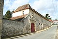
Attractions
See also: List of Monuments historiques in Brueil-en-Vexin
- “La Cave aux Fées ” footpath covered with dolmen , Monument historique
- Castle, also a monument historique
- Saint-Denis church
- Ballroom
- War memorial
Castle of Brueil-en-Vexin

Saint-Denis church

Mairie (Town Hall)


literature
- Le Patrimoine des Communes des Yvelines. Volume 1, Flohic Editions, Paris 2000, ISBN 2-84234-070-1 , pp. 363-3365.