
Chaufour-lès-Bonnières
| Chaufour-lès-Bonnières | ||
|---|---|---|
.svg)
|
|
|
| region | Île-de-France | |
| Department | Yvelines | |
| Arrondissement | Mantes-la-Jolie | |
| Canton | Bonnières-sur-Seine | |
| Community association | Portes de l'Île-de-France | |
| Coordinates | 49 ° 1 ′ N , 1 ° 29 ′ E | |
| height | 133-158 m | |
| surface | 3.02 km 2 | |
| Residents | 471 (January 1, 2017) | |
| Population density | 156 inhabitants / km 2 | |
| Post Code | 78270 | |
| INSEE code | 78147 | |

Chaufour-lès-Bonnières is a commune in the French department of Yvelines in the Ile-de-France . It belongs to the canton of Bonnières-sur-Seine in the arrondissement of Mantes-la-Jolie . It borders in the north on Blaru , in the north-east on La Villeneuve-en-Chevrie , in the south-east on Lommoye , in the south on Cravent , in the south-west on Villegats and in the west on Chaignes . The residents call themselves Chaufouriens .
Population development
| year | 1962 | 1968 | 1975 | 1982 | 1990 | 1999 | 2008 | 2014 |
|---|---|---|---|---|---|---|---|---|
| Residents | 140 | 150 | 185 | 300 | 376 | 413 | 412 | 448 |
Attractions
- War memorial
- Saint-Sauveur church

Saint-Sauveur church and war memorial
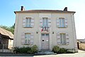
Mairie Chaufour-lès-Bonnières


literature
- Le Patrimoine des Communes des Yvelines. Volume 1, Flohic Editions, Paris 2000, ISBN 2-84234-070-1 , pp. 99-100.
Web links
Commons : Chaufour-lès-Bonnières - Collection of images, videos and audio files
- Monuments historiques (objects) in Chaufour-lès-Bonnières in the base Palissy of the French Ministry of Culture