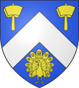
Criquebeuf-en-Caux
| Criquebeuf-en-Caux | ||
|---|---|---|

|
|
|
| region | Normandy | |
| Department | Seine-Maritime | |
| Arrondissement | Le Havre | |
| Canton | Fécamp | |
| Community association | Fécamp Caux Littoral Agglomération | |
| Coordinates | 49 ° 44 ' N , 0 ° 20' E | |
| height | 5-102 m | |
| surface | 2.08 km 2 | |
| Residents | 404 (January 1, 2017) | |
| Population density | 194 inhabitants / km 2 | |
| Post Code | 76111 | |
| INSEE code | 76194 | |
| Website | http://pagesperso-orange.fr/criquebeufencaux/ | |
 View of Criquebeuf-en-Caux |
||
Criquebeuf-en-Caux is a commune with 404 inhabitants (at January 1, 2017) in the Seine-Maritime department in the region of Normandy .
geography
The place lies between Yport and Dieppe on the Alabaster coast in the Pays de Caux . There is no direct access to the sea from the high cliffs. These are located in the neighboring valley cuts of Yport and the hamlet of Grainval, which belongs to the municipality of Saint-Léonard . The GR 21 long-distance hiking trail leads through the village .
history
The Norman place name goes back to the Scandinavian names kirkja (church) and buth (house, settlement). As the oldest traces of settlement, the remains of a Roman ditch and a medieval moth were found near today's church. The bell tower of the Saint-Martin church dates back to the Middle Ages. The nave was rebuilt in the 16th and 17th centuries from the local flint of the chalk cliffs.
Population development
| year | 1793 | 1836 | 1846 | 1866 | 1881 | 1906 | 1968 | 1975 | 1982 | 1990 | 2006 |
| Residents | 1,437 | 1,838 | 263 | 322 | 242 | 388 | 170 | 197 | 275 | 417 | 393 |
In 1842 Yport separated from Criquebeuf, so that the place had only 263 inhabitants in 1846. Yport had 1412 inhabitants in the same year.
Web links
Individual evidence
- ↑ Criquebeuf-en-Caux on cassini.ehess.fr (French)

