Heiligenberg (Bas-Rhin)
| Heiligenberg | ||
|---|---|---|

|
|
|
| region | Grand Est | |
| Department | Bas-Rhin | |
| Arrondissement | Molsheim | |
| Canton | Dirty | |
| Community association | Region of Molsheim-Mutzig | |
| Coordinates | 48 ° 32 ' N , 7 ° 23' E | |
| height | 204-407 m | |
| surface | 5.47 km 2 | |
| Residents | 676 (January 1, 2017) | |
| Population density | 124 inhabitants / km 2 | |
| Post Code | 67190 | |
| INSEE code | 67188 | |
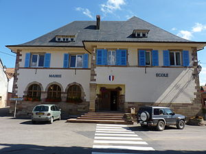
 Mairie and school buildings |
||
Heiligenberg is a French commune with 676 inhabitants (as of January 1, 2017) in the Bas-Rhin department in the Grand Est region ( Alsace until 2015 ).
geography
The village lies on a hill above the Breuschtal . To the west of the place is the large wooded area of the Fôret domaniale de Haslach .
Population development
| 1962 | 1968 | 1975 | 1982 | 1990 | 1999 | 2006 | 2013 |
|---|---|---|---|---|---|---|---|
| 326 | 350 | 464 | 508 | 535 | 562 | 618 | 642 |
Community partnerships
A partnership has existed between Heiligenberg and the German community of the same name in Heiligenberg in Baden-Württemberg since 1968.
Personalities
- Joseph Kübler (1848–1935), notary and member of the state parliament
literature
- Le Patrimoine des Communes du Bas-Rhin . Flohic Editions, Volume 1, Charenton-le-Pont 1999, ISBN 2-84234-055-8 , pp. 726-728.
Web links
Commons : Heiligenberg - Collection of images, videos and audio files
