Janův Důl
| Janův Důl | ||||
|---|---|---|---|---|
|
||||
| Basic data | ||||
| State : |
|
|||
| Region : | Liberecký kraj | |||
| District : | Liberec | |||
| Area : | 455.3731 ha | |||
| Geographic location : | 50 ° 42 ' N , 14 ° 56' E | |||
| Height: | 399 m nm | |||
| Residents : | 164 (Jan. 1, 2019) | |||
| Postal code : | 463 52 | |||
| License plate : | L. | |||
| traffic | ||||
| Street: | Osečná - Světlá pod Ještědem | |||
| structure | ||||
| Status: | local community | |||
| Districts: | 1 | |||
| administration | ||||
| Mayor : | Jiří Kořínek (as of 2008) | |||
| Address: | Janův Důl 75 463 52 Janův Důl |
|||
| Municipality number: | 546658 | |||
| Website : | www.januvdul.info | |||
Janův Důl (German Johannesthal ) is a municipality in the Czech Republic . It is located eleven kilometers southwest of the city center of Liberec and belongs to the Okres Liberec .
geography
Janův Důl is located southwest of the Jeschkengebirge four and a half kilometers from Ještěd on the Ralská pahorkatina ( Rollberg hill country ) on the upper reaches of the Ploučnice . The Činkův kopec (502 m) rises to the northeast and the Stejskalův kopec (433 m) to the west. To the west of the village is the Lower Polzenquelle ( Hlavní pramen Ploučnice ) and to the northwest is the former uranium mine Křižany I.
Neighboring towns are Druzcov in the north, Křižany and Dolení Paseky in the north-east, Rozstání in the east, Kozlenec, Suchý Janův Důl, Modlibohov and Sobákov in the south-east, Kotel in the south, Osečná , Lázně Kundratice and Jenišev in the south-west, as well as Lesnáníšev B in the west , Druzcovský Dvůr and U Lípy in the northwest.
history
The village was first mentioned in a document in 1569, when Johann von Oppersdorff , Baron von Aich and Friedstein acquired the Drausendorf estate including the new Jintscher and Johannesthal settlements from the Biebersteiners . Both settlements later grew together, and today's village was created.
After the abolition of patrimonial formed Johannesthal / Janův Důl 1850 a municipality in the judicial district Niemes or in the district Česká Lípa . In 1930 the community had 284 inhabitants, the majority of whom were Germans. A Czech minority also lived in Johannesthal.
After the Munich Agreement , Johannesthal was added to the German Reich in 1938 and initially belonged to the Bohemian Leipa district . In 1939 there were 252 people in Johannesthal. On May 1, 1939, the community was reclassified to the Reichenberg district .
After the end of the Second World War, the village came back to Czechoslovakia and became part of the Okres Liberec-okolí. In 1961 Janův Důl lost his independence and was incorporated into Rozstání and at the same time assigned to Okres Liberec . In 1980 it was incorporated into Světlá pod Ještědem ; since 1992 the community exists again.
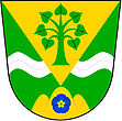
In Janův Důl there is the campsite "Camping 2000", which is mainly used by Dutch people. The town hall is located in the former school. Since 2004 Janův Důl has had a coat of arms and a banner.
Community structure
No districts are shown for the municipality of Janův Důl. The settlements Suchý Janův Důl and Zadní Ves belong to Janův Důl.
Attractions
- Chapel, built in 1796, the chapel on the campsite was reconstructed in 2005, has been the destination of the St. John's pilgrimage in the village since 2006
- Marterl

