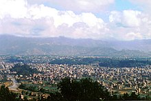
Kathmandu (District)
| काठमाडौं जिल्ला Kathmandu District
|
|
|---|---|
 Location of the Kathmandu district (red) in Nepal |
|
| Basic data | |
| Country | Nepal |
| province | Bagmati |
| Seat | Kathmandu |
| surface | 395 km² |
| Residents | 1,744,240 (2011 census) |
| density | 4416 inhabitants per km² |
| ISO 3166-2 | NP-P3 |
| Cities (blue) in the Kathmandu district | |
Coordinates: 27 ° 45 ' N , 85 ° 21' E
The Kathmandu district ( Nepali काठमाडौं जिल्ला ) is one of the 77 districts in Nepal and has 1,744,240 inhabitants (as of 2011) and an area of 395 km².
The administrative seat is the city of the same name Kathmandu . Kathmandu District is the most densely populated area of Nepal.
geography
The Kathmandu District is one of three districts in the Kathmandu Valley . He himself is in the hills of the Bagmati Zone. The elevation of the terrain of the Kathmandu district varies between 1262 m and 2732 m above sea level. The district is surrounded by Bhaktapur district and Kabhrepalanchok in the east, Dhading and Nuwakot in the west, Sindhupalchok in the north and Lalitpur and Makwanpur in the south .
economy
Most of Nepal's offices and industries are located in the Kathmandu district. Major economic centers are Durbar Marg and Putalisadak. In addition to the manufacture and export of handicrafts, art objects, clothing, pashmina and paper, tourism is one of the most important industries in this region. Hindu and Buddhist pilgrims come here from all over the world to visit the various religious places like Pashupatinath , Swayambhunath , Baudhanath, Budhanilkantha and Thamel, the touristic part of Kathmandu.
Administrative division
The following cities are in the Kathmandu District:
- Budhanilkantha
- Chandragiri
- Dakshinkali
- Gokarneshwar
- Kageshwari-Manohara
- Kathmandu
- Kirtipur
- Nagarjun
- Shankharapur
- Tarakeshwar
- Tokha
All Village Development Committees in the Kathmandu District were merged into newly founded cities as part of the community reform at the end of 2014.
Web links
Individual evidence
- ↑ Central Bureau of Statistics, Census 2011: National Report (pp. 51–52, Population Total and Area in Sq. Km ). ( Memento of the original from April 18, 2013 in the Internet Archive ) Info: The archive link was inserted automatically and has not yet been checked. Please check the original and archive link according to the instructions and then remove this notice. (PDF; 7.8 MB)

