Maillat
| Maillat | ||
|---|---|---|
|
|
||
| region | Auvergne-Rhône-Alpes | |
| Department | Ain | |
| Arrondissement | Nantua | |
| Canton | Nantua | |
| Community association | Haut-Bugey agglomeration | |
| Coordinates | 46 ° 8 ' N , 5 ° 32' E | |
| height | 497-825 m | |
| surface | 11.31 km 2 | |
| Residents | 635 (January 1, 2017) | |
| Population density | 56 inhabitants / km 2 | |
| Post Code | 01430 | |
| INSEE code | 01228 | |
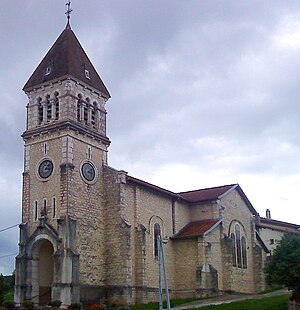
 Saint-Irénée church |
||
Maillat is a French commune of 635 inhabitants (at January 1, 2017) in the department of Ain in the region Auvergne Rhône-Alpes . It belongs to the canton of Nantua in the Arrondissement of Nantua .
geography
Maillat is located at 505 m , about 17 kilometers southwest of the city of Oyonnax and 25 kilometers east-southeast of the prefecture of Bourg-en-Bresse (as the crow flies). The village extends in the north of Bugey , in a wide hollow in the Jura , at the confluence of the Borrey and Doye to the Oignin .
The area of the 11.31 km² large municipality covers a section of the southern French Jura. The eastern part is occupied by the approximately 1.5 kilometers wide, north-south oriented valley basin of the Oignin, which forms a syncline in the Folded Jura and is drained to the north to the Ain . To the east, the communal soil extends with a narrow tip into the valley of the Doye, to the south into that of the Borrey ( Combe du Val ). The community area extends westward from the valley basin to the anticline of the Montagne d'Oisselle , on which the highest elevation of Maillat is reached at 825 m . This range of hills is subdivided by several short side valleys of the Oignin and Ausräumungskessel .
Maillat includes the hamlet of Oisselaz ( 575 m ) at the eastern foot of the Montagne d'Oisselle and a few individual farms. Neighboring municipalities of Maillat are Saint-Martin-du-Frêne in the north and east, Chevillard in the south-east, Condamine , Vieu-d'Izenave and Labalme in the south and Ceignes and Peyriat in the west.
history
Maillat formed a parish from the 13th century that was dependent on the Nantua Monastery . Since 1280 the village was the center of its own small rule, which was under the sovereignty of the Counts of Savoy . With the Treaty of Lyon , Maillat came to France in 1601. In 1932 the hamlet of Oisselaz was merged with Maillat.
Attractions
Today's village church was built at the beginning of the 20th century in the neo-Romanesque style and is dedicated to St. Dedicated to Irenaeus . The Château de Maillat dates from the 13th century. It was extensively restored in the 19th century; the residential buildings from the 15th and 16th centuries have been preserved. The former church is located in the castle park.
The Chapelle Sainte-Claire has been classified as a Monument historique since 1931 .
population
| Population development | |
|---|---|
| year | Residents |
| 1962 | 487 |
| 1968 | 520 |
| 1975 | 556 |
| 1982 | 578 |
| 1990 | 623 |
| 1999 | 664 |
| 2006 | 640 |
| 2011 | 670 |
With 635 inhabitants (as of January 1, 2017) Maillat is one of the small communities in the Ain department. After the population had decreased significantly in the first half of the 20th century (618 people were still counted in 1896), the population has increased again since the beginning of the 1960s. The local residents of Maillat are called Maillati (e) s in French .
Economy and Infrastructure
Until well into the 20th century, Maillat was primarily a village characterized by agriculture , in particular dairy and cattle breeding, and forestry. There are also some small and medium-sized businesses today, namely a sawmill, mechanical workshops and the plastics industry. In the meantime, the village has also turned into a residential community. Many workers are commuters who work in the larger towns in the area.
The village is very well developed in terms of traffic. It is located on the D1084 departmental road, which leads from Bellegarde-sur-Valserine through the Cluse de Nantua to Pont-d'Ain . Other road connections exist with Brénod, Vieu-d'Izenave and Peyriat. The next connection to the A40 motorway , which crosses the municipality and forms the junction with the A404 to Oyonnax, is around a kilometer away.
In Maillat there is a state école primaire (elementary school with an integrated preschool ).
Web links
Individual evidence
- ↑ É. Philipon: Dictionnaire Topographique du Département de l'Ain . Imprimerie Nationale, 1911, p. 237 (French, online [PDF; accessed January 3, 2014]).
- ^ Chapelle Sainte-Claire in the Base Mérimée of the French Ministry of Culture (French).
- ↑ French Statistics Institute ( www.insee.fr )
- ↑ Maillat - notice communal. In: cassini.ehess.fr. Retrieved on June 14, 2015 (French, INSEE population from 1968 ).

