Boyeux-Saint-Jérôme
| Boyeux-Saint-Jérôme | ||
|---|---|---|
|
|
||
| region | Auvergne-Rhône-Alpes | |
| Department | Ain | |
| Arrondissement | Nantua | |
| Canton | Pont d'Ain | |
| Community association | Rives de l'Ain-Pays du Cerdon | |
| Coordinates | 46 ° 2 ′ N , 5 ° 28 ′ E | |
| height | 329-900 m | |
| surface | 16.94 km 2 | |
| Residents | 346 (January 1, 2017) | |
| Population density | 20 inhabitants / km 2 | |
| Post Code | 01640 | |
| INSEE code | 01056 | |
| Website | www.boyeuxsaintjerome.fr | |
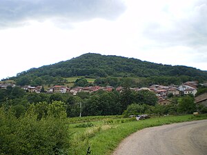
 View of the place |
||
Boyeux-Saint-Jérôme is a French municipality with 346 inhabitants (at January 1, 2017) in the department of Ain in the region Auvergne Rhône-Alpes . It belongs to the canton of Pont-d'Ain and the Arrondissement of Nantua .
geography
Boyeux-Saint-Jérôme is located at 537 m , about 12 kilometers northeast of the city of Ambérieu-en-Bugey (as the crow flies) in the southern French Jura mountains, about halfway between Lyon and Geneva . The area of the 16.94 km 2 municipal area includes a strongly reliefed section of the southern French Jura. It is drained by the streams Marlieux and Riez to the river Ain to the west. In the north, the area drops steeply to the Fouge , along which the northern municipal boundary runs.
The community is an amalgamation of several hamlets:
- Boyeux ( 540 m ) on a plateau between the deeply cut valleys of the two brooks Marlieux and Riez
- Saint-Jérôme ( 350 m ) in a basin on the Riez
- Châtillon-de-Cornelle ( 560 m ) in the northern part of the municipality on a valley basin deepened between several hilltops on the connecting road between Jujurieux and Saint-Martin-du-Frêne
- Cornelle ( 430 m ) below one of these mountain tops
- Poncieux ( 538 m ) on another plateau west of the Marlieux.
Neighboring municipalities of Boyeux-Saint-Jérôme are Mérignat and Cerdon in the north, Corlier in the east, Nivollet-Montgriffon in the south and L'Abergement-de-Varey and Jujurieux in the west.
history
The history of the individual hamlets goes back well into the Middle Ages. Boyeux is first mentioned in 1031, and Saint-Jérôme in 1169 as Sanctus Jeronimus . In the 12th century, Châtillon-de-Cornelle was owned by the Coligny family and its hilltop castle was listed in the archives in 1327 as Castrum de Castellione in Cornella . In the 13th century the villages went to the House of La Tour-du-Pin , then belonged to the Thoire-Villars rule from 1337 to 1375 and finally came under the suzerainty of the Counts of Savoy . Poncieux, mentioned in the 14th century as Ponciu , also belonged to Châtillon-de-Cornelle, its parish church was subordinate to that of Jujurieux. With the Treaty of Lyon , the entire Bugey came to France in 1601. The current double name of the parish was created in 1879 when Boyeux became the capital, but the parish remained in Saint-Jérôme.
Attractions
The village church in Saint-Jérôme, construction of which began in the 13th century, has a church room with a ribbed vault and an entrance portal in the Renaissance style.
The chapel is the only structure left in Châtillon-de-Cornelle castle. It dates from the 16th century and is richly furnished with figures and decorated columns.
population
| year | Residents |
|---|---|
| 1962 | 271 |
| 1968 | 225 |
| 1975 | 212 |
| 1982 | 254 |
| 1990 | 241 |
| 1999 | 277 |
| 2006 | 305 |
| 2011 | 339 |
With 346 inhabitants (as of January 1, 2017) Boyeux-Saint-Jérôme is one of the small communities in the Ain department. After the population had decreased sharply during the 20th century (in 1901 there were still 759 people), a slight increase in population has been recorded since the beginning of the 1990s.
Economy and Infrastructure
Boyeux-Saint-Jérôme has been shaped in the past by agriculture , and mainly by viticulture . Even today, the community has 16 winegrowers (as of 2014, see website of the community) who grow Poulsard and Gamay and produce a rosé sparkling wine under the protected designation of origin Cerdon . Those who are not employed in viticulture are mostly commuters who work in the larger towns in the area.
The departmental road D12 connects the municipality with Jujurieux and the valley of the Ain and continues to Saint-Martin-du-Frêne in the eastern syncline valley Combe du Val . Another road leads from the basin of Saint-Jérôme to Nivollet-Montgriffon and over the Col du Cendrier to Corlier. There are connections to the regional motorway network in Pont-d'Ain ( A42 ) and Saint-Martin-du-Frêne ( A40 ), each around 20 kilometers away.
Web links
Individual evidence
- ↑ É. Philipon: Dictionnaire Topographique du Département de l'Ain . Imprimerie Nationale, 1911, p. 61, 104, 319, 385 (French, online [PDF; accessed January 4, 2014]).
- ^ Church of Saint-Jérôme in the Base Mérimée of the French Ministry of Culture (French).
- ↑ Chapel of Châtillon-de-Cornelle in the Base Mérimée of the French Ministry of Culture (French).
- ↑ French Statistics Institute ( www.insee.fr )
- ↑ Boyeux-Saint-Jérome - notice communal. In: cassini.ehess.fr. Retrieved December 15, 2014 (French, INSEE population from 1968 ).
