Perthes (Haute-Marne)
| Perthes | ||
|---|---|---|
|
|
||
| region | Grand Est | |
| Department | Haute-Marne | |
| Arrondissement | Saint-Dizier | |
| Canton | Saint-Dizier-1 | |
| Community association | Saint-Dizier, Der et Blaise | |
| Coordinates | 48 ° 39 ′ N , 4 ° 49 ′ E | |
| height | 121-134 m | |
| surface | 13.08 km 2 | |
| Residents | 526 (January 1, 2017) | |
| Population density | 40 inhabitants / km 2 | |
| Post Code | 52100 | |
| INSEE code | 52386 | |
Perthes is a commune with 526 inhabitants (as of January 1, 2017) in France , in the arrondissement of Saint-Dizier , in the west of the Haute-Marne department , in the Grand Est region (before 2016 Champagne-Ardenne ). Perthes belongs to the canton of Saint-Dizier-1 (until 2015 Saint-Dizier-Ouest ).
geography
Perthes is located about twelve kilometers west-northwest of the city center of Saint-Dizier on the Canal entre Champagne et Bourgogne . Perthes is surrounded by the neighboring communities of Saint-Vrain and Vouillers in the north, Saint-Eulien in the northeast, Hallignicourt in the east and southeast, Sapignicourt in the south, Hauteville in the southwest, Orconte in the west and Heiltz-le-Hutier in the northwest.
The National Route 4 runs through the municipality .
Population development
| year | 1962 | 1968 | 1975 | 1982 | 1990 | 1999 | 2006 | 2013 |
|---|---|---|---|---|---|---|---|---|
| Residents | 667 | 735 | 700 | 630 | 587 | 617 | 555 | 552 |
| Source: Cassini and INSEE | ||||||||
Attractions
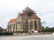
- Notre-Dame-de-la-Nativité church, monument historique since 1909

