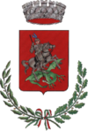
Ripi
| Ripi | ||
|---|---|---|

|
|
|
| Country | Italy | |
| region | Lazio | |
| province | Frosinone (FR) | |
| Coordinates | 41 ° 37 ' N , 13 ° 26' E | |
| height | 300 m slm | |
| surface | 31 km² | |
| Residents | 5,223 (Dec 31, 2019) | |
| Population density | 168 inhabitants / km² | |
| Post Code | 03027 | |
| prefix | 0775 | |
| ISTAT number | 060058 | |
| Popular name | Ripani | |
| Patron saint | San Giorgio Martire | |
| Website | Ripi | |
Ripi is a municipality in the province of Frosinone in the Italian region of Lazio with 5223 inhabitants (as of December 31, 2019). It is 94 km southeast of Rome and 10 km southeast of Frosinone .
geography
Ripi is located on a hill in the historic Ciociaria countryside . The districts of Colle Castagno and San Giovanni belong to Ripi.
The neighboring towns are: Arnara , Boville Ernica , Ceprano , Pofi , Strangolagalli , Torrice and Veroli .
history
The settlement of the Volscians was founded in 306 BC. A Roman colony. After the Great Migration Period , it became a bone of contention between local noble families and the Bishops of Veroli . In 1410 the Colonna finally prevailed, who ruled Ripi until 1816.
Population development
| year | 1881 | 1901 | 1921 | 1936 | 1951 | 1971 | 1991 | 2001 |
|---|---|---|---|---|---|---|---|---|
| Residents | 4,045 | 5,233 | 7.127 | 7,628 | 7,748 | 5,296 | 5,333 | 5,282 |
Source: ISTAT
politics
Giovanni Celli (list of citizens) was elected mayor in June 2004. Roberto Zeppieri has been mayor since May 26, 2014.
Web links
- Portal about Ripi (Italian)
- Ripi on www.comuni-italiani.it (Italian)
Individual evidence
- ↑ Statistiche demografiche ISTAT. Monthly population statistics of the Istituto Nazionale di Statistica , as of December 31 of 2019.

