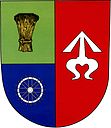
Suchov
| Suchov | ||||
|---|---|---|---|---|
|
||||
| Basic data | ||||
| State : |
|
|||
| Region : | Jihomoravský kraj | |||
| District : | Hodonín | |||
| Area : | 1445 ha | |||
| Geographic location : | 48 ° 54 ' N , 17 ° 34' E | |||
| Height: | 380 m nm | |||
| Residents : | 487 (Jan. 1, 2019) | |||
| Postal code : | 696 71 | |||
| License plate : | B. | |||
| traffic | ||||
| Street: | Blatnička - Nová Lhota | |||
| structure | ||||
| Status: | local community | |||
| Districts: | 1 | |||
| administration | ||||
| Mayor : | Milan Švrček (as of 2010) | |||
| Address: | Suchov 63 696 71 Blatnice pod Svatým Antonínkem |
|||
| Municipality number: | 586617 | |||
| Website : | www.suchov.cz | |||
Suchov (German Suchow , older also Gaumpsdorf ) is a municipality in the Czech Republic . It is located 15 kilometers southeast of Veselí nad Moravou and belongs to the Okres Hodonín .
geography
Suchov is located in the Bílé Karpaty Protected Landscape Area in the White Carpathians . The street village extends along the upper reaches of the Suchovský creek. To the north rises the Jasenová (409 m), in the northeast the Stráž (401 m) and the Kolo (490 m), to the east the Lipinka (504 m) and the Suchovský Šumárník (477 m), in the southwest the Háj (573 m) and to the northwest the Draha (374 m).
Neighboring towns are Babí Hora and Boršice u Blatnice in the north, Slavkov and Horní Němčí in the northeast, Drahy and Strání in the east, Uherskohradišťské Vápenky , Fojtické Mlýny, Podširocké Mlýny, Čerešnické Mlýny, Čerešnické Mlýny, Čerešnické Mlýný, Suchovýmýský, Zlýnýskny, Zlýnýskny, South Mlýmečny, South Mlýnýskny, Mlýnýskny, Mlýnýskny, South East Pod Kozimelkou, Petruchovy Mlýny and Kománkův Mlýn in the south, Javorník and Velká in the south-west, Horákův Mlýn, Žilkův Mlýn and Louka in the west and Blatnice pod Svatým Antonínkem and Blatnička in the north-west.
history
Suchov was founded in the middle of the 13th century during the German colonization and was first mentioned under the place name Gaumpsdorf in 1354. In the 14th century, Suché Němcí belonged to the Gansberg Castle . During the Hussite Wars , Peter Strážnický von Krawarn acquired the castle and added the goods to his rule in Strážnice . In 1439 he pledged the Gansberg property to Drslav von Náklo and his wife Elisabeth von Roštín. After the death of Georg Strážnický von Krawarn in 1466 his daughter Elisabeth and her husband Perchtold von Leipa in Moravia inherited Kromau. After he died in 1482, Elisabeth married Peter IV von Rosenberg in 1483 . Three years later, Peter and Wok II von Rosenberg pawned the Strážnice estate with all its accessories, including the desolate Kansberg castle and the village of Suchov, for 30,000 ducats to Johann the Elder. Ä. from Zierotin to Fulnek. Since the Kansberg estates were pledged to Čeněk Drslav von Náklo by the previous owners for 10,000 ducats, the von Rosenberg brothers undertook to redeem the castle with the village Suchow and the shares of Horní Němčí and Dolní Němčí and to hand it over to Johann von Zierotin. After the death of Elisabeth von Krawarn († 1500), the Rosenbergs officially ceded the rule of Strážnice in 1501 to Johann von Zierotin's widow Machna and his sons Johann, Bartholomäus, Georg and Viktorin. After Johann Dietrich the Elder J. von Zierotin died in 1620, the rule was sold for 200,000 Rhenish guilders to Franz von Magnis , who was made Count of Straßnitz in the same year. In 1702, the heavily indebted Count Anton von Magnis sold the allod rule Strážnice to Dominik Andreas I von Kaunitz for 339,000 Rhenish guilders . His son Maximilian Ulrich sold it in 1716 for the same price to the curator of the feeble-minded Joseph Anton von Magnis. In 1790 Suchov consisted of 114 houses and had 622 inhabitants. Suchov always remained subject to the Counts of Magnis on Strážnice until the middle of the 19th century.
After the replacement of patrimonial Suchov / Suchow formed from 1850 a municipality in the district administration Göding and the judicial district Strážnice . In 1882 the artist society Súchovská republika was founded in Suchov around the painter Joža Uprka, which met in the house of the teacher Matúš Béna. In 1890 the community was assigned to the Hradisch district . Suchov belonged to Okres Veselí nad Moravou between 1949 and 1960 and was added to Okres Hodonín after its dissolution .
Community structure
No districts are shown for the municipality of Suchov. Suchov includes the settlements Podhajské Mlýny, Suchovské Mlýny, Trnovský Mlýn and Zámečníkovy Mlýny.
Attractions
- Chapel of St. Lukas, consecrated in 2006 by the Auxiliary Bishop Josef Hrdlička from Olomouc
- Podhajský mlýn watermill
- CHKO Bílé Karpaty Protected Landscape Area
- Nature reserves Búrová and Zahrady pod Hájem, southwest of the village
- Chapel with a protected linden tree
- desert castle Kanšperk (Gansberg), south of the village
Web links
Individual evidence
- ↑ Český statistický úřad - The population of the Czech municipalities as of January 1, 2019 (PDF; 7.4 MiB)
- ↑ a b L. Hosák, R. Šrámek, Místní jména na Moravě a ve Slezsku I, Academia, Prague 1970, II, Academia, Prague 1980.


