
Peene
| Peene | ||
 Middle course between Kummerower See and Demmin |
||
| Data | ||
| Water code | DE : 966 (with Westpeene) | |
| location | Mecklenburg-Western Pomerania , Germany | |
| River system | Peene | |
| River basin district | Warnow / Peene | |
| source | Peene: Altkalen Teterower P .: Groß Wokern Westpeene : Vollrathsruhe Ostpeene: Torgelow am See / Schloen-Dratow 53 ° 39 ′ 26 ″ N , 12 ° 30 ′ 18 ″ E |
|
| Source height | 30 m above sea level NHN | |
| muzzle | At Anklam in the Peenestrom coordinates: 53 ° 51 '20 " N , 13 ° 48' 30" E 53 ° 51 '20 " N , 13 ° 48' 30" E |
|
| Mouth height | 0 m above sea level NN | |
| Height difference | 30 m | |
| Bottom slope | 0.25 ‰ | |
| length | 120.4 km with West Peene , 126 km with Peene, 128 km Peene / Kleine Peene, 137.8 km with East Peene |
|
| Catchment area | 5110 km² | |
| Discharge at the Anklam road bridge gauge negative values when the flow is reversed A Eo : 5012 km² |
NNQ (2009) MNQ 1961–2014 MQ 1961–2014 Mq 1961–2014 MHQ 1961–2014 HHQ (2002) |
-100 m³ / s -51.1 m³ / s 21.7 m³ / s 4.3 l / (s km²) 80 m³ / s 239 m³ / s |
| Left tributaries | Röcknitzbach, Trebel , Schwinge , Swinow , Libnower Mühlbach | |
| Right tributaries | Kittendorfer Peene (to the Ostpeene), Tollense , Kuckucksgraben, Stegenbach | |
| Flowing lakes |
Kummerower See , Teterower See (Kleine Peene), Malchiner See (Westpeene), Torgelower See and Rittermannshagener See (Ostpeene) |
|
| Small towns | Teterow (Kleine Peene), Malchin (West and East Peene), Neukalen (Teterower Peene), Demmin , Loitz , Jarmen , Gützkow , Anklam | |
| Ports | Malchin, Demmin, Loitz, Jarmen, Anklam | |
| Navigable | from Malchin harbor, nautical km 0.00 |
|
| In the area of the lower Peene, the largest contiguous fen area in Central Europe. | ||
The Peene is a coastal river in Mecklenburg-Western Pomerania . It is the seventh largest sea tributary with a catchment area in Germany (after the Ems ). The name comes from the Slavic: Pěna and means "foam" or "the foamy (river)".
location
The Peene arises from several source rivers, all of which have the Peene in their name and which unite partly in front of and partly in the Kummerower See . The source river without additional designation is neither the strongest nor the longest nor the middle one and therefore not classified as the main source river. And the Westpeene, classified as the main source river, lies in the valley axis of the Kummerower and Malchiner See , but has the shortest river path of all to the confluence with the sea.
The river system has an overall star shape with several incoming beams and one outgoing beam. Its center is at Demmin .
The bottom of the water is more than a meter below sea level from the Kummerower See , i.e. still upstream of the center, to the confluence with the Peenestrom estuary . The gradient in the water level of the Peene is determined solely by the upward pressure of the upper water. When the Baltic Sea or the Oder floods, the current and gradient in this area can reverse. The situation is thus similar to the (much shorter) lows on the North Sea coast.
None of the tributaries of the Kummerower See contribute to the longest river route in the river system of the Peene; the stretch of water from the source of the Werbender Mühlbach (upper reaches of the Nonnenbach ) east of Vorheide through Tollensesee and Tollense to the confluence of the Peene and the Peene is 185 km.
In its lower reaches of Demmin to its mouth in the more recently linguistically from their distinct Peenestrom near the town of Anklam the Peene flows through a wide Weichselian temporal glacial valley . This Peene Valley is probably the largest contiguous fen in Central Europe. There are several nature reserves and almost the entire valley is under landscape protection .
Source rivers
Teterower Peene and (North) Peene

The Teterower Peene in its hydrographic definition begins with the largest tributary of the Teterower See as the Kleine Peene , also known as Köthelbach . It rises near Nienhagen, southwest of Teterow . In Teterow it forks into the Ruderbach and the Bullerbach, which only flow together again shortly before the confluence in the Teterower See ( 2.2 m above sea level ). It leaves the Teterower See near Alt Sührkow as the Teterower Canal. After four kilometers, it joins two bodies of water coming from the north, the Reyer Mühlbach and the more water-rich ditch “ Längsdamm ”.
Since around the middle of the 20th century, the Reyer Mühlbach has been labeled with the name "Peene" in most maps without additional designation, although it is by far not the most important spring water of the Peene. It is named after the Reyer mill, which no longer exists, which was located west of the town of Reye (which itself is on the Vurzbach stream ). It rises 5 km south of Gnoien on the road to Teterow in the hamlet of Granzow expansion, This source at a height of 28 m above sea level. NN is considered by many as the source of peene. After 2 km the Reyer Mühlbach reaches a Soll called "Großer See" near the village of Granzow . There it joins the longer and more watery Pannekower Graben, which forms the hydrographic upper reaches of the (northern) Peene. From the Großer See near Gramzow it flows southwards to the approx. 15 km distant confluence with the Teterower Peene at 0.5 m above sea level. NN .
The water from this confluence flows 12 km to the east through the town of Neukalen into the Kummerower See . Shortly below the confluence, since 1888, the top entry "Peene" was on the measuring table. Topographically, the water here has also been called Teterower Peene since 2017. From Neukalen it forms the Neukalen Peene Canal.
In the maps of Schmettau and Wiebeking, there is not a single water body name at the source waters that flow out at Neukalen, but there is a "Pehnwiese" a little below the confluence of the northern and Teterow waters. In the measuring table sheets from 1888 and up to the 1930s, the name “Peene” can only be found below the union and the northern spring water is unmarked.

Nordpeene near Granzow
Teterower Peene near Neukalen

Dahmer Canal in the course of the (West) Peene


Westpeene
The Westpeene rises from a peat basin crossed by several streams with several springs east of Vollrathsruhe and north of Klocksin . After about 4 km in a north-easterly direction, it flows into the Malchiner See ( 0.3 m above sea level ). Its longest and most water-rich tributary, however, is the Ziddorfer Mühlenbach, which flows a few meters to the north . A few meters to the south, the shorter Dahmer Mühlbach also flows into the lake, which rises near Moltzow. At the northeastern end of the lake, the West Peene enters a wetland, where the Dahmer Canal , which is no longer navigable today, forms the main outflow of the lake, while the West Peene is only preserved in sections, mostly as a dry channel between lower-lying drainage ditches. On the northern edge of Malchin, the Dahmer Canal and the Ostpeene merge to form the Peene Canal . In the Malchiner Hafen, at the beginning of the Peene Canal, the nautical kilometering of the Peene begins. After 2.5 km, the Peene Canal meets the developed lower reaches of the West and South Peene at the former confluence of the West and South Peene, also known as the “Kiekpeene”, which flows into the Kummerower See (0.2 m above sea level) at 4.6 km.
In the Schmettauschen map series , this common underflow is labeled as "Peene Fl.". At the spring water above the Malchiner See, the entry "Peene" south of Grosse Luckow can be found on this map. In the measuring table sheet from 1888, the name "Westpeene" is used from Kirch Grubenhagen to the point where it flows into the Kummerower See.
Ostpeene

The source of the 40.6 km long Ostpeene is four and a half kilometers east of Waren at over 80 m above sea level. NN between the villages of Neu-Schloen and Kargow on the eastern edge of the 93.8 m high Mörderberg it. The Ice Age ridge is part of the watershed between the North Sea and the Baltic Sea . From there it first flows south to Kargow, then east to Schwastorf and then north through the Torgelower See near Torgelow am See and the Rittermannshagener See . Between Hungersdorf and Faulenrost , it is labeled "Die Pene" on the Schmettau map. North of the village of Faulenrost it takes 30 m above sea level. NN and 24.7 river kilometers from its source on its largest tributary, the 28 km long Kittendorfer Peene , which, in the upper reaches also called Grenzbach, rises half a kilometer south of the Schwandter See , between Schwandt (zu Rosenow ) and Groß Helle (to Mölln (Mecklenburg) ). In some maps, an origin is still entered north of Schwandt, 25.6 km from the mouth. In addition to the current mouth of the Kittendorfer Peene, there is an older one a little further north. Below the confluence, the Ostpeene has dug a narrow breakthrough valley up to 30 m deep, from which it emerges at the Gielower Mühle in the wide valley of Malchin . At the mill, the water level is only 5 m above sea level, in Malchin less than a meter (see above).
In measuring table sheets from 1888 the name Ostpeene can be found from Malchin up to Schwastorf. The Kittendorfer Peene is also registered by name.
Systematics
- see also the river system of the Peene - detailed table with tributaries from 10 km length, lakes from 1 ha area, pseudobifurcations -
In the case of confluences, the shorter river code is retained.
| Source river | Kittendorfer Peene | Ostpeene | Westpeene | Teterower Peene | North Peene (DTK: Peene) |
| GKZ | 96626 | 9662 | 966 | 96632 | 966324 |
| Location of the source | 53 ° 34 '46 " N , 13 ° 2' 26" E | 53 ° 31 ′ 17 " N , 12 ° 46 ′ 38" E | 53 ° 39 '26 " N , 12 ° 30' 18" E | 53 ° 42 ′ 56 " N , 12 ° 30 ′ 6" E | 53 ° 55 ′ 42 " N , 12 ° 40 ′ 14" E |
| Source height [m above sea level NHN ] | 65-70 | > 80 | 30th | just under 85 | 30th |
| Flow path [km] to the sea | 140.76 | 138.5 | 120.4 | 128.1 | 126 |
| 1st river section [km] | Grenzbach, 0.76 (longer: Bach from Vossfeld, 6.0) |
Ostpeene 10.85 | Westpeene 5.3 (longer: Ziddorfer Mühlenbach 17.27) |
Small Peene 11.80 | Pannekower Graben / Nordpeene (DTK: Peene) 4 |
| 1st lake [km] | Schwandter See 1.3 | Torgelower See 3.25 | Malchiner See 19.1 | Teterower See 4.0 | Large lake in Granzow 0.4 |
| 2nd river section [km] | Grenzbach 25.6 | Ostpeene 6.4 | Reyer Mühlbach / Nordpeene (DTK: Peene) 14.2 |
||
| 2nd lake [km] | Rittermannshagener See 0.84 | ||||
| 3rd river section [km] | Kittendorfer Peene 20.0-19.3 | Ostpeene 3.26-3.96 | Dahmer channel 7,8 | Teterower Canal ( DTK : Canal) 3.9 | |
| 4th river section [km] | Ostpeene (two confluences) 15.3–16.0 | Teterower Peene (DTK until 2017: Peene → Peenekanal) 11.0 |
|||
| 5th river section [km] | Peene Canal (DTK: Peene Canal → West Peene) 4.2 | ||||
| Kummerower See | |||||

Middle course
The Peene leaves the almost eleven kilometers long and on average three kilometers wide Kummerower See at the north end west of Verchen near the Dargun district of Aalbude with a mean water of 0.17 m above sea level. NHN . Two kilometers north of the lake, the Röcknitzbach coming from Dargun flows into the Peene. From there it flows for almost twelve kilometers east-northeast through a valley that narrows between mostly 20 m high slopes to sometimes less than half a kilometer. Then she turns west around Demmin.
Water star Demmin
At Demmin, which was a seaport until the late 19th century , the water level averages 0.1 m above sea level. NHN . Here opens at home Demmin east from the Tollensesee km 68 km from its source 95.8 long Tollense , the 2.7 km upstream of the mouth nor the Augraben flows. And 2.4 km after the Tollense, the Trebel flows into the Peene from the west .
| Water "jet" | Catchment area | Longest river path to or from Demmin | |
|---|---|---|---|
| Tollense without digging | 1630 km² | with Nonnenbach (Tollense) | 115 km |
| Dig | 199 km² | 41.7 km | |
| Peene in front of the Tollensee estuary | 1139 km² | with Bach from Vossfeld → Grenzbach → Kittendorfer Peene → Ostpeene |
76.2 km |
| Trebel | 956 km² | with Poggendorfer Trebel | 78 km |
| Peene below Demmin | 984 km² | from the mouth of the Trebel, including the Delta | 66.9 km |
Lower course

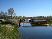
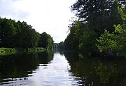
At the mouth of the Trebel, the Peene turns to the northeast and flows in this direction to Loitz . At Loitz the Schwinge flows into the river, which runs through the valley of the Ibitzgraben on its last kilometers. From there it flows eastwards to about Görmin , which is not directly on the river, and then in a south-easterly direction via Jarmen to Anklam . In the wide glacial valley of its lower reaches there are many swamp and wetlands. Almost the whole valley is a nature reserve or at least a landscape reserve . However, nature is not as untouched as it appears from the river; Between Demmin and Anklam there are numerous old peat cuttings , today water areas often several hectares in size. The largest, between the Stegenbach and Anklam, measures 1.2 km². At Dersewitz there is a pumping station, through which water is pumped up into the Peene-Südkanal in times of great drought , in order to be directed through this into the eastern part of the ditch and thus to Friedland's Großer Wiese . 10 km east of Anklam opens the Peene 120 kilometers from the source of the West Peene and 82 km from Lake Kummerow with a small delta in the Peenestrom . 98.5 km of its course are navigable.
Peene near Jarmen

Flooding of the Peene at the Gützkower ferry in 1920

Frozen Peene in Anklam

Peenemoor between Stegenbach and Anklam


Water level and river beds

The water level of the Kummerower See is on average only 0.15 m above that of the Baltic Sea, (mean water at the outflow of the Kummerower See in Aalbude 0.16 m above sea level, in the Peenestrom −0.02 m above sea level) The water depth is at the outlet of the Kummerower See 2 m (fairway), in Demmin 4 m and in Anklam 5 m. This means that the bottom of the river from the estuary to the Kummerower See is consistently below sea level.
Overview of the levels:
(Series of measurements: Anklam 1961–2014, others 2005–2014)
| Waters | from the Peenestrom |
Place, level | Mean water above sea level |
Water depth | River bed above / below sea level |
medium discharge |
Catchment area of the water level (of the river) |
|---|---|---|---|---|---|---|---|
| Peenestrom | Wolgast | -0.02 m | |||||
| Electricity / small lagoon | Karnin (Usedom) | -0.02 m | |||||
| Peene below the Kummerower See |
9.8 km |
Anklam , road bridge |
−0.01 m | 5.0 m | approx. -5 m | 21.7 m³ / s | |
| 36.1 km | Jarmen | 0.04 m | 5.0 m | approx. -5 m | - | ||
| 66.3 km |
Demmin , Meyenkrebs Bridge |
0.13 m | 4.0 m | approx. -4 m | 18.8 m³ / s (*) | 4121 km² | |
| 83.2 km |
Aalbude (150 m from Lake Kummerower ) |
0.16 m | 1.5 m | −1.3 m | - | ||
|
Dahmer Canal (Westpeene obh. Ostpeene) |
98.5 km |
Malchin (port at the train station) |
0.33 m | 1.5 m | -1.2 m | - | 265.5 km² |
| Malchiner See | 114, ... km | Dahmen | 0.37 m | 0.5-10 m | −0.2 - −10 m | ||
| Ostpeene | 104.7 km | Gielow South | 12.0 m | 1 m | +11 m | 1.67 m³ / s | 361.5 km² |
| Teterower Peene | 92 km | Recalculation | 0.36 m | 2.0 m | −1.6 m | 1.42 m³ / s | 324.4 km² |
| Trebel | 78.0 km | Volksdorf | 0.15 m | 2.0 m | approx. −2 m | - | |
| 89.7 km | Bassendorf | 0.20 m | 1.0 m | −0.8 m | - | ||
| 102.7 km | Tribsees south | 0.32 m | 1.0 m | −0.7 m | - | ||
| 122.3 km | Baggendorf church | 1.0 m | 0.7 m | +0.3 m | 1.11 m³ / s | 182 km² (956 km²) | |
| Tollense | 96.5 km |
Klempenow , road bridge |
2.05 m | <1.8 m | > +0.2 m | 6.14 m³ / s | 1,409 km² (1,829 km², without excavation 1,639 km²) |
| Dig | 89.3 km | Gehmkow | 33.15 m | <1 m | > +32 m | 0.586 m³ / s | 133.3 km² (199 km²) |
(*) In the case of high water in the Baltic Sea, the water flow upstream at the Meyenkrebsbrücke is often (-) 10 m³ / s, rarely more than (-) 25 m³ / s.
Flow reversal
Normally , more water flows from the lagoon into the Baltic Sea than vice versa through the three inlets between the Stettiner Haff (Oderhaff) and the open Baltic Sea, i.e. Strom / Peenestrom, Swine (PL: Swina) and Dievenow (PL: Dziwna ). By far the largest part of the Oder water reaches the open sea through the Swine. In the event of a storm flood with wind directions from the northeast, however, considerable amounts of seawater can also be pressed into the lagoon and the Peene River.
Due to the lack of a gradient, the water level of the Kummerower and Malchiner lakes depends on that of the Baltic Sea and the Stettiner Haff. Several times a year there is a reversal of the current during floods in the Baltic Sea, which often exceeds half the amount of the mean discharge. The amounts of the rivers, backwards and forwards, often reach in Demmin the order of magnitude of the mean discharge. In Anklam, they are often significantly higher. The difference is explained by the open entrances to most of the peat cuttings (i.e. the bodies of water created by peat cutting) along the lower Peene. They can accommodate a significant amount of pendulum. The largest receiving area for pendulum volume is of course the Kummerower See.
Apart from the water level in the open Baltic Sea and in the Szczecin Lagoon, the slope of the water level of the Peene depends on the amount of water to be discharged, a general phenomenon in rivers with very low slopes. After a long period of drought, the difference in altitude between Malchiner See and Peenestrom can be less than a decimeter. The lowest water level measured so far (1961 to today) at the Dahmen gauge was -1 cm below sea level. Because of the wind kettle function of the Kummerower See, precipitation-related flooding of the tributaries from the inland does not prevent the lower and middle Peene from reversing currents.


shipping

The Peene (Pe) is a federal waterway with inland waterway classification IV from km 2.50 (confluence of the Malchiner Peene Canal into the West Peene) to the confluence through the Richtgraben into the Peene River (km 98.16) . It has been new kilometers since 2010. The estuary next to the straightening trench is also part of the federal waterway. The Stralsund Waterways and Shipping Office is responsible . Above Demmin, to Malchin, the Peene inland waterway is class III. The depth of the fairway from the mouth to the northeast end of the Kummerower See is 2.5 m, from the mouth into the lake to km 2.50 it is two meters. In the course of a reform of the waterways and shipping administration in the 2010s by the Federal Ministry of Transport, Building and Urban Development and the associated re-categorization of the federal waterways, it was planned to downgrade the Peene to an “other waterway”.
The Peene has been a much-used waterway since ancient times due to its relatively large cross-sectional ratios, the very low gradient and the thus barely perceptible flow speed. Apart from a few punctures and dredging, there were no hydraulic changes. There are only three bridge crossings (movable bridges in Anklam, Demmin and Loitz) that are only detrimental to shipping. Nowadays the bridges in Demmin represent an insurmountable obstacle for higher watercraft; If bascule and swing bridges were built here before the Second World War , today's are rigid.
Historical meaning
Between the Treaty of Stockholm in 1720 and the Congress of Vienna in 1815, the Peene formed the border between the Old Western Pomerania , which had become Prussian, and the remainder of Swedish Pomerania , later called New Western Pomerania , and the border of the Prussian administrative district of Stralsund until 1932 .


Strom and Peenestrom
The river and the Peenestrom together form the westernmost estuary of the Oder and separate the island of Usedom from the West Pomeranian mainland. The river connects the Stettiner Haff , also called Oderhaff, in a westerly direction through the Kleine Haff with the small delta of the Peene, six kilometers away. From this union, the Peene River flows in a northerly direction and opens to the east to a large bay, the Achterwasser . Then it narrows again and passes the town of Wolgast between hills . About 15 kilometers north of Wolgast (between Peenemünde and Kröslin ) the Peenestrom reaches the Spandowerhagener Wiek , a bay in the Greifswalder Bodden , and thus the Baltic Sea .
From the mouth of the Peene northwards to the exit in the Spandowerhagener Wiek there are 52.5 kilometers of water, from the mouth of the Peene south-eastwards 4 kilometers of water to the transition of the stream into the Stettiner Haff (Kleines Haff). Including this, the distance from the Peene estuary through the waist between the Kleinem and Großem Haff to the island of Chełminek (German Leitholm) at the exit of the estuary of the Oder is also 52.5 km.
Strom and Peenestrom are federal sea waterways, on which the sea waterway regulations apply; is responsible, as for the Peene, the waterways and shipping authority Stralsund .
See also
literature
- Rainer Höll: Peene experience. From Malchiner See to the Greifswalder Bodden . nordlicht verlag, Ostseebad Karlshagen 2017, ISBN 978-3-9819272-0-7 .
Web links
- Literature about Peene in the Landesbibliographie MV
- Natural landscape profile of the BfN
- peenetal-landschaft.de - Organization for the natural protection of the Peene Valley
Individual evidence
- ↑ a b c Geodata MV, topics water (numbers and kilometers) and terrain MV
- ↑ Level portal MV: Anklam road bridge → Level profile (PDF; 1.7 MB)
- ^ Paul Kühnel: The Slavic place names in Meklenburg. In: Yearbooks of the Association for Mecklenburg History and Archeology. Vol. 46, 1881, ISSN 0259-7772 , pp. 3–168, here p. 105: Pyana (old pêna foam; Polish piana) adj. § 21: "the foamy (river)".
- ↑ Google Maps. In: Google Maps. Retrieved December 8, 2016 .
- ↑ Water Framework Directive - Delimitation of the bodies of rivers
- ↑ Mean water in Aalbude 0.17 m above sea level (the mean water in Anklam is 0.0 above sea level with the same height reference), pegelonline.wsv.de
- ↑ Current water level and mean water at the Aalbude gauge (discharge of the Kummerower See) , above sea level corresponds to above sea level; different information on the tourist website info-MV.de - Kummerower See
- ↑ Holidays in the Peene Valley: General conditions for motor boating and sailing
- ↑ http://www.pegelportal-mv.de/pegel_mv.html
- ↑ Monthly water management report February 2005 (PDF)
- ↑ Monthly report on the water management situation December 2006 (PDF)
- ↑ Water Management Report April 2007 , LUNG-MV (PDF), p. 5
- ↑ Level course Dahmen - Malchiner See - 04718.0: NW = 0.88 m, PNP = –0.892 m above sea level. NHN
- ↑ Lengths (in km) of the main shipping lanes (main routes and certain secondary routes) of the federal inland waterways ( memento of the original from January 21, 2016 in the Internet Archive ) Info: The archive link was inserted automatically and has not yet been checked. Please check the original and archive link according to the instructions and then remove this notice. , Federal Waterways and Shipping Administration
- ↑ Directory E, Ser. No. 42 of the Chronicle ( Memento of the original from July 22, 2016 in the Internet Archive ) Info: The archive link was inserted automatically and has not yet been checked. Please check the original and archive link according to the instructions and then remove this notice. , Federal Waterways and Shipping Administration
- ↑ BinSchStrO, Chapter 27 ( Memento of the original from April 6, 2012 in the Internet Archive ) Info: The archive link was inserted automatically and has not yet been checked. Please check the original and archive link according to the instructions and then remove this notice.
- ↑ Reform of the waterways and shipping administration - network categorization ( page no longer available , search in web archives ) Info: The link was automatically marked as defective. Please check the link according to the instructions and then remove this notice. , BMVBS (PDF; 711 kB)
- ↑ Frank Binder: Peene remains a federal waterway . In: Daily port report of March 15, 2017, p. 15
- ↑ Martin Eckoldt (Ed.): Rivers and canals. The history of the German waterways. (The development of the waterways under the influence of law, politics, economy, administration, hydraulic engineering and shipping). DSV-Verlag u. a., Hamburg u. a. 1998, ISBN 3-88412-243-6 .