
Baleyssagues
|
Baleyssagues Balaiçagas |
||
|---|---|---|
|
||
| region | Nouvelle-Aquitaine | |
| Department | Lot-et-Garonne | |
| Arrondissement | Marmande | |
| Canton | Les Coteaux de Guyenne | |
| Community association | Communauté de communes du Pays de Duras | |
| Coordinates | 44 ° 41 ′ N , 0 ° 9 ′ E | |
| height | 25-108 m | |
| surface | 8.18 km 2 | |
| Residents | 176 (January 1, 2017) | |
| Population density | 22 inhabitants / km 2 | |
| Post Code | 47120 | |
| INSEE code | 47020 | |
 Baleyssagues Town Hall (September 2012) |
||

Baleyssagues is a community in southwestern France and is located in the Lot-et-Garonne in the region Nouvelle-Aquitaine (up to 2016: Aquitaine ).
The inhabitants are called Baleyssaguais .
geography
Baleyssagues is located in the Guyenne in the Côtes de Duras wine region in the west of Duras . The municipality borders on the Gironde department and is made up of the towns of Riquets, Ramiére, Grave, Mirathe and Fontmorin.
Baleyssagues borders five other municipalities, two of which are in the Gironde department.
| Esclottes | ||
| Sainte-Colombe-de-Duras |
.svg)
|
Duras |
|
Dieulivol (Gironde) |
Cours-de-Monségur (Gironde) |
Toponymy
In the Gascon language , the community name is Balaiçagas.
history
Between 1841 and 1852, Baleyssagues was merged with the adjacent Saint-Colombe-de-Duras .
Demographics
The population development in Baleyssagues has been documented since 1793. With the exception of 2006, statistics were published annually by Insee .
In 2015 the community had 174 inhabitants, which means a decrease of 4.4% compared to 2010.
| year | 1793 | 1800 | 1846 | 1876 | 1901 | 1946 | 1975 | 1999 | 2005 | 2010 | 2017 |
|---|---|---|---|---|---|---|---|---|---|---|---|
| Residents | 660 | 560 | 907 | 426 | 347 | 309 | 182 | 176 | 191 | 182 | 176 |
Attractions
- Jardin de Boissonna ; private garden, which primarily from a rose garden consists

Notre-Dame church (September 2012)
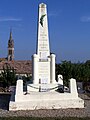
Monument to the Dead (September 2012)

