Karagandy
|
||
| Basic data | ||
|---|---|---|
| State : |
|
|
| Territory : | Karagandy | |
| Founded : | 1931 | |
| Coordinates : | 49 ° 50 ′ N , 73 ° 10 ′ E | |
| Height : | 546 m | |
| Area : | 498.4 km² | |
| Residents : | 497,777 (Jan 1, 2020) | |
| Population density : | 999 inhabitants per km² | |
| Time zone : | EKST ( UTC + 6 ) | |
| Telephone code : | (+7) 7212 | |
| Postal code : | 100000-100030 | |
| License plate : | 09 (old: M, K) | |
| Structure : | 2 boroughs | |
| Äkim ( Mayor ) : | Nurlan Äubäkirow | |
| Website : | ||
| Location in Kazakhstan | ||
|
|
||
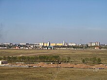
Qaraghandy ( Kazakh Қарағанды , Russian Караганда Karaganda ) is a city in Kazakhstan . It is located in the eastern center of the country on the Kazakh threshold and is surrounded by a steppe-like landscape and large coal deposits . With 497,777 inhabitants (as of January 1, 2020) it is the fourth largest city in Kazakhstan.
The development of the city of Karagandy began in the early 1930s with the development of coal deposits in the area around the city, and in 1934 the place was granted city rights. At that time the city was shaped by the large Soviet forced labor camps , whose prisoners were mainly used for coal mining. Karagandy quickly grew into one of the industrial centers of the Soviet Union, but with the dissolution of the Soviet Union had to accept a significant slump in industrial production.
Origin of name
The origin of the city name is controversial. One theory says that the Karagana bushes widespread in the area gave the city its name. Another theory says that the coal deposits give the city its name.
Since the independence of Kazakhstan, official names have been written in Kazakh .
geography
Geographical location
The city with an area of 497.8 square kilometers is located in the northern part of the Qaraghandy area on the Kazakh Threshold ( Saryarka ), an average of 546 meters above sea level. To the southeast of the city rises the Karkaraly mountain range with the highest mountain Aksoran . The area around Qaraghandy, which has numerous mineral resources, is structured like a steppe .
Water resources
Since 1971 the city has been supplied with water via the Irtysh-Karagandy Canal .
City structure
The city is divided into two districts:
| Administrative district | Kazakh name | Russian name | Residents | Area [km²] |
|---|---|---|---|---|
| Qasybek bi | Қазыбек би ауданы | Казыбекбийский район | 278.169 | |
| Oktyabr | Октябрь ауданы | Октябрьский район | 219,608 | |
| Karagandy | 497,777 | 498.4 | ||
| As of January 1, 2020 | ||||
climate
The climate in Karagandy is extremely continental . The lowest registered temperature was -42.9 ° C in 1938.
| Karagandy | ||||||||||||||||||||||||||||||||||||||||||||||||
|---|---|---|---|---|---|---|---|---|---|---|---|---|---|---|---|---|---|---|---|---|---|---|---|---|---|---|---|---|---|---|---|---|---|---|---|---|---|---|---|---|---|---|---|---|---|---|---|---|
| Climate diagram | ||||||||||||||||||||||||||||||||||||||||||||||||
| ||||||||||||||||||||||||||||||||||||||||||||||||
|
Monthly average temperatures and rainfall for Karaganda
Source: wetterkontor.de
|
|||||||||||||||||||||||||||||||||||||||||||||||||||||||||||||||||||||||||||||||||||||||||||||||||||||||||||||||||||||||||||||||||||||||||||||||||||||||||||||||||||||
history
The place was founded in 1856 as a settlement for the extraction of copper. The small-scale coal mining served to supply the nearby copper smelter. During the Stalinist period at the end of the 1920s, the large-scale development of the coal deposits and the rebuilding of the city began, mainly through numerous prisoners.
On March 10, 1932, the Karaganda Region was founded with the center in Petropavlovsk . Within a very short time, a gigantic industrial complex and an urban civilization emerged in Karaganda. On February 6, 1934, the place was granted city rights. The city became the capital of the Karaganda region on July 20, 1936 (see list of Kazakh capitals ).
According to Alexander Solzhenitsyn , Karaganda was "the largest provincial capital of the Gulag archipelago, " the Soviet forced labor camp . The following camps belonged to the local gulag system:
- Karaganda-ITL (Dolinka), 1931–1959, up to 66,000 people,
- ITL of Karaganda Coal, 1943–1944, up to 3,000 people,
- Saran-ITL , 1945, up to 1,500 people,
- ITL of the Karaganda housing estate, 1946–1948, up to 3,200 people,
- LugLag (also Wiesenlager, special camp No. 9) (Spasski), 1949–1951, up to 12,800 people.
On August 24, 1955, the previous special camp No. 8 PestschanLag (sand camp ) was dissolved and added to the Karaganda ITL.
In addition, there was a prisoner of war camp 99 for German prisoners of war in Karaganda , which was converted into a special camp of the Gulag in 1949.
On October 22, 1962, Karagandy suffered the strongest electromagnetic pulse (EMP) effect ever observed. The cause was the test of a Soviet nuclear weapon weighing 300 kilotons at an altitude of 290 kilometers above Schesqasghan . The EMP caused by test no. 184 as a result of intense gamma radiation overloaded a 1,000-kilometer-long flat power cable with a current of 2,500 amperes. The city's electric power station caught fire and all fuses blew.
In February 1983 the 600,000. Born in town.
In December 1986, the plenum of the Central Committee of the Kazakh SSR decided to replace the long-time First Secretary of the Central Committee of the Communist Party of Kazakhstan and a member of the Politburo of the Communist Party of the Soviet Union Dinmuchamed Kunaev, due to irregularities in his office in the Kazakh Soviet Republic, for Gennady Kolbin , who is the Country, the people and the language did not know. As a result, between 80 and 120 students demonstrated at a rally on December 19 and another 300 on the 20 against the arbitrariness of the Central Committee. As a result, 5 students were arrested and 54 were suspended from their studies ( Sheltoksan riots ).
politics
The current mayor ( Äkim , kas. Әкім) of Karagandy has been Nurlan Äubäkirow since June 28, 2014 . During the Soviet period, the city administration was headed by the chairman of the executive committee. The following are the mayors of the city since 1988:
- Schaimerden Orasalino (1988–1997)
- Nikolai Filato (1997-2000)
- Kornei Isaac (2000–2002)
- Alschyn Shalabayev (2002-2003)
- Yuri Litvinov (2003-2006)
- Vladimir Tschirkow (2006)
- Islam Toghaibayev (2006-2010)
- Bauyrshan Abbdishev (2010–2012)
- Meiram Smaghulow (2012-2014)
- Nurlan Äubäkirow (since 2014)
population
Ethnic composition
| Ethnic groups in Karaganda 2018 | ||||
|---|---|---|---|---|
| Ethnic group | percent | |||
| Kazakhs | 44.9% | |||
| Russians | 40.5% | |||
| Ukrainians | 3.0% | |||
| Tatars | 2.6% | |||
| German | 2.6% | |||
The population of Karagaphy was around 150 nationalities. Qaraghandy is the place of origin of around 100,000 Russian-German repatriates in Germany. Their share is likely to have been over 70 percent of the city's population in the 1940s.
In 2018 the ethnic groups were distributed as follows: Kazakhs 44.92%, Russians 40.48%, Ukrainians 3.04%, Tatars 2.64%, Germans 2.56%, Koreans 1.49%, Belarusians 0.70%.
Population development
In Soviet times, as a result of the industrialization of the surrounding region , the population rose from 118,900 in 1933 to a high of 613,797 in 1989. At the census on February 25, 2009, 459,778 people lived in Karagandy. The population loss since 1989 is 25.1 percent.
The following overview shows the development of the population since 1933:
|
|
Religions
| Religions in Karaganda 2009 | ||||
|---|---|---|---|---|
| religion | percent | |||
| Muslims | 40.4% | |||
| Christians | 53.7% | |||
| Other | 5.9% | |||
The predominant religions in Karaganda are Islam ( Sunnis ) and Christianity ( Russian Orthodox Church ). Karaganda is also the seat of the Roman Catholic Diocese of Karaganda . There is also a Gospel Christian Baptist Church in Karaganda , founded in 1948, and a Mennonite Brethren Church , founded in 1957.
Culture and sights
Sights include the dramaturgical theater, the musical theater of comedy, the ice rink and the zoological garden. A landmark of the city is the Palace of the Miners' Culture . The Qaraghandy Circus is a stationary circus that has existed since 1982.
In the city are the statues of the writer Alexander Pushkin and the fighter pilot and hero of the Soviet Union Nurken Abdirow (1919–1943), as well as a bust of the writer Nikolai Gogol .
You can also see numerous wide streets and several parks. The city has two cathedrals, the Russian Orthodox Vvedensky Cathedral and the Roman Catholic Cathedral of Mother of All Nations . There are also some mosques in Karagandy.
Sports
Soccer
The Shakhtar football stadium with a capacity of 19,000 is the venue for Shakhtar Karagandy . The team plays in the first Kazakh football league . In 2011 and 2012 they won the Kazakh championship.
ice Hockey
The ice hockey team HK Saryarka Karaganda , which represents the city in place of the Awtomobilist Karaganda , who was dissolved in the late 90s and played for four seasons in the top division of the post-Soviet era, the International Hockey League , has been taking part in addition to the Kazakh championship since 2012/13 season in the game operation of the Vysschaya Hockey League , the second highest Russian league. The club plays its home games in the 5,500-seat Karaganda Arena .
economy
Industry
The city is the second most important industrial base in Kazakhstan after Almaty. Above all, the huge coal deposits have secured it this status. The coal mining company Schubarkol Komir is headquartered in Qaraghandy and also operates a coal mine nearby. The metal industry, mechanical engineering, the chemical industry and the food industry are also important. Two large fossil thermal power plants are in the area.
Agriculture
In the wide steppe and semi-desert areas around Qaraghandy, cattle breeding, especially sheep breeding, is strongly developed. Cattle and pigs are also kept and wheat is grown. Vegetable growing is practiced in the area; especially of potatoes. There are occasional small sunflower plantations and orchards.
traffic
Airport
Qaraghandy owns the international airport "Sary-Arka" ( Сары-Арка ) with the IATA code KGF, from where there are national and international flight connections. The airport is also used for military purposes. All 30 in the service of the Kazakh air defense high-speed fighter aircraft type MiG-31 are stationed in Karaganda.
Transportation
The main burden of local public transport (ÖPNV) is carried by diesel-powered buses. The trolleybus operation lasted from May 30, 1967 to April 20, 2010.
railroad
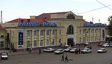
Since 1953, Qaraghandy has been connected to the Turksib and the northern Kazakh route network via the Schu station in the south of the country . The rail connection and the central location within Kazakhstan with the largest marshalling yard in the country are favorable prerequisites for further economic development. There are direct international passenger train connections to Moscow to the Kazan railway station and to Kiev .
In a park named after the 30th anniversary of the Komsomol in 1956 there is the narrow-gauge Karaganda children's railway , which originally served as a pioneer railway for the education of children.
tram
An electric tram ran in the city between August 25, 1950 and September 1997 . Three lines were operated:
- Staryj Gorod - Novyj Gorod (1950–1978)
- Staryj Gorod - Shakhta No. 70 (? –1976)
- Schachta 33/34 - Maikuduk, Combine Strojplassmass (1982–1997)
Initially, the lines were operated with KTM-1 . Between 1982 and 1984 12 KTM-5s were delivered to Karaganda.
Trunk roads
Several highways run through or near Karagandy:
- M36 , which leads north to Nur-Sultan, 200 km away, and south to Balqasch am Balchaschsee , 380 km away ,
- A20 , which leads east over Qarqaraly, 220 km away, to Bugaz ,
- A17 , a major east-west road in Kazakhstan, Karaganda with the 480 km northeastern Pavlodar and 530 km south-western jezkazgan connects.
education
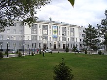
The city is home to several colleges, universities ( Karagandy State University , Medical Academy, Technical University), technical schools, colleges and libraries. In addition to state educational institutions, there are also private universities, etc. a. the Kazpotrebsoyuz Karaganda Economic University .
Personalities
sons and daughters of the town
Qaraghandy is the birthplace of numerous prominent personalities.
Well-known prisoners
- Margarete Buber-Neumann (1901–1989), German political publicist
- Nicetas Budka (1877–1949), Ukrainian Greek Catholic bishop
- Sonja Friedmann-Wolf (1923–1986), German author
- Robert Gilles (1923–2003), Belgian handball player, handball trainer and sports official
- Jewgenija Ginsburg (1904–1977), Russian historian and writer
- Lev Gumiljow (1912–1992), Russian historian and ethnologist as well as poet and translator from the Persian language
- Wojciech Jaruzelski (1923–2014), Polish politician and general; Head of State of Poland 1985–1990
- Vera Yermolajewa (1893–1937), Russian painter and book illustrator
- Alexander Jessenin-Wolpin (1924-2016), Russian-American mathematician
- Reinhart Koselleck (1923-2006), German historian
- Christian Rakowski (1873-1941), Bulgarian socialist revolutionary, Bolshevik politician and Soviet diplomat
- Kurt Rosenkranz (* 1927), Austrian adult educator
- Nikolai Urwanzew (1893–1985), Soviet geologist and polar explorer
- Heinrich Vogeler (1872–1942), German painter, graphic artist, architect, designer, educator, writer and socialist
- Helmut Weiß (1913–2000), German writer
See also
literature
- Karl-Johann Hering: Among gray wolves. Karaganda Camp, Memoirs 1944–1949 . Zeitgut-Verlag, Berlin 2005, ISBN 3-933336-87-2 .
- Werner Weiss: Karaganda . Fouque-Literaturverlag, Frankfurt am Main 2006, ISBN 3-86548-557-X .
- Günter Ochs: Unwanted to Kazakhstan. Experiences of a youth at the end of World War II, captivity - prison - penal camp II Buchenwald concentration camp and labor camp in Karaganda, Kazakhstan . Self-published, Darmstadt, ISBN 3-9804977-1-2 .
- Wolfgang Leonhard: The revolution releases its children - Chapter IV. Forced relocation to Karaganda . Kiepenheuer & Witsch, Cologne-Berlin 1961.
Web links
- Official city site
- HistoryTime: KARAGANDA - City of the Exiles ( Memento from September 29, 2007 in the Internet Archive ). In: WDR website .
- Karaganda Diocese
- Karlag camp
- Spassk warehouse 7099
- Karaganda pictures and photos from karaganda.de
- Tram in Karaganda
Individual evidence
- ↑ a b Численность населения Республики Казахстан по полу в разрезе областей и столицы, столицы, столицы, столицы, народон 2020, столицыкы, церодав,. ( Excel ; 96 KB) stat.gov.kz, accessed on July 19, 2020 (Russian).
- ↑ Karaganda-akimat.kz: About the city of Qaraghandy ( Memento of the original from February 9, 2012 in the Internet Archive ) Info: The archive link was automatically inserted and not yet checked. Please check the original and archive link according to the instructions and then remove this notice.
- ↑ Climate in Karaganda
- ↑ Karaganda-ITL in the GULAG Internet portal of Memorial Deutschland e. V.
- ↑ ITL of Karaganda coal in the GULAG Internet portal of Memorial Deutschland e. V.
- ↑ Saran-ITL in the GULAG Internet portal of Memorial Deutschland e. V.
- ↑ ITL of the housing construction Karaganda in the internet portal GULAG des Memorial Deutschland e. V.
- ↑ Wiesenlager on the GULAG website of Memorial Deutschland e. V.
- ↑ Sand storage in the Internet portal GULAG des Memorial Deutschland e. V.
- ↑ Erich Maschke (ed.): On the history of the German prisoners of war of the Second World War. Verlag Ernst and Werner Gieseking, Bielefeld 1962–1977.
- ↑ Ethnic composition: 2018 estimation , accessed on August 13, 2018 (English).
- ↑ Pop-stat.mashke.org: Cities & towns of Kazakhstan
- ↑ Religious composition: 2009 census (in Russian) , accessed August 15, 2018 (Russian).
- ↑ Karaganda Eparchy
- ↑ Routemap on kgf.aero , accessed December 27, 2015


