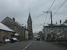
Longeau-Percey
| Longeau-Percey | ||
|---|---|---|

|
|
|
| region | Grand Est | |
| Department | Haute-Marne | |
| Arrondissement | Langres | |
| Canton | Villegusien-le-Lac | |
| Community association | Auberive, Vingeanne et Montsaugeonnais | |
| Coordinates | 47 ° 46 ′ N , 5 ° 19 ′ E | |
| height | 299-403 m | |
| surface | 7.48 km 2 | |
| Residents | 743 (January 1, 2017) | |
| Population density | 99 inhabitants / km 2 | |
| Post Code | 52250 | |
| INSEE code | 52292 | |
Longeau-Percey is a French commune in the department of Haute-Marne in the region Grand Est . It belongs to the Arrondissement of Langres and is part of the canton of Villegusien-le-Lac (until 2015: Longeau-Percey ). 743 residents live in the municipality (as of January 1, 2017).
geography
Longeau-Percey is about 40 kilometers south-southeast of Chaumont . In the south lies the Lac de Villegusien . Longeau-Percey is surrounded by the neighboring communities of Bourg in the north, Cohons in the northeast, Heuilley-Cotton in the east, Villegusien-le-Lac in the south, Verseilles-le-Haut in the west and Brennes in the north-west.
Here the former Route nationale 67 departs from the former Route nationale 74 .
history
On December 16, 1870, a battle broke out in the Franco-German War near Longeau, which resulted in the retreat of the French army.
Population development
| year | 1962 | 1968 | 1975 | 1982 | 1990 | 1999 | 2006 | 2013 | |||||
| Residents | 268 | 318 | 536 | 549 | 638 | 669 | 695 | 793 | |||||
| Sources: Cassini and INSEE | |||||||||||||
Attractions
- church
- Percey-le-Pautel Castle

