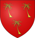
Saints-Geosmes
| Saints-Geosmes | ||
|---|---|---|

|
|
|
| region | Grand Est | |
| Department | Haute-Marne | |
| Arrondissement | Langres | |
| Canton | Langres | |
| Community association | Grand Langres | |
| Coordinates | 47 ° 49 ′ N , 5 ° 20 ′ E | |
| height | 348-476 m | |
| surface | 27.61 km 2 | |
| Residents | 1,129 (January 1, 2017) | |
| Population density | 41 inhabitants / km 2 | |
| Post Code | 52200 | |
| INSEE code | 52449 | |
Saints-Geosmes is a municipality located at 450 meters above sea level in the French department Haute-Marne with 1,129 inhabitants (as of January 1, 2017) in the Grand Est region . It belongs to the canton of Langres and the arrondissement of the same name . With effect from January 1, 2016, the neighboring Balesmes-sur-Marne was incorporated. Since then, Saints-Geosmes has been a commune nouvelle and is divided into the communes déléguées Balesmes-sur-Marne and Saints-Geosmes.
Neighboring municipalities are Perrancey-les-Vieux-Moulins in the north-west, Langres in the north, Saint-Vallier-sur-Marne in the north-east, Chalindrey in the east, Noidant-Chatenoy and Le Pailly in the south-east, Bourg and Cohons in the south, Brennes in the south-west and Noidant -le-Rocheux to the west.
structure
| District | former INSEE code |
Area (km²) | Population (2016) |
|---|---|---|---|
| Balesmes-sur-Marne | 52036 | 12.67 | 236 |
| Saints-Geosmes (administrative headquarters) | 52449 | 14.94 | 919 |
Population development excluding Balesmes-sur-Marne
| year | 1962 | 1968 | 1975 | 1982 | 1990 | 1999 | 2008 | 2015 |
|---|---|---|---|---|---|---|---|---|
| Residents | 343 | 364 | 510 | 563 | 872 | 864 | 966 | 893 |
Attractions
- Military cemetery
- War memorial
- Trois-Jumeaux de Saints-Geosmes church
Web links
Individual evidence
- ↑ Population figures retrospectively from January 1, 2016

