Peñamellera Alta
| Peñamellera Alta municipality | ||
|---|---|---|
 Town hall of the municipality
|
||
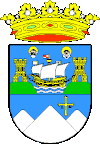
| coat of arms | Map of Spain | |

|
|
|
| Basic data | ||
| Autonomous Community : |
|
|
| Comarca : | Oriente | |
| Coordinates | 43 ° 20 ′ N , 4 ° 42 ′ W | |
| Height : | 187 msnm | |
| Area : | 92.19 km² | |
| Residents : | 514 (Jan. 1, 2019) | |
| Population density : | 5.58 inhabitants / km² | |
| Postal code : | 33578 | |
| Municipality number ( INE ): | 33046 | |
| Nearest airport : | Asturias airport | |
| administration | ||
| Address of the municipal administration: | Lugar Barrio Llombero, 0 S / N, 33578 Everything, Tel .: +34 985 41 57 75 | |
| Website : | aytopenamelleraalta.es | |
| Location of the municipality | ||

|
||
Peñamellera Alta is a municipality in the autonomous region of Asturias , in northern Spain . Bounded to the north by Llanes , to the south by Peñamellera Baja , to the west by Cabrales and to the east by Cantabria .
economy
Agricultural characteristics. The queso ( cheese ) de Peñamellera produced here is known and loved in Spain . The wild salmon caught in the nearby Río Cares is extremely popular in gastronomy . The abundance of fish also makes the region a tourist destination for passionate anglers from all over Europe.
| Employees | Percentage | ||||
|---|---|---|---|---|---|
| TOTAL | 201 | 100 | |||
| Agriculture, livestock and fishing | 79 | 39.30 | |||
| Industry | 5 | 2.49 | |||
| Construction industry | 31 | 15.42 | |||
| Service companies | 86 | 42.79 | |||
| * Data from the Statistical Office for Economic Development in Asturias, status 2009 , SADEI | |||||
politics
|
|
||||||||||
| Political party | 1979 | 1983 | 1987 | 1991 | 1995 | 1999 | 2003 | 2007 | 2011 | 2015 |
| CD / AP / PP | 1 | 1 | ||||||||
| FAC | 4th | 4th | ||||||||
| PSOE | 2 | 2 | ||||||||
| Total | 7th | 7th | 7th | 7th | 7th | 7th | 7th | 7th | 7th | 7th |
Population development of the municipality

Attractions
- Church of San Pedro de Plecín from the 12th century
- Cueva de Traúno - cave near the city with finds from the Stone Age
Parroquias
The parish is divided into eight parroquias :
swell
- ↑ Cifras oficiales de población resultantes de la revisión del Padrón municipal a 1 de enero . Population statistics from the Instituto Nacional de Estadística (population update).
- ^ Election results 2011 Spanish Ministry of the Interior
- ↑ Election results 2015 Spanish Ministry of the Interior ( Memento of the original from June 24, 2015 in the Internet Archive ) Info: The archive link was automatically inserted and not yet checked. Please check the original and archive link according to the instructions and then remove this notice.
- Population figures see INE
- Postcodes [1]
- Coordinates and heights refer to the town hall (Ayuntamiento) from Google Maps
Web links
Commons : Peñamellera Alta - Collection of images, videos and audio files

